Shanghai, Shanghai
Shanghai: Located on the eastern coast of China, this megalopolis is a global financial hub and the most populous urban area in the country.
About
Quick Facts about Shanghai
| Population | 23,390,000 |
| Country | Republic of China (1912–1949), Great Way Government, People's Republic of China, Wang Jingwei regime, Republic of China (1912–1949), Reformed Government of the Republic of China |
| State | Shanghai (China) |
| Postal code | 200000 |
| Plate code | 沪A |
| Phone Area Codes | 21 |
| Area | 6341 km2 |
| Official name | 上海市 |
| Latitude & Longitude | 31.2222,121.4581 |
| Altitude | 13 feet / 4 meters |
| Establishment | January 01, 0751 (1275 years ago) |
| Time Zone | UTC+08:00 |
| Local time | 10:43:11 (9th June 2026) |
Geography
Shanghai is located at 31°13'20"N 121°27'29"E (31.2222200, 121.4580600).
Shanghai map
Click "full screen"  icon to open full mode. View satellite images
Official website of Shanghai
Official Website- Aden (1995 )
- Alexandria (1992 )
- Antwerp (1984 )
- Bangkok (2012 )
- Barcelona (2001 )
- Basel (2007 )
- Bratislava Region (2003 )
- Budapest (2012 )
- Busan (1993 )
- Casablanca (1986 )
- Central Denmark Region (2003 )
- Chiang Mai (2000 )
- Chicago (1985 )
- City of London
- Colombo (2003 )
- Constanța (2002 )
- Cork (2005 )
- Dubai (2000 )
- Dunedin (1994 )
- East Java (2006 )
- Espoo (1998 )
- Gdańsk (2004 )
- Gothenburg Municipality (1986 )
- Guayaquil (2001 )
- Haifa (1993 )
- Hamburg (1986 )
- Hamhung (1979 )
- Hirakata
- Ho Chi Minh City (1994 )
- Istanbul (1989 )
- Izumisano
- Jalisco (1998 )
- Karachi (1984 )
- KwaZulu-Natal (2001 )
- Lille
- Liverpool (1999 )
- London
- Manila (1983 )
- Maputo (1999 )
- Marseille (1987 )
- Milan (1979 )
- Montreal (1985 )
- Nagasaki Prefecture
- New York City (2013 )
- Neyagawa
- Nicosia Municipality (2004 )
- North Jeolla Province
- Okahandja
- Oslo (2001 )
- Phnom Penh (2008 )
- Piraeus (1985 )
- Pomeranian Voivodeship (1985 )
- Port Vila (1994 )
- Porto (1995 )
- Prague
- Quebec
- Queensland (1989 )
- Rhône-Alpes (2008 )
- Rosario (1997 )
- Rotterdam (1978 )
- Saint Petersburg (1988 )
- Salzburg (2006 )
- San Francisco (1980 )
- Santiago de Cuba Province (1996 )
- South Jeolla Province
- São Paulo (1988 )
- Tashkent (1994 )
- Valparaíso (2001 )
- Vladivostok
- Windhoek (1995 )
- Winston-Salem (2006 )
- Yao
- Yerevan (2009 )
- Yokohama (1973 )
- Zagreb (1980 )
- Ōsaka (1974 )
- Ōsaka Prefecture (1980 )
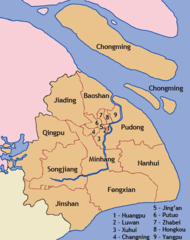
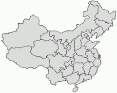
- Baoshan District
- Jiading District
- Putuo District
- Xuhui District
- Songjiang District
- Yangpu District
- Jing'an District
- Jinshan District
- Fengxian District
- Qingpu District
- Pudong
- Chongming District
- Hongkou
- Minhang District
- Changning District
- Huangpu District
Demographics
| Year | Population | % Change | Method |
|---|---|---|---|
| 2015 | 24,152,700 | - | |
| 2016 | 23,390,000 | -3.26% |
Map of countries with a smaller population than Shanghai
SHA, San'nkae, Sanchajus, Sangaj, Sangay, Sanghaj, Sanghay, Sanhaja, Sanhajo, Sanxay, Schanghai, Shang-hai, Shang-hai-shih, Shangai, Shangaj, Shanghai - shang hai, Shanghai - 上海, Shankhaj, Sjanghae, Sjanghai, Sjanghæ, Szanghaj, Thuong Hai, Thượng Hải, Xangai, cankay, sangha'i, sanghae, sanghai, seiynghi, shang hai, shang hai shi, shanghay, shanghhay, shanhai, zhong guo shang hai, Ŝanhajo, Şangay, Şanghay, Şanxay, Šanchajus, Šangaj, Šanghaj, Šanhaja, Σανγκάη, Шангај, Шанхай, שאנגחאי, شانغهاي, شانگهای, شاڭخەي, شاڭخەي شەھىرى, সাংঘাই, சாங்காய், เซี่ยงไฮ้, შანჰაი, 上海, 上海市, 中国上海, 상하이, 상해
Map & Images (more maps)
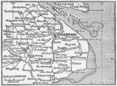
Karte Schanghai Mkl1888
369 x 270
- 40,632k -
png
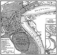
Shanghai Ca 1910
1027 x 979
- 406,858k -
jpg
Shanghai 1933
800 x 1150
- 402,617k -
jpg

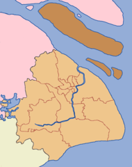
Shanghai Admin Cs
949 x 1200
- 46,116k -
png
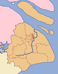
Shanghai Administrative
380 x 480
- 18,920k -
png
Shanghai Chongming
949 x 1200
- 59,859k -
png
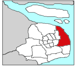
Shanghai Highlight
250 x 200
- 5,568k -
png
Shanghai Hongkou
949 x 1200
- 67,075k -
png

Shanghai Yangpu
949 x 1200
- 63,891k -
png
Chinashanghaipudong
400 x 356
- 8,643k -
png
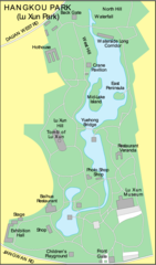
Shanghai Hangkou Garden Map
687 x 1167
- 72,629k -
png
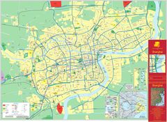
Shanghai Map
3799 x 2772
- 2,333,946k -
jpg
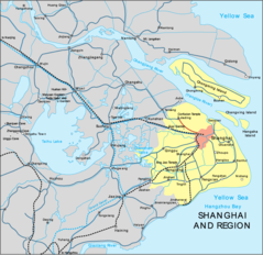
Shanghai Region Map
849 x 823
- 106,118k -
png
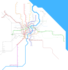
Shanghai Metro Map
3444 x 3500
- 95,511k -
png