Portugal (Portuguese Republic), PT
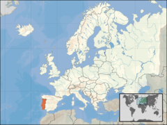
Portugal: Located on the Iberian Peninsula, Portugal is a southwestern European country with a population of over 10 million people and an area of 92, 212 km².
About

Country Snapshot
Portuguese Republic at a glance
Portuguese Republic currently has 334 quality-checked populated place pages and 20 state or regional pages linked on MapSof.
Mapped cities & towns
334
These counts use a stricter populated-place filter so the main lists stay focused on real city and town pages.
States & regions
20
Open related pagesLargest city
LisbonPopulation 506,654
Top linked places
Quick Facts about Portuguese Republic
| Population | 10,749,635 |
| Country | Portugal |
| Plate code | P |
| Area | 92212 km2 |
| Official name | Portugalská republika, Portugal, la République portugaise |
| Has part | autonomous region of Portugal, list of districts of Portugal, Continental Portugal |
| Continent | Europe |
| Easternmost point | Point(-6.19021386 41.57488702) |
| Northernmost point | Point(-8.2 42.15) |
| Latitude & Longitude | 39.6945,-8.1306 |
| Patron saint | Saint George |
| Legislative body | Assembly of the Republic |
| Official language | Portuguese, Mirandese |
| Capital | Coimbra, Lisbon |
| Establishment | October 12, 1143 (882 years ago) |
| Time Zone | Europe/Lisbon, Western European Time, UTC±00:00, Western European Summer Time, UTC−01:00 |
| Local time | 10:48:29 (21st July 2026) |

Geography
Portuguese Republic is located at 39°41'40"N 8°7'50"W (39.6945000, -8.1305700). It has 2 neighbors: Spain and Castilla y Leon.
Portugal map
The largest city of Portuguese Republic is Lisbon with a population of 506,654. Other cities include, Setúbal population 117,110, Queluz population 103,399, Amora population 52,577 and Ermesinde population 39,420. See all Portuguese Republic cities & populated places.
Official website of Portuguese Republic
Official WebsiteCompare Portuguese Republic with
- Castelo Branco
- Guarda
- Braga
- Faro
- Aveiro
- Lisbon
- Bragança
- Leiria
- Beja
- Santarém
- Portalegre
- Évora
- Viseu
- Porto
- Setúbal
- Vila Real
- Coimbra
- Viana do Castelo
- Madeira
- Azores
Demographics
| Year | Population | % Change | Method |
|---|---|---|---|
| 1940 | 17,103,400 | - | census |
| 1960 | 8,857,716 | -93.09% | census |
| 1961 | 8,929,316 | 0.8% | census |
| 1962 | 8,993,985 | 0.72% | census |
| 1963 | 9,030,355 | 0.4% | census |
| 1964 | 9,035,365 | 0.06% | census |
| 1965 | 8,998,595 | -0.41% | census |
| 1966 | 8,930,990 | -0.76% | census |
| 1967 | 8,874,520 | -0.64% | census |
| 1968 | 8,836,650 | -0.43% | census |
| 1969 | 8,757,705 | -0.9% | census |
| 1970 | 8,680,431 | -0.89% | census |
| 1971 | 8,643,756 | -0.42% | census |
| 1972 | 8,630,430 | -0.15% | census |
| 1973 | 8,633,100 | 0.03% | census |
| 1974 | 8,754,365 | 1.39% | census |
| 1975 | 9,093,470 | 3.73% | census |
| 1976 | 9,355,810 | 2.8% | census |
| 1977 | 9,455,675 | 1.06% | census |
| 1978 | 9,558,250 | 1.07% | census |
| 1979 | 9,661,265 | 1.07% | census |
| 1980 | 9,766,312 | 1.08% | census |
| 1981 | 9,851,362 | 0.86% | census |
| 1982 | 9,911,771 | 0.61% | census |
| 1983 | 9,957,865 | 0.46% | census |
| 1984 | 9,996,232 | 0.38% | census |
| 1985 | 10,023,613 | 0.27% | census |
| 1986 | 10,032,734 | 0.09% | census |
| 1987 | 10,030,031 | -0.03% | census |
| 1988 | 10,019,610 | -0.1% | census |
| 1989 | 10,005,000 | -0.15% | census |
| 1990 | 9,983,218 | -0.22% | census |
| 1991 | 9,960,235 | -0.23% | census |
| 1992 | 9,952,494 | -0.08% | census |
| 1993 | 9,964,675 | 0.12% | census |
| 1994 | 9,991,525 | 0.27% | census |
| 1995 | 10,026,176 | 0.35% | census |
| 1996 | 10,063,945 | 0.38% | census |
| 1997 | 10,108,977 | 0.45% | census |
| 1998 | 10,160,196 | 0.5% | census |
| 1999 | 10,217,828 | 0.56% | census |
| 2000 | 10,289,898 | 0.7% | census |
| 2001 | 10,362,722 | 0.7% | census |
| 2002 | 10,419,631 | 0.55% | census |
| 2003 | 10,458,821 | 0.37% | census |
| 2004 | 10,483,861 | 0.24% | census |
| 2005 | 10,503,330 | 0.19% | census |
| 2006 | 10,522,288 | 0.18% | census |
| 2007 | 10,542,964 | 0.2% | census |
| 2008 | 10,558,177 | 0.14% | census |
| 2009 | 10,568,247 | 0.1% | census |
| 2010 | 10,573,100 | 0.05% | census |
| 2011 | 10,557,560 | -0.15% | census |
| 2012 | 10,514,844 | -0.41% | census |
| 2013 | 10,457,295 | -0.55% | census |
| 2014 | 10,401,062 | -0.54% | (Worldbank) |
| 2015 | 10,358,076 | -0.41% | (Worldbank) |
| 2016 | 10,325,452 | -0.32% | (Worldbank) |
| 2017 | 10,300,300 | -0.24% | (Worldbank) |
| 2018 | 10,600,000 | 2.83% | census |
| 2019 | 10,269,417 | -3.22% | (Worldbank) |
| 2026 | 10,749,635 | 4.47% |
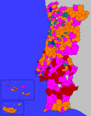
Map & Images (more maps)
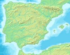
Mapa Iberia Minifisico 1
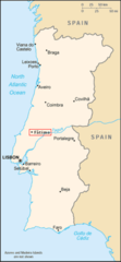
278px Po Map Fatima
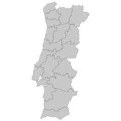
328px Mapa De Portugal Distritos Plain2
Alcobertas Rio Maior
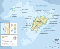
Berlengas En
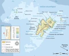
Berlengas Fr

Berlengas Pt
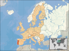
Eu Location Por
Europe Location Por
Macaronesia
Map Parque Natural Do Sudoeste Alentejano E Costa Vicentina
Mapa Da Cidade De Almada
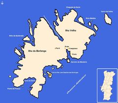
Mapa Das Berlengas
Mapa De Portugal Tribos Principais
Mapa De Portugal 2
Po Map Es
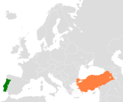
Portugal Turkey Locator
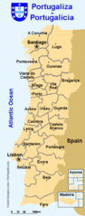
Portugalicia Map
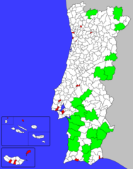
Portuguese Municipalities Area
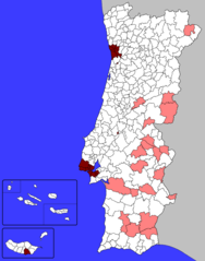
Portuguese Municipalities Density1