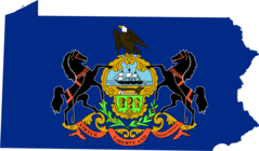
Pennsylvania, US
Pennsylvania: This Mid-Atlantic state is bordered by six other states and features a diverse landscape, from the Appalachian Mountains to the fertile farmlands.
About
Pennsylvania is a state located in the Northeastern and Mid-Atlantic regions of the United States. It played a pivotal role in early American history as one of the 13 original colonies.
Some key facts about Pennsylvania:
- Capital: Harrisburg
- Population: Around 13 million (5th most populous state)
- Area: 46,055 square miles
- Nicknames: The Keystone State, Quaker State
Pennsylvania has a diverse landscape including metropolitan areas, mountains, forests, rivers, and farmland. Major cities include Philadelphia and Pittsburgh. The state has four seasons and a humid continental climate.
Historically, Pennsylvania was home to Native American tribes like the Lenape and Shawnee. In 1681, William Penn founded the Pennsylvania colony which became a haven for Quakers and others seeking religious freedom. Key events like the signing of the Declaration of Independence later occurred in Pennsylvania.
Pennsylvania played a vital role in the Industrial Revolution and development of manufacturing, steel production, railroads, and mining. It continues to be an industrial and agricultural powerhouse today with major industries including health care, biotech, education, and tourism.
The state is home to renowned educational institutions such as the University of Pennsylvania and Carnegie Mellon as well as historic sites like Independence Hall and the Liberty Bell. Outdoor recreational activities like hiking, fishing, and skiing are also popular.
In summary, Pennsylvania is an influential historic state and economic powerhouse known for independence, industry, natural beauty, and metropolitan diversity. Its rich heritage and resources make it a dynamic place to live and visit.

State Snapshot
Pennsylvania at a glance
Pennsylvania currently has 1,581 quality-checked populated place pages and 67 county pages linked on MapSof.
Mapped cities & towns
1,581
These counts use a stricter populated-place filter so the main lists stay focused on real city and town pages.
County pages
67
Open related pagesLargest city
PhiladelphiaPopulation 1,578,487
Top linked places
Quick Facts about Pennsylvania
| Population | 12,783,254 |
| Country | United States of America |
| Area | 119283 km2 |
| Water as percent of area | 2.85% |
| Land as percent of area | 97.15% |
| Northernmost point | Point(-79.761872222 42.499847222) |
| Latitude & Longitude | 40.8000,-77.7000 |
| Legislative body | Pennsylvania General Assembly |
| Named for | William Penn |
| Official language | English |
| Altitude | 1,099 feet / 335 meters |
| Capital | Harrisburg |
| Establishment | December 12, 1787 (238 years ago) |
| Time Zone | UTC−05:00, America/New_York, Eastern Time Zone |
| Local time | 06:45:13 (15th June 2026) |
| Weather | 82℉ Chance Rain Showers 7-days weather |

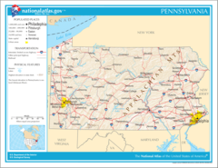
Geography
Pennsylvania is located at 40°48'0"N 77°42'0"W (40.8000000, -77.7000000). It has 7 neighbors: Delaware, Maryland, West Virginia, New Jersey, New York, Ohio and Ontario.
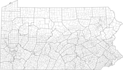
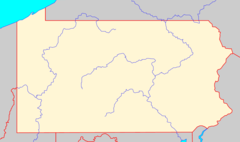
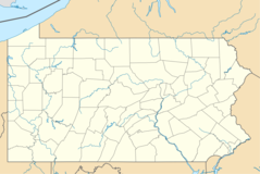
Pennsylvania map
The largest city of Pennsylvania is Philadelphia with a population of 1,578,487. Other cities include, Pittsburgh population 299,226, Allentown population 121,470, Erie population 95,077 and Reading population 88,217. See all Pennsylvania cities & populated places.
Largest Cities in Pennsylvania (more)
Cities, Towns, Villages, Neighborhoods & Other Populated Places in Pennsylvania.
| City Name | County | Population |
|---|---|---|
| Philadelphia | Philadelphia | 1,578,487 |
| Pittsburgh | Allegheny | 299,226 |
| Allentown | Lehigh | 121,470 |
| Erie | Erie | 95,077 |
| Reading | Berks | 88,217 |
| Upper Darby | Delaware | 82,883 |
| Scranton | Lackawanna | 76,532 |
| Bethlehem | Northampton | 74,892 |
| McMurray | Washington | 66,573 |
| Bensalem | Bucks | 60,491 |
| Abington | Montgomery | 55,285 |
| Bristol | Bucks | 53,311 |
| Levittown | Bucks | 52,983 |
| Haverford | Montgomery | 49,547 |
| Harrisburg | Dauphin | 49,322 |
| Altoona | Blair | 42,989 |
Show more Pennsylvania cities and populated places
Weather
A chance of rain showers before 2pm, then a chance of showers and thunderstorms. Partly sunny, with a high near 82. Chance of precipitation is 50%.
7-Day ForecastOfficial website of Pennsylvania
Official Website- Luzerne County
- Allegheny County
- Butler County
- Warren County
- Westmoreland County
- Erie County
- Carbon County
- Mifflin County
- Cambria County
- Snyder County
- Armstrong County
- McKean County
- Columbia County
- Greene County
- Wayne County
- Sullivan County
- Centre County
- Clinton County
- Philadelphia County
- Clearfield County
- Northampton County
- Potter County
- Montour County
- Lycoming County
- Fulton County
- Berks County
- York County
- Huntingdon County
- Delaware County
- Lancaster County
- Blair County
- Elk County
- Susquehanna County
- Monroe County
- Lehigh County
- Clarion County
- Cumberland County
- Franklin County
- Forest County
- Bucks County
- Lebanon County
- Bradford County
- Lawrence County
- Wyoming County
- Montgomery County
- Jefferson County
- Beaver County
- Fayette County
- Washington County
- Schuylkill County
- Union County
- Northumberland County
- Adams County
- Venango County
- Chester County
- Somerset County
- Perry County
- Pike County
- Juniata County
- Crawford County
- Indiana County
- Tioga County
- Lackawanna County
- Bedford County
- Dauphin County
- Mercer County
- Cameron County
Demographics
| Year | Population | % Change | Method |
|---|---|---|---|
| 1820 | 1,049,458 | - | census |
| 1830 | 1,348,233 | 22.16% | census |
| 1840 | 1,724,033 | 21.8% | demographic balance |
| 1910 | 7,665,111 | 77.51% | census |
| 1920 | 8,720,017 | 12.1% | census |
| 1930 | 9,631,350 | 9.46% | census |
| 1940 | 9,900,180 | 2.72% | census |
| 1950 | 10,498,012 | 5.69% | census |
| 1960 | 11,319,366 | 7.26% | census |
| 1970 | 11,793,909 | 4.02% | census |
| 1980 | 11,863,895 | 0.59% | census |
| 1990 | 11,881,643 | 0.15% | census |
| 2000 | 12,281,054 | 3.25% | census |
| 2010 | 12,702,379 | 3.32% | census |
| 2011 | 12,745,815 | 0.34% | estimation process |
| 2012 | 12,767,118 | 0.17% | estimation process |
| 2013 | 12,776,309 | 0.07% | estimation process |
| 2014 | 12,788,313 | 0.09% | estimation process |
| 2015 | 12,784,826 | -0.03% | estimation process |
| 2016 | 12,782,275 | -0.02% | estimation process |
| 2017 | 12,787,641 | 0.04% | estimation process |
| 2018 | 12,800,922 | 0.1% | estimation process |
| 2019 | 12,801,989 | 0.01% | estimation process |
| 2020 | 12,783,254 | -0.15% | estimation process |
People born in Pennsylvania (200)
People born in Pennsylvania, including prelate of the Roman Catholic Church Andrew James Louis Brennan, writer Diane Hoh, puppeteer and pianist Norman Shetler, .
More notable people
- William Julius Wilson (American sociologist) he was born in 20/12/1935
- Al Herman (American racing driver) he was born in 15/03/1927
- Claude AnShin Thomas (Recipient of the Purple Heart medal) he was born in 01/01/1947
- Anne Davies (figure skater) she was born in 21/12/1930
- Cornstalk (Native American in the American Revolution) he was born in 01/01/1720
- Florence Foster Jenkins (American soprano, renowned for her lack of musical skill and singing ability) she was born in 19/07/1868
- Michael Everson (American Irish linguist, typesetter and font designer, publisher) he was born in 09/01/1963
- Matt Wagner (American comic book writer and artist) he was born in 09/10/1961
- Abbie Neal (American country singer) she was born in 04/04/1918
- George Grey Barnard (American artist) he was born in 24/05/1863
- Tom Mix (American actor (1880-1940)) he was born in 06/01/1880
- Bruce Harlan (diver) he was born in 02/01/1926
- Les Brown (American bandleader, jazz musician, songwriter) he was born in 14/03/1912
- Adriano Jaime Miriam Veigle (American priest) he was born in 15/09/1912
- Agnes Sligh Turnbull (American writer) she was born in 14/10/1888
- A. W. Tozer (American missionary) he was born in 21/04/1897
- Cameron Carpenter (American musician) he was born in 18/04/1981
- Amy Steel (American actress) she was born in 03/05/1960
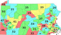
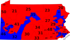
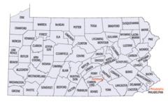
Pennsylvania Counties (more)
Philadelphia County

county in Pennsylvania, United States
Allegheny County

county in the southwestern part of the U.
Montgomery County

county in Pennsylvania, United States
| County Name | Population |
|---|---|
| Philadelphia County | 1,578,487 |
| Allegheny County | 1,211,358 |
| Montgomery County | 833,869 |
| Bucks County | 627,987 |
| Delaware County | 566,753 |
| Lancaster County | 546,192 |
| Chester County | 526,759 |
| York County | 450,448 |
| Berks County | 421,017 |
| Lehigh County | 370,802 |
| Westmoreland County | 347,087 |
| Luzerne County | 316,982 |
| Northampton County | 305,892 |
| Dauphin County | 279,874 |
| Erie County | 268,426 |
| Cumberland County | 255,857 |
Show more Pennsylvania counties
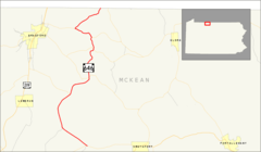
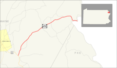
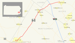
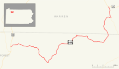
Map & Images (more maps)
Map of Pennsylvania Na 1
17th Congressional District
Area Code 412
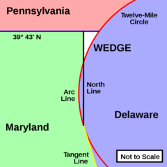
Delaware Wedge
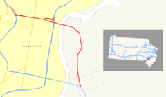
I 676 (nj Pa) Map
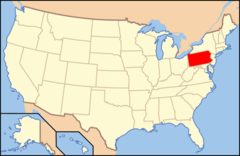
Map of Usa Pa
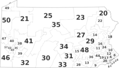
Pa State Senate District Alt
Pa State Senate Districts By Muni
Pa State Senate Districts By Party
Pa 402 Map
Pa 434 Map
Pa 646 Map
Pa 652 Map
Pa 663 Map
Pa 666 Map
Pennsylvania Municipalities
Pennsylvania Blank
Pennsylvania Counties Map
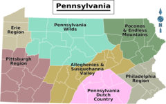
Pennsylvania Regions Map
Usa Pennsylvania Location Map