Oceania,
Oceania:
About
Quick Facts about Oceania
| Area | 8525989 km2 |
| Has part | Australasia, Polynesia, Malay Archipelago, Micronesia, Melanesia |
| Latitude & Longitude | -18.3128,138.5156 |
| Time Zone | UTC+12:00, UTC−10:00, UTC+10:00, UTC−09:00, UTC+13:00, UTC−08:00, UTC−09:30, UTC+11:00, UTC+09:00 |
| Local time | 03:18:13 (10th June 2026) |
Geography
Oceania is located at 18°18'46"S 138°30'56"E (-18.3128108464254, 138.515625).
Oceania map
Click "full screen"  icon to open full mode. View satellite images
Eyjaalfa, Eyjaálfa, Oceanie, Oceanien, Oceanio, Oceanía, Oceánie, Océanie, Okeanija, Okyanusya, Oseania, Ozeanien, an Aigeine, an Aigéine, Óceánia
Map & Images (more maps)
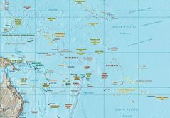
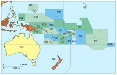
Oceania Map
1246 x 864
- 152,062k -
jpg
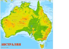
Australia Map 1
800 x 641
- 17,195k -
jpg
Australiamap
3508 x 2478
- 523,702k -
jpg
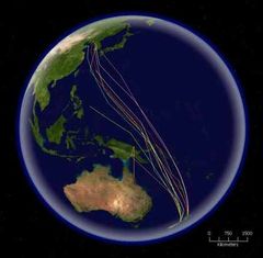
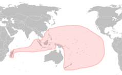
Bar Tailed Godwit Migration
416 x 408
- 31,685k -
jpg
Langues Autronesiennes
1012 x 628
- 20,410k -
png
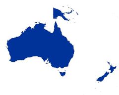
Locationoceania Transparent
2759 x 1404
- 42,983k -
png

Locationoceania
2759 x 1404
- 42,958k -
png
Loyalty Islands Lifou Map
914 x 927
- 29,161k -
png
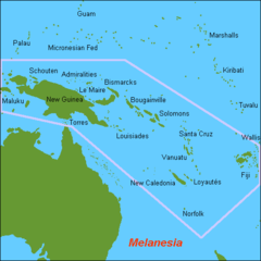
Map Oc Melanesia
500 x 500
- 7,344k -
png
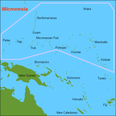
Map Oc Micronesia
500 x 500
- 6,012k -
png
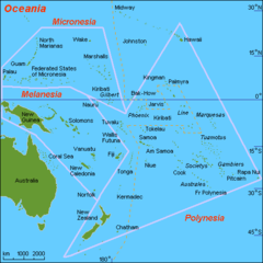
Map Oc Oceania
500 x 500
- 11,312k -
png
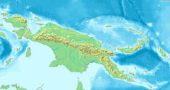
Map of New Guinea Demis
1373 x 728
- 126,575k -
png

Mapoftutuila American Samoa 1
3033 x 1968
- 328,405k -
gif
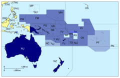
Members of Pacific Island Forum
920 x 598
- 25,119k -
png
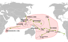
Migrations Autronesiennes
1012 x 628
- 29,118k -
png
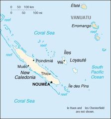
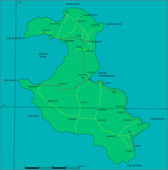
New Caledonia
351 x 377
- 14,870k -
jpg

Oceania Iso 3166 1
920 x 598
- 24,591k -
png
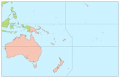
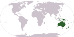
Oceania Continents
920 x 598
- 16,100k -
png
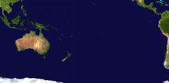
Oceania Satellite
2349 x 1155
- 104,990k -
jpg
Oceania Without Asian Country Codes
794 x 514
- 46,739k -
jpg
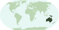
Oceanialocation
920 x 469
- 20,047k -
png