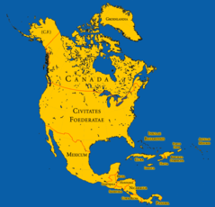
North America,
North America: continent on the Earth's northwestern quadrant
About
North America is the third largest continent on Earth spanning over 24 million square kilometers. It is located primarily in the Western and Northern hemispheres.
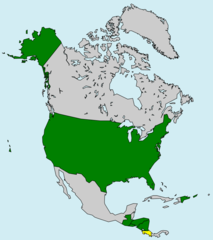
The continent is bordered by the Arctic Ocean to the north, the Pacific Ocean to the west, the Atlantic Ocean to the east, and South America to the south. North America includes the countries of Canada, the United States, Mexico, Guatemala, Belize, El Salvador, Honduras, Nicaragua, Costa Rica, Panama and several island nations in the Caribbean.
Major Geographic Regions
Some of the main geographic regions in North America include:
- The Canadian Shield - ancient rock formation containing the Hudson Bay watershed
- The Appalachian Mountains stretching from Canada to Alabama
- The Rocky Mountains extending from Alaska to New Mexico
- The massive Mississippi River system and basin
- The sprawling Great Plains grassland region
Other major areas include the Gulf of Mexico, the Great Lakes, Death Valley, and the Mojave Desert.
Diverse Climate and Ecosystems
North America contains a highly diverse range of climates and ecosystems including:
- Arctic tundra in northern Canada and Alaska
- Temperate rainforests along the Pacific Northwest coast
- Arid deserts like the Sonoran and Chihuahuan
- Vast grasslands and prairie across the Great Plains
- Subtropical wetlands in the Gulf Coast and Florida
This variety contributes to a rich abundance of plant and animal life.
Human History and Populations
North America has been inhabited by humans for over 20,000 years. Major native groups include the Iroquois, Navajo, Inuit, and Apache. European colonization began in the 16th century led by Spain, France and England. The continent was later settled by immigrants from around the world.
Today, the population of North America exceeds 579 million. The most populous countries are the United States, Mexico and Canada.
North America contains immense geographic diversity, resources and economic power. Understanding this influential continent provides key insights into human civilization.

Quick Facts about North America
| Population | 579,000,000 |
| Different from | Northern America, Northern America and Mexico |
| Area | 24930000 km2 |
| Has part | Central America, United States of America, Mexico, Canada, Northern America and Mexico, Caribbean |
| Latitude & Longitude | 46.0732,-100.5469 |
| Time Zone | Alaska Time Zone, Atlantic Time Zone, Eastern Time Zone, Mountain Time Zone, Newfoundland Standard time, Central Time Zone, Pacific Time Zone, Hawaii–Aleutian Time Zone |
| Local time | 19:50:53 (25th July 2026) |

Geography
North America is located at 46°4'24"N 100°32'49"W (46.0732306254083, -100.546875).
North America map
Countries in North America
- Anguilla
- Antigua and Barbuda
- Aruba
- Bahamas
- Barbados
- Belize
- Bermuda
- Bonaire, Saint Eustatius and Saba
- British Virgin Islands
- Canada
- Cayman Islands
- Costa Rica
- Cuba
- Curacao
- Dominica
- Dominican Republic
- El Salvador
- Greenland
- Grenada
- Guadeloupe
- Guatemala
- Haiti
- Honduras
- Jamaica
- Martinique
- Mexico
- Montserrat
- Netherlands Antilles
- Nicaragua
- Panama
- Puerto Rico
- Saint Barthelemy
- Saint Kitts and Nevis
- Saint Lucia
- Saint Martin
- Saint Pierre and Miquelon
- Saint Vincent and the Grenadines
- Sint Maarten
- Trinidad and Tobago
- Turks and Caicos Islands
- U.S. Virgin Islands
- United States
Demographics
| Year | Population | % Change | Method |
|---|---|---|---|
| 1960 | 198,624,409 | - | (Worldbank) |
| 1961 | 202,007,500 | 1.67% | (Worldbank) |
| 1962 | 205,198,600 | 1.56% | (Worldbank) |
| 1963 | 208,253,700 | 1.47% | (Worldbank) |
| 1964 | 211,262,900 | 1.42% | (Worldbank) |
| 1965 | 214,031,100 | 1.29% | (Worldbank) |
| 1966 | 216,659,000 | 1.21% | (Worldbank) |
| 1967 | 219,176,000 | 1.15% | (Worldbank) |
| 1968 | 221,503,000 | 1.05% | (Worldbank) |
| 1969 | 223,759,000 | 1.01% | (Worldbank) |
| 1970 | 226,431,000 | 1.18% | (Worldbank) |
| 1971 | 229,677,632 | 1.41% | (Worldbank) |
| 1972 | 232,168,663 | 1.07% | (Worldbank) |
| 1973 | 234,454,577 | 0.97% | (Worldbank) |
| 1974 | 236,715,369 | 0.96% | (Worldbank) |
| 1975 | 239,169,275 | 1.03% | (Worldbank) |
| 1976 | 241,538,008 | 0.98% | (Worldbank) |
| 1977 | 244,018,243 | 1.02% | (Worldbank) |
| 1978 | 246,601,803 | 1.05% | (Worldbank) |
| 1979 | 249,310,344 | 1.09% | (Worldbank) |
| 1980 | 251,795,337 | 0.99% | (Worldbank) |
| 1981 | 254,340,965 | 1% | (Worldbank) |
| 1982 | 256,836,391 | 0.97% | (Worldbank) |
| 1983 | 259,214,381 | 0.92% | (Worldbank) |
| 1984 | 261,488,476 | 0.87% | (Worldbank) |
| 1985 | 263,823,014 | 0.88% | (Worldbank) |
| 1986 | 266,290,660 | 0.93% | (Worldbank) |
| 1987 | 268,793,450 | 0.93% | (Worldbank) |
| 1988 | 271,349,094 | 0.94% | (Worldbank) |
| 1989 | 274,154,622 | 1.02% | (Worldbank) |
| 1990 | 277,373,464 | 1.16% | (Worldbank) |
| 1991 | 281,077,441 | 1.32% | (Worldbank) |
| 1992 | 284,943,859 | 1.36% | (Worldbank) |
| 1993 | 288,662,674 | 1.29% | (Worldbank) |
| 1994 | 292,185,983 | 1.21% | (Worldbank) |
| 1995 | 295,640,057 | 1.17% | (Worldbank) |
| 1996 | 299,064,347 | 1.15% | (Worldbank) |
| 1997 | 302,623,445 | 1.18% | (Worldbank) |
| 1998 | 306,070,116 | 1.13% | (Worldbank) |
| 1999 | 309,502,571 | 1.11% | (Worldbank) |
| 2000 | 312,909,974 | 1.09% | (Worldbank) |
| 2001 | 316,052,361 | 0.99% | (Worldbank) |
| 2002 | 319,048,184 | 0.94% | (Worldbank) |
| 2003 | 321,815,286 | 0.86% | (Worldbank) |
| 2004 | 324,809,693 | 0.92% | (Worldbank) |
| 2005 | 327,824,506 | 0.92% | (Worldbank) |
| 2006 | 331,015,609 | 0.96% | (Worldbank) |
| 2007 | 334,185,120 | 0.95% | (Worldbank) |
| 2008 | 337,406,357 | 0.95% | (Worldbank) |
| 2009 | 340,466,060 | 0.9% | (Worldbank) |
| 2010 | 343,391,679 | 0.85% | (Worldbank) |
| 2011 | 345,960,766 | 0.74% | (Worldbank) |
| 2012 | 348,610,010 | 0.76% | (Worldbank) |
| 2013 | 565,265,000 | 38.33% | census |
| 2014 | 353,803,581 | -59.77% | (Worldbank) |
| 2015 | 356,403,308 | 0.73% | (Worldbank) |
| 2016 | 579,000,000 | 38.45% | census |
| 2017 | 361,592,733 | -60.12% | (Worldbank) |
| 2018 | 363,809,186 | 0.61% | (Worldbank) |
| 2019 | 365,892,703 | 0.57% | (Worldbank) |
Map & Images (more maps)
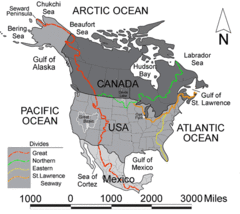
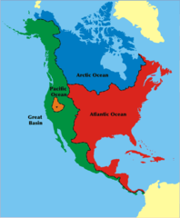
Northamericadivides
1888031210pm
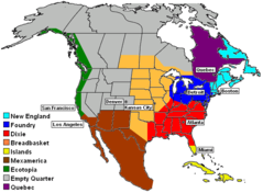
9nations
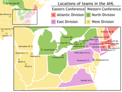
Ahl Team Locations
Apdw En
Apdw
Amazing Race 8 Map
America Septentrionalis
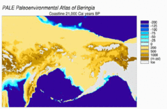
Beringia Land Bridge Noaagov 1
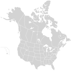
Blankmap Usa States Canada Provinces, Hi Closer
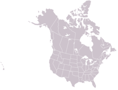
Blankmap Usa States Canada Provinces
Cafta Members
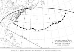
Cloud Cover Analysis 1959 Spac0036 Repair
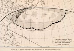
Cloud Cover Analysis 1959 Spac0036
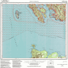
Contour Map of Dixon Entrance
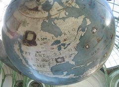
Coronelli Amnord
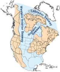
Cretaceous Seaway
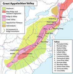
Greatvalley Map
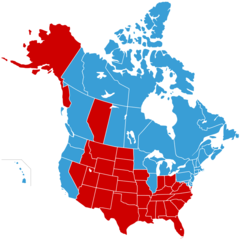
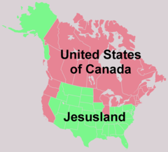
Jesusland Map With Alberta
Jesusland Map