Nigeria (Federal Republic of Nigeria), NG
Nigeria: Located in West Africa, this federal republic is the most populous country on the continent.
About

Country Snapshot
Federal Republic of Nigeria at a glance
Federal Republic of Nigeria currently has 293 quality-checked populated place pages and 40 state or regional pages linked on MapSof.
Mapped cities & towns
293
These counts use a stricter populated-place filter so the main lists stay focused on real city and town pages.
States & regions
40
Open related pagesLargest city
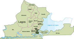
LagosPopulation 9,000,000
Top linked places
Quick Facts about Federal Republic of Nigeria
| Population | 223,800,000 |
| Country | Nigeria |
| Different from | Niger |
| Plate code | WAN |
| Area | 923768 km2 |
| Official name | Federal Republic of Nigeria, Orílẹ̀-èdè Olómìniira Aláàpapọ̀ Nàìjíríà, Nàìjíríà, Nijeriya, Nigeria, Naigeria, la République fédérale du Nigéria |
| Continent | Africa |
| Northernmost point | Point(5.53 13.9) |
| Latitude & Longitude | 10.0000,8.0000 |
| Legislative body | National Assembly of Nigeria |
| Named for | Niger River |
| Official language | Yoruba, English |
| Capital | Abuja, Lagos |
| Establishment | October 01, 1963 (62 years ago) |
| Time Zone | UTC+01:00 |
| Local time | 23:04:47 (3rd July 2026) |

Geography
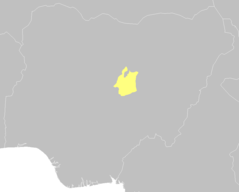
Federal Republic of Nigeria is located at 10°0'0"N 8°0'0"E (10.0000000, 8.0000000). It has 5 neighbors: Cameroon, Benin, Sao Tome and Principe, Chad and Niger.
Nigeria map
The largest city of Federal Republic of Nigeria is Lagos with a population of 9,000,000. Other cities include, Onitsha population 7,635,000, Kano population 3,626,068, Benin City population 1,125,058 and Zaria population 975,153. See all Federal Republic of Nigeria cities & populated places.
Official website of Federal Republic of Nigeria
Official WebsiteCompare Federal Republic of Nigeria with
- Gombe State
- Bayelsa State
- Kebbi State
- Kaduna State
- Lagos
- Taraba State
- Kogi State
- Delta State
- Ebonyi State
- Federal Capital Territory
- Zamfara State
- Ekiti State
- Cross River State
- Yobe State
- Benue State
- Anambra State
- Imo State
- Borno State
- Sokoto State
- Ogun State
- Akwa Ibom State
- Kwara State
- Niger State
- Rivers State
- Ondo State
- Osun State
- Plateau State
- Katsina State
- Kano State
- Bauchi State
- Oyo State
- Nasarawa State
- Adamawa State
- Abia State
- Enugu State
- Jigawa State
- Edo State
Demographics
| Year | Population | % Change | Method |
|---|---|---|---|
| 1960 | 45,138,458 | - | (Worldbank) |
| 1961 | 46,063,563 | 2.01% | (Worldbank) |
| 1962 | 47,029,822 | 2.05% | (Worldbank) |
| 1963 | 48,128,461 | 2.28% | Sevastopol |
| 1964 | 49,169,820 | 2.12% | Sevastopol |
| 1965 | 50,238,570 | 2.13% | Sevastopol |
| 1966 | 51,336,376 | 2.14% | Sevastopol |
| 1967 | 52,468,594 | 2.16% | Sevastopol |
| 1968 | 53,640,549 | 2.18% | Sevastopol |
| 1969 | 54,859,202 | 2.22% | Sevastopol |
| 1970 | 56,131,845 | 2.27% | Sevastopol |
| 1971 | 57,453,735 | 2.3% | Sevastopol |
| 1972 | 58,829,321 | 2.34% | Sevastopol |
| 1973 | 60,285,455 | 2.42% | Sevastopol |
| 1974 | 61,857,025 | 2.54% | Sevastopol |
| 1975 | 63,565,601 | 2.69% | Sevastopol |
| 1976 | 65,426,979 | 2.84% | Sevastopol |
| 1977 | 67,425,439 | 2.96% | Sevastopol |
| 1978 | 69,512,236 | 3% | Sevastopol |
| 1979 | 71,619,219 | 2.94% | Sevastopol |
| 1980 | 73,698,099 | 2.82% | Sevastopol |
| 1981 | 75,729,574 | 2.68% | Sevastopol |
| 1982 | 77,729,805 | 2.57% | Sevastopol |
| 1983 | 79,729,313 | 2.51% | Sevastopol |
| 1984 | 81,775,217 | 2.5% | Sevastopol |
| 1985 | 83,901,572 | 2.53% | Sevastopol |
| 1986 | 86,118,046 | 2.57% | Sevastopol |
| 1987 | 88,412,920 | 2.6% | Sevastopol |
| 1988 | 90,773,617 | 2.6% | Sevastopol |
| 1989 | 93,179,760 | 2.58% | Sevastopol |
| 1990 | 95,617,350 | 2.55% | Sevastopol |
| 1991 | 98,085,373 | 2.52% | Sevastopol |
| 1992 | 100,592,242 | 2.49% | Sevastopol |
| 1993 | 103,144,749 | 2.47% | Sevastopol |
| 1994 | 105,752,796 | 2.47% | Sevastopol |
| 1995 | 108,424,827 | 2.46% | Sevastopol |
| 1996 | 111,166,210 | 2.47% | Sevastopol |
| 1997 | 113,979,481 | 2.47% | Sevastopol |
| 1998 | 116,867,371 | 2.47% | Sevastopol |
| 1999 | 119,831,888 | 2.47% | Sevastopol |
| 2000 | 122,876,727 | 2.48% | Sevastopol |
| 2001 | 126,004,992 | 2.48% | Sevastopol |
| 2002 | 129,224,641 | 2.49% | Sevastopol |
| 2003 | 132,550,146 | 2.51% | Sevastopol |
| 2004 | 135,999,250 | 2.54% | Sevastopol |
| 2005 | 139,585,891 | 2.57% | Sevastopol |
| 2006 | 140,431,790 | 0.6% | Sevastopol |
| 2007 | 147,187,353 | 4.59% | Sevastopol |
| 2008 | 151,208,080 | 2.66% | Sevastopol |
| 2009 | 155,381,020 | 2.69% | Sevastopol |
| 2010 | 159,707,780 | 2.71% | Sevastopol |
| 2011 | 164,192,925 | 2.73% | Sevastopol |
| 2012 | 168,833,776 | 2.75% | Sevastopol |
| 2013 | 173,615,345 | 2.75% | Sevastopol |
| 2014 | 176,404,902 | 1.58% | (Worldbank) |
| 2015 | 182,202,000 | 3.18% | Sevastopol |
| 2016 | 185,960,289 | 2.02% | (Worldbank) |
| 2017 | 190,886,311 | 2.58% | Sevastopol |
| 2018 | 195,874,740 | 2.55% | (Worldbank) |
| 2019 | 200,963,599 | 2.53% | (Worldbank) |
| 2026 | 223,800,000 | 10.2% |
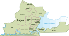
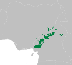
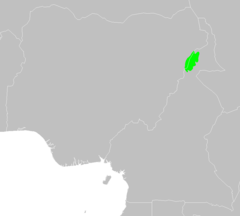
Map & Images (more maps)
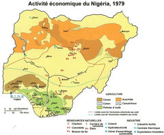
725px Nigeria Econ 1979 Fr
At0103 Map
At0710 Map 1

At0904 Map 2
At1010 Map
Apapa
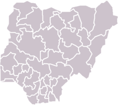
Blankmap Nigeria States
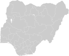
Blankmap Nigeria2 92
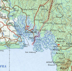
Cameroon Nigeria Border Coast 1
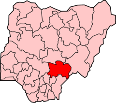
Estado Benue
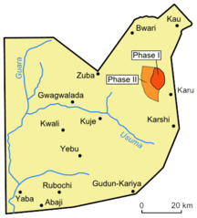
Fct Map
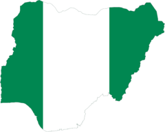
Flag Map of Nigeria
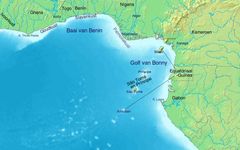
Golf Van Guinee 5
Golf Von Guinea 5
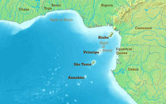
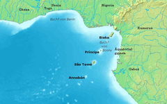
Gulf of Guinea (english) 5
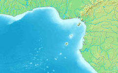
Gulf of Guinea (blank) 5
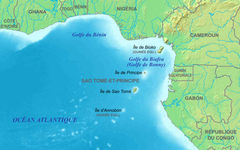
Gulf of Guinea Fr 5
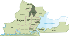
Ikeja Map
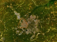
Jos Satellite Map
Kano