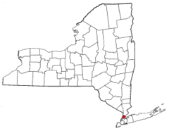
New York, US
New York: Located in the northeastern United States, it is home to New York City, Albany, and Buffalo.
About
New York is a large, populous state located in the Northeastern United States. It stretches from the Atlantic Coast to the Great Lakes and borders Vermont, Massachusetts, Connecticut, Pennsylvania, New Jersey, and Ontario, Canada.
Some key facts about New York:
- Capital: Albany
- Population: Around 20 million (4th most populous state)
- Area: 54,556 square miles (27th largest state)
- Nickname: The Empire State
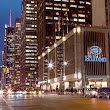
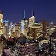
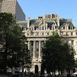
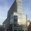
New York contains cosmopolitan, bustling cities as well as remote wilderness areas. The city of New York is an international hub of culture, commerce and entertainment. Other major cities include Buffalo, Rochester, Syracuse and Albany.
Upstate New York features the Adirondack and Catskill Mountains, the Finger Lakes region dotted with wineries, and miles of coastline along the Great Lakes and Atlantic Ocean. Iconic sites include Niagara Falls and the Statue of Liberty.
New York has had major influence on industry, fashion, finance, commerce and culture. Wall Street is located in NYC. The state is birthplace to movements like women's rights and abolitionism as well as artistic schools like the Hudson River School of painting.
New York experiences humid continental summers and cold, snowy winters. The climate varies across the large state based on elevation and latitude.
In summary, New York is a hub of culture and commerce that encompasses towering skyscrapers, tranquil lakes, rich history, and bustling cities, exemplifying the diversity, energy and ambition of America.

State Snapshot
New York at a glance
New York currently has 1,410 quality-checked populated place pages and 61 county pages linked on MapSof.
Mapped cities & towns
1,410
These counts use a stricter populated-place filter so the main lists stay focused on real city and town pages.
County pages
61
Open related pagesLargest city
BrooklynPopulation 2,577,000
Top linked places
Quick Facts about New York
| Population | 19,336,776 |
| Country | United States of America |
| Area | 141300 km2 |
| Water as percent of area | 13.62% |
| Land as percent of area | 86.38% |
| Continent | North America |
| Latitude & Longitude | 43.0004,-75.4999 |
| Legislative body | New York State Legislature |
| Named for | Duke of York |
| Altitude | 1,001 feet / 305 meters |
| Capital | Albany |
| Establishment | July 26, 1788 (237 years ago) |
| Time Zone | Eastern Time Zone, UTC−05:00, America/New_York |
| Local time | 13:28:10 (10th June 2026) |
| Postal code | 10001 |
| Weather | 84℉ Slight Chance Rain Showers then Slight Chance Showers And Thunderstorms 7-days weather |

Geography
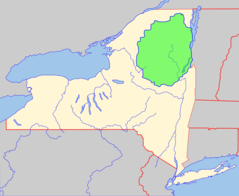
New York is located at 43°0'1"N 75°29'60"W (43.0003500, -75.4999000). It has 7 neighbors: Connecticut, New Jersey, Vermont, Ontario, Quebec, Massachusetts and Pennsylvania.
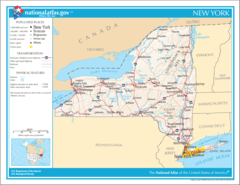
New York map
The largest city of New York is Brooklyn with a population of 2,577,000. Other cities include, Hempstead population 764,055, Brookhaven population 479,883, Staten Island population 474,558 and Islip population 322,328. See all New York cities & populated places.
Largest Cities in New York (more)
Cities, Towns, Villages, Neighborhoods & Other Populated Places in New York.
| City Name | County | Population |
|---|---|---|
| Brooklyn | Kings | 2,577,000 |
| Hempstead | Nassau | 764,055 |
| Brookhaven | Suffolk | 479,883 |
| Staten Island | Richmond | 474,558 |
| Islip | Suffolk | 322,328 |
| Oyster Bay | Nassau | 296,592 |
| Buffalo | Erie | 254,479 |
| Babylon | Suffolk | 218,223 |
| Jamaica | Queens | 216,866 |
| Huntington | Suffolk | 200,102 |
| Yonkers | Westchester | 200,040 |
| East Flatbush | Kings | 178,464 |
| Syracuse | Onondaga | 141,229 |
| Ramapo | Rockland | 138,356 |
| Amherst | Erie | 120,809 |
| Smithtown | Suffolk | 110,876 |
Show more New York cities and populated places
Weather
A slight chance of rain showers between 8am and 2pm, then a slight chance of showers and thunderstorms. Mostly sunny, with a high near 84.
7-Day ForecastOfficial website of New York
Official Website- Franklin County
- Monroe County
- Fulton County
- Wayne County
- Ulster County
- Onondaga County
- Orleans County
- Dutchess County
- Niagara County
- Greene County
- Oswego County
- Genesee County
- Essex County
- Otsego County
- Delaware County
- Seneca County
- Madison County
- Rensselaer County
- Hamilton County
- Kings County
- Nassau County
- Erie County
- Yates County
- Washington County
- Columbia County
- Tioga County
- Westchester County
- Cayuga County
- Ontario County
- Sullivan County
- Steuben County
- Montgomery County
- Albany County
- Schenectady County
- Rockland County
- Cattaraugus County
- Schuyler County
- Chautauqua County
- Herkimer County
- Wyoming County
- Allegany County
- St. Lawrence County
- New York County
- Warren County
- Richmond County
- Orange County
- Broome County
- Oneida County
- Chenango County
- Queens County
- Chemung County
- Livingston County
- Bronx County
- Putnam County
- Suffolk County
- Tompkins County
- Lewis County
- Saratoga County
- Clinton County
- Jefferson County
- Cortland County
- Schoharie County
Demographics
| Year | Population | % Change | Method |
|---|---|---|---|
| 2010 | 19,378,102 | - | census |
| 2011 | 19,499,241 | 0.62% | estimation process |
| 2012 | 19,572,932 | 0.38% | estimation process |
| 2013 | 19,624,447 | 0.26% | estimation process |
| 2014 | 19,651,049 | 0.14% | estimation process |
| 2015 | 19,654,666 | 0.02% | estimation process |
| 2016 | 19,633,428 | -0.11% | estimation process |
| 2017 | 19,589,572 | -0.22% | estimation process |
| 2018 | 19,530,351 | -0.3% | estimation process |
| 2019 | 19,453,561 | -0.39% | estimation process |
| 2020 | 19,336,776 | -0.6% | estimation process |
Best Things to Do in New York
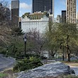
1Central Park
New York, NY, United States View details
Phone: +12123106600 | Website available

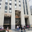
2Rockefeller Center
45 Rockefeller Plaza, New York, NY 10111, United States View details
Phone: +12125888601 | Website available
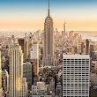
3Empire State Building
20 W 34th St, New York, NY 10001, United States View details
Phone: +12127363100 | Website available
4Statue of Liberty National Monument
New York, NY 10004, United States View details
Phone: +12123633200 | Website available
5The Metropolitan Museum of Art
1000 5th Ave, New York, NY 10028, United States View details
Phone: +12125357710 | Website available

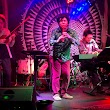
Where to Eat in New York
1The Loeb
Park Drive North, E 72nd St, New York, NY 10021, United States View details
Phone: +12125172233 | Website available
2Applebee's Grill + Bar
509 E 117th St, New York, NY 10035, United States View details
Phone: +16468962700 | Website available

3Shrine
2271 Adam Clayton Powell Jr Blvd, New York, NY 10030, United States View details
Phone: +12126907807 | Website available
4Le Pain Quotidien
1399 Madison Ave, New York, NY 10029, United States View details
Phone: +16466633149 | Website available
Where to Stay in New York
1New York Hilton Midtown
1335 6th Ave, New York, NY 10019, United States View details
Phone: +12125867000 | Website available
2The New Yorker Hotel
481 8th Ave, New York, NY 10001, United States View details
Phone: +12129710101 | Website available
3The Plaza - A Fairmont Managed Hotel
5th Avenue at, Central Park S, New York, NY 10022, United States View details
Phone: +12127593000 | Website available
4Warwick New York
65 W 54th St, New York, NY 10019, United States View details
Phone: +12122472700 | Website available
5The Algonquin Hotel Times Square, Autograph Collection
59 W 44th St, New York, NY 10036, United States View details
Phone: +12128406800 | Website available

Services and Civic Places in New York
1New York City Marriage Bureau
141 Worth St, New York, NY 10007 View details
Phone: +12126698090 | Website available
2City Clerks Office
141 Worth St, New York, NY 10013 View details
Phone: +12126399675 | Website available

3Office of New York City Council Member Helen Rosenthal
563 Columbus Ave, New York, NY 10024 View details
Phone: +12128730282 | Website available
4Nysed Office-The Professions
1411 Broadway, New York, NY 10018, United States View details
Phone: +12129516400 | Website available
5New York City Department of Records and Information Services
31 Chambers St #103, New York, NY 10007 View details
Phone: +12127888611 | Website available
6New York City Council Member Ben Kallos
244 E 93rd St, New York, NY 10128 View details
Phone: +12128601950 | Website available

7Nyc Dept Of Ed
388 W 125th St, New York, NY 10027, United States View details
Phone: +12123428300 | Website available
8US Department of State - Bureau of Educational and Cultural Affairs
666 5th Ave, New York, NY 10103, United States View details
Phone: +12123995750 | Website available
9New York City Council
250 Broadway, New York, NY 10007 View details
Phone: +12127887370 | Website available

10St Lucia Tourist Board
800 2nd Ave #910, New York, NY 10017, United States View details
Phone: +12128672950 | Website available

People born in New York (200)
People born in New York, including artist Eyvind Earle, photographer Mathew Brady, singer-songwriter Natalie Merchant, .
More notable people
- Elijah White (United States Indian agent and missionary) he was born in 01/01/1806
- Alan Gross (American international development professional) he was born in 02/05/1949
- Ohlin Harrison Adsit (American politician (1855-1909)) he was born in 01/08/1855
- Richard Shweder (American anthropologist) he was born in 17/02/1945
- Joe Alexander (American football player and coach (1898-1975)) he was born in 01/04/1898
- George Westinghouse (19th century American inventor and businessman) he was born in 06/10/1846
- Paul Foster Case (American occultist) he was born in 03/10/1884
- Lewis H. Morgan (United States ethnologist (1818-1881)) he was born in 21/11/1818
- David Feintuch (American writer) he was born in 21/07/1944
- Harry Lorayne (American magician) he was born in 04/05/1926
- Alexandros Onassis (Greek businessman, son of Aristotle Onassis) he was born in 30/04/1948
- Arthur P. Schmidt (American film editor) he was born in 21/08/1912
- Charles Warren Stoddard (American writer) he was born in 07/08/1843
- Ned Buntline (American novelist) he was born in 20/03/1821
- Louis Weiss (American film producer) he was born in 21/11/1890
- Adam Gussow (American scholar, memoirist, and blues harmonica player) he was born in 03/04/1958
- Albert Graham Ingalls (American astronomer) he was born in 16/01/1888
- Alvan E. Bovay (American politician (1818-1903)) he was born in 12/07/1818
Other places with the same name (1)
- New York, Missouri human settlement in Missouri, United States of America with a population of 264 people.
New York Counties (more)
Queens County

county in New York, United States
New York County
county in New York state, United States of America
Suffolk County

county in New York, United States
| County Name | Population |
|---|---|
| Queens County | 2,225,821 |
| New York County | 1,611,989 |
| Suffolk County | 1,474,273 |
| Bronx County | 1,401,142 |
| Nassau County | 1,351,334 |
| Westchester County | 965,802 |
| Erie County | 917,241 |
| Monroe County | 740,900 |
| Richmond County | 475,327 |
| Onondaga County | 459,214 |
| Orange County | 385,234 |
| Rockland County | 326,225 |
| Albany County | 303,654 |
| Dutchess County | 293,293 |
| Saratoga County | 230,298 |
| Oneida County | 227,346 |
Show more New York counties
Map & Images (more maps)
Map of New York Na 1
Adirondack Park Map With Blue Line
Adirondack And Catskill Parks Locator
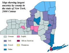
Ancestry New York By County 2000
Area Codes Ny
Catskill Park Locator
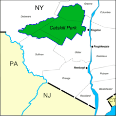
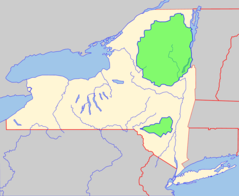
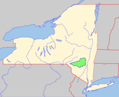
Catskill Park Location Map
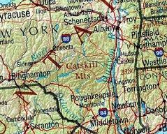
Catskills
Clarendon Linden Fault
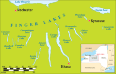
Fingerlakesmap
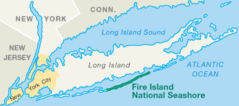
Fire Island Ny Usa Location Map of Fire Island National Seashore
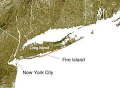
Fire Island Ny Usa Location Map 01
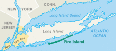
Fire Island Ny Usa Location Map
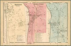
Hastings Dobbs Ferry Irvington Map
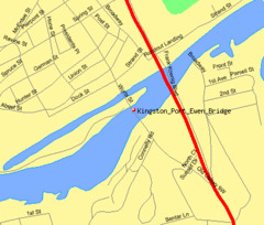
Kingston Port Ewen Bridge Map3
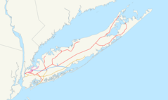
Lirr Map 1876
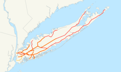
Lirr Map
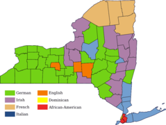
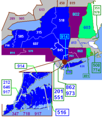
Largest Ancestry of Each New York County (en)
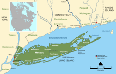
Longisland
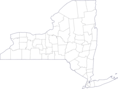
Map of New York County Outlines