Massachusetts, US
Massachusetts: Located in the New England region of the northeastern United States, Massachusetts is home to major cities like Boston and Worcester.
About
Massachusetts is a historic New England state located in the northeastern United States. It played a major role in the American Revolution and became the 6th state admitted to the Union in 1788.
History and Culture
Massachusetts has a rich history dating back to the Pilgrims landing at Plymouth Rock in 1620. The Massachusetts Bay Colony was founded in 1630. Boston became known as the Cradle of Liberty for early revolutionary activities opposing British rule.
Historical attractions include the Freedom Trail, Fenway Park, and Plimoth Patuxent. Massachusetts has prestigious universities, world-renowned medical facilities, and vibrant artistic and cultural institutions.
Geography and Climate
Massachusetts covers 10,554 square miles. It is bordered by Vermont, New Hampshire, Connecticut, Rhode Island, New York and the Atlantic Ocean. The varied landscape includes islands, coastal areas around Cape Cod, forests, mountains and fertile farmland in the Connecticut River Valley.
The climate is humid continental with cold winters and warm humid summers.
Economy and Industry
Massachusetts has a thriving knowledge-based economy centered around education, biotechnology and financial services. Major industries include information technology, health care and tourism. The state is home to many top companies such as General Electric, Raytheon, and MassMutual Insurance.
An economic hub, Massachusetts has two major seaports in Boston and New Bedford along with Worcester Regional Airport. The state invests heavily in education from top universities to public schools.
Government and Politics
Boston is the state capital and largest city. The current governor is Charlie Baker, a Republican. Massachusetts has reliably voted Democratic in recent presidential elections.
In summary, Massachusetts is an historic, economically robust state known for playing a significant early role in American independence. It continues to carry influence today through education, biotech and finance.

State Snapshot
Massachusetts at a glance
Massachusetts currently has 410 quality-checked populated place pages and 14 county pages linked on MapSof.
Mapped cities & towns
410
These counts use a stricter populated-place filter so the main lists stay focused on real city and town pages.
County pages
14
Open related pagesLargest city
BostonPopulation 691,531
Top linked places
Quick Facts about Massachusetts
| Population | 6,893,574 |
| Country | United States of America |
| Twitter username | massgov |
| Area | 27336 km2 |
| Water as percent of area | 26.1% |
| Land as percent of area | 73.9% |
| Continent | North America |
| Latitude & Longitude | 42.3657,-71.1083 |
| Legislative body | Massachusetts General Court |
| Named for | Great Blue Hill |
| Official language | English |
| Altitude | 492 feet / 150 meters |
| Capital | Boston |
| Establishment | February 06, 1788 (238 years ago) |
| Time Zone | America/New_York, Eastern Time Zone |
| Local time | 21:34:08 (7th July 2026) |
| Weather | 71℉ Patchy Fog 7-days weather |

Geography
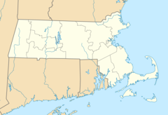
Massachusetts is located at 42°21'56"N 71°6'30"W (42.3656500, -71.1083200). It has 5 neighbors: Connecticut, New Hampshire, New York, Rhode Island and Vermont.
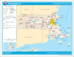
Massachusetts map
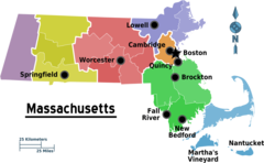
The largest city of Massachusetts is Boston with a population of 691,531. Other cities include, Worcester population 184,570, Springfield population 152,646, Cambridge population 119,192 and Lowell population 110,904. See all Massachusetts cities & populated places.
Largest Cities in Massachusetts (more)
Cities, Towns, Villages, Neighborhoods & Other Populated Places in Massachusetts.
| City Name | County | Population |
|---|---|---|
| Boston | Suffolk | 691,531 |
| Worcester | Worcester | 184,570 |
| Springfield | Hampden | 152,646 |
| Cambridge | Middlesex | 119,192 |
| Lowell | Middlesex | 110,904 |
| Brockton | Plymouth | 95,770 |
| New Bedford | Bristol | 95,517 |
| Lynn | Essex | 94,539 |
| Quincy | Norfolk | 94,421 |
| Fall River | Bristol | 89,792 |
| Newton | Middlesex | 87,803 |
| Somerville | Middlesex | 80,935 |
| Lawrence | Essex | 80,007 |
| Framingham | Middlesex | 73,892 |
| Framingham Center | Middlesex | 65,413 |
| Haverhill | Essex | 64,098 |
Show more Massachusetts cities and populated places
Weather
Patchy fog and showers and thunderstorms. Some of the storms could produce heavy rain. Cloudy, with a high near 71. Northeast wind around 9 mph, with...
7-Day Forecast- Norfolk County
- Plymouth County
- Hampshire County
- Barnstable County
- Dukes County
- Berkshire County
- Worcester County
- Hampden County
- Nantucket County
- Suffolk County
- Essex County
- Middlesex County
- Bristol County
- Franklin County
Demographics
| Year | Population | % Change | Method |
|---|---|---|---|
| 1910 | 3,366,416 | - | census |
| 1920 | 3,852,356 | 12.61% | census |
| 1930 | 4,249,614 | 9.35% | census |
| 1940 | 4,316,721 | 1.55% | census |
| 1950 | 4,690,514 | 7.97% | census |
| 1960 | 5,148,578 | 8.9% | census |
| 1970 | 5,689,170 | 9.5% | census |
| 1980 | 5,737,037 | 0.83% | census |
| 1990 | 6,016,425 | 4.64% | census |
| 2000 | 6,349,097 | 5.24% | census |
| 2010 | 6,547,629 | 3.03% | census |
| 2011 | 6,613,583 | 1% | estimation process |
| 2012 | 6,663,005 | 0.74% | estimation process |
| 2013 | 6,713,315 | 0.75% | estimation process |
| 2014 | 6,762,596 | 0.73% | estimation process |
| 2015 | 6,794,228 | 0.47% | estimation process |
| 2016 | 6,823,608 | 0.43% | estimation process |
| 2017 | 6,859,789 | 0.53% | estimation process |
| 2018 | 6,882,635 | 0.33% | estimation process |
| 2019 | 6,892,503 | 0.14% | estimation process |
| 2020 | 6,893,574 | 0.02% | estimation process |
People born in Massachusetts (200)
People born in Massachusetts, including author, columnist and reporter Robert Cormier, harpsichordist and musicologist Ralph Kirkpatrick, computer scientist; creator of Morris Worm; associate professor at MIT Robert Tappan Morris, .
More notable people
- Bradley C. Livezey (American ornithologist) he was born in 15/06/1954
- Ray Bolger (American actor (1904-1987)) he was born in 10/01/1904
- Elliot Silverstein (Film and television director) he was born in 03/08/1927
- Abigail Williams (Accuser in the Salem Trials) she was born in 12/07/1680
- John Black (American politician from Mississippi (1800-1854)) he was born in 11/08/1800
- George Phillips Bond (American astronomer) he was born in 20/05/1825
- Brooks Atkinson (American critic) he was born in 28/11/1894
- William Manchester (American author, journalist and historian) he was born in 01/04/1922
- Johnny Kelley (American distance runner) he was born in 06/09/1907
- Samuel Guthrie (American physician) he was born in 01/01/1782
- Jeff Reardon (American baseball player) he was born in 01/10/1955
- Robert Preston (American actor) he was born in 08/06/1918
- VenetianPrincess (American YouTube personality) she was born in 22/02/1984
- Jessica Bird (U.S. novelist) she was born in 01/01/1969
- Gladys Kuchta (American opera singer) she was born in 16/06/1915
- Anna Winger (American writer) she was born in 01/01/1970
- Joe Philbin (American football coach) he was born in 02/07/1961
- Cyril Ring (American film actor (1892-1967)) he was born in 05/12/1892
Massachusetts Counties
Middlesex County

county in Massachusetts, United States
Worcester County

county in Massachusetts, United States
Suffolk County

county in Massachusetts, United States
| County Name | Population |
|---|---|
| Middlesex County | 1,609,379 |
| Worcester County | 829,212 |
| Suffolk County | 801,582 |
| Essex County | 791,263 |
| Norfolk County | 709,409 |
| Bristol County | 566,765 |
| Plymouth County | 523,738 |
| Hampden County | 463,986 |
| Barnstable County | 213,164 |
| Hampshire County | 161,401 |
| Berkshire County | 124,571 |
| Franklin County | 70,267 |
| Dukes County | 17,461 |
| Nantucket County | 11,376 |
Show more Massachusetts counties
Map & Images (more maps)
Map of Massachusetts Na 1
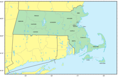
Map of Massachusetts Regions
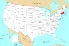
Usa Massachusetts Location Map
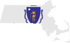
Massachusetts Flag Map
Counties Map of Massachusetts
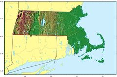
Massachusetts Relief Map
Where Is Massachusetts Located
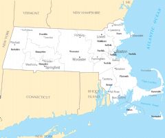
Massachusetts Cities And Towns
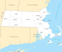
Massachusetts County Map
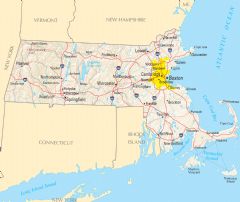
Massachusetts Reference Map
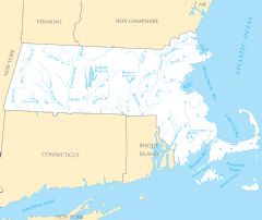
Massachusetts Rivers And Lakes