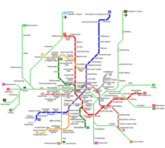
Munich Transport Map
Click on the Munich Transport Map to view it full screen. File Type: png, File size: 676436 bytes (660.58 KB), Map Dimensions: 3215px x 2394px (256 colors)
More Munich Static Maps
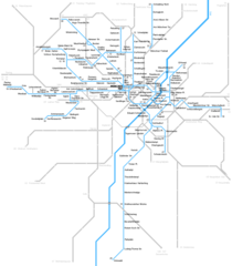
Munich Metro Map
4797 x 1164 - 173,038k - png
Munich Transport Map
3215 x 2394 - 676,436k - png
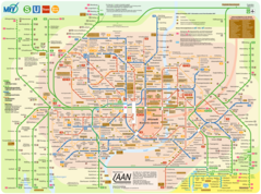
Munchen Metro Map
1013 x 1157 - 32,221k - png

Munich Metro Map 1
1000 x 900 - 25,091k - png