MapSof
.net
Places
Countries
States
Capital Cities
All Places
Maps
Physical Maps
Political Maps
Historical Maps
All Maps
Tools
Distance Calculator
Address Locator
Geocoder
Street View
Coordinate Finder
Distances
Countries
States
Cities
Maps
Distance Calculator
Geocoder
Distances
Home
/
Maps
/
Physical Maps
Physical Maps
Browse our collection of physical maps from around the world.
Physical
Political
Historical
Relief
Climate
Thematic
Elevation
Satellite
Road
Topo
Street
Contour
Election
Showing
5
maps
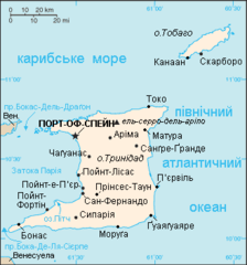
Map of Trinidad And Tobago Uk
Republic of Trinidad and Tobago
329x353 · 7,272k · png
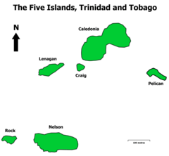
The Five Islands, Trinidad And Tobago
Republic of Trinidad and Tobago
650x600 · 10,766k · png
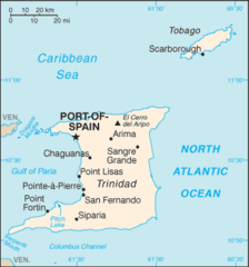
Trinidad And Tobago Cia Wfb Map
Republic of Trinidad and Tobago
329x353 · 9,793k · png
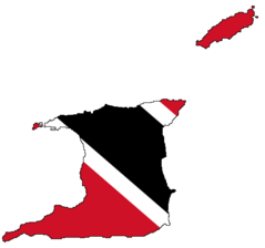
Trinidad And Tobago Flag Map
Republic of Trinidad and Tobago
510x477 · 5,557k · png
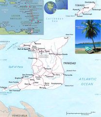
Trinidad And Tobago
Tobago
970x1115 · 126,444k · jpg