MapSof
.net
Places
Countries
States
Capital Cities
All Places
Maps
Physical Maps
Political Maps
Historical Maps
All Maps
Tools
Distance Calculator
Address Locator
Geocoder
Street View
Coordinate Finder
Distances
Countries
States
Cities
Maps
Distance Calculator
Geocoder
Distances
Home
/
Maps
/
Physical Maps
Physical Maps
Browse our collection of physical maps from around the world.
Physical
Political
Historical
Relief
Climate
Thematic
Elevation
Satellite
Road
Topo
Street
Contour
Election
Showing
7
maps
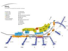
Philadelphia Airport Map
Philadelphia
1200x910 · 59,849k · png
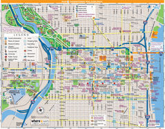
Philadelphia Downtown Map (city Center)
Philadelphia
1400x1100 · 615,548k · jpg
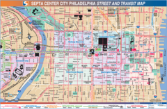
Philadelphia Downtown Transport Map
Philadelphia
1600x1047 · 451,003k · png
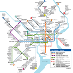
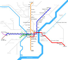
Philadelphia Subway Map (metro)
Philadelphia
900x900 · 166,791k · png
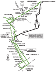
Philadelphia Trolley Map
Philadelphia
1000x1307 · 81,136k · png
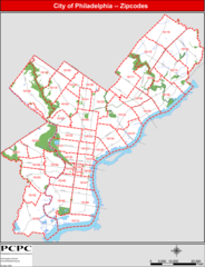
Philadelphia Zip Code Map
Philadelphia
1200x1568 · 172,665k · png
Philadelphia Metro Map
Philadelphia
866x768 · 17,682k · png