MapSof
.net
Places
Countries
States
Capital Cities
All Places
Maps
Physical Maps
Political Maps
Historical Maps
All Maps
Tools
Distance Calculator
Address Locator
Geocoder
Street View
Coordinate Finder
Distances
Countries
States
Cities
Maps
Distance Calculator
Geocoder
Distances
Home
/
Maps
/
Physical Maps
Physical Maps
Browse our collection of physical maps from around the world.
Physical
Political
Historical
Relief
Climate
Thematic
Elevation
Satellite
Road
Topo
Street
Contour
Election
Showing
12
maps
Kiribati Map Loc
Republic of Kiribati
2417x1969 · 391,909k · jpg
Kiribati Cia Wfb Map
Republic of Kiribati
330x354 · 11,028k · png
Kiribati Caroline Highlighted
Republic of Kiribati
300x322 · 15,896k · png
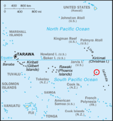
Kiribati Flint Highlighted
Republic of Kiribati
330x354 · 11,300k · png
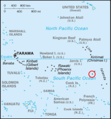
Kiribati Malden Highlighted
Republic of Kiribati
330x354 · 11,282k · png
Kiribati Starbuck Highlighted
Republic of Kiribati
330x354 · 11,308k · png
Kiribati Vostok Highlighted
Republic of Kiribati
330x354 · 11,282k · png
Kiritimati Kiribati Labels
Republic of Kiribati
920x698 · 16,239k · png
Kiritimati Kiribati
Republic of Kiribati
920x698 · 13,194k · png
Phoenix Islands Kiribati
Republic of Kiribati
821x593 · 44,358k · jpg
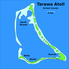
Tarawa Atoll, Kiribati
Republic of Kiribati
920x920 · 26,906k · png
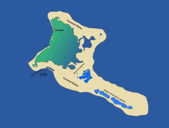
Teraina, Kiribati
Republic of Kiribati
832x511 · 60,961k · png