Los Angeles, California
Los Angeles: The second most populous city in the United States and the center of the Los Angeles metropolitan area.
About
Los Angeles is a city located in the county of Los Angeles in the U.S. state of California. Its population at the 2010 census was 3,792,621. After 10 years in 2020 city had an estimated population of 3,970,219 inhabitants.
The city was created 244 years ago in 1781.
Los Angeles is the largest city in California and the second most populous city in the United States with nearly 4 million residents as of July 29, 2023. Here are some key facts about L.A.:
History
Los Angeles was founded in 1781 by Spanish settlers. It officially became part of the U.S. in 1848 after the Mexican-American War. L.A. saw rapid growth in the 20th century and became a cultural hub.
Location & Geography
Los Angeles spans across the southern California coastline along the Pacific Ocean. It encompasses diverse terrain like mountains, valleys, forests, islands, and deserts.
Economy
L.A. is home to major companies in industries like entertainment, aerospace, technology, petroleum, and fashion. The Hollywood district is the center of the world's film industry.
Population & Diversity
The population of L.A. is highly diverse with large Hispanic/Latino, Asian, and African American communities. Nearly 40% of residents were born outside the U.S.
Culture & Sports
L.A. is considered a global cultural capital with world-class museums and performing arts. It is also home to major sports teams like the L.A. Lakers and L.A. Dodgers.
In summary, Los Angeles is an enormous, diverse, and influential metropolis known for Hollywood, entertainment, culture, innovation, and its sprawling geography along the Pacific coast. It's a leading global city.

Quick Facts about Los Angeles
| Population | 3,970,219 (2020) |
| Country | United States of America |
| State | California (United States) |
| County | Los Angeles County |
| Different from | La (surname particle) |
| Twitter username | LACity |
| Postal code | 90093–90097, 91601–91609, 90174, 90101–90103, 91401–91499, 91356–91357, 91364–91367, 90001–90068, 91342–91349, 91307, 90029, 90001, 90062, 90058, 90035, 90040, 90033, 90056, 90046, 90185, 90086–90089, 90091, 90189, 91040–91043, 90070–90084, 90099, 91352–91353, 91303–91308, 90291–90293 |
| Phone Area Codes | 213, 747, 818, 424, 323, 310 |
| Official name | City of Los Angeles |
| Water as percent of area | 6.77% |
| Land as percent of area | 93.23% |
| Continent | North America |
| Latitude & Longitude | 34.0522,-118.2437 |
| Legislative body | Los Angeles City Council, Los Angeles Common Council |
| Altitude | 305 feet / 93 meters |
| Capital city | Los Angeles is capital of Los Angeles County |
| Establishment | September 04, 1781 (244 years ago) |
| Time Zone | Pacific Time Zone, UTC−08:00, UTC−07:00 |
| Local time | 10:20:15 (9th June 2026) |
| Population growth | 4.47% (2010-2020) |
| Weather | 60℉ Mostly Cloudy then Patchy Fog 7-days weather |

Geography
Los Angeles is located at 34°3'8"N 118°14'37"W (34.0522300, -118.2436800). It has 26 neighbors: San Pedro, Pasadena, Glendale, Beverly Hills, Burbank, Carson, Compton, Culver City, East Los Angeles, El Segundo, Gardena, Hidden Hills, Huntington Park, Inglewood, Ladera Heights, Lomita, Long Beach, Monterey, San Fernando, Santa Monica, South Pasadena, Torrance, West Athens, West Carson, West Hollywood and Willowbrook.
Los Angeles map
Weather
Patchy fog after 5am. Mostly cloudy, with a low around 60. South southwest wind 5 to 10 mph.
7-Day Forecast- Ahome, Los Mochis
- Amsterdam
- Ashdod
- Athens
- Auckland
- Auckland City
- Beirut
- Berlin (1967 )
- Bordeaux (1964 )
- Busan
- Dubai
- Eilat
- Giza
- Guangzhou
- Ischia
- Jakarta
- Kaunas (1991 )
- London
- Lusaka
- Makati
- Manchester
- Manila
- Mexico City (1969 )
- Montreal
- Mumbai
- Nagoya (1959 )
- Podgorica
- Saint Petersburg
- Salvador
- Santa Maria degli Angeli
- Split
- Taipei (1979 )
- Tehran (1972 )
- Tijuana
- Vancouver
- Yerevan
Demographics
The population of Los Angeles increased by 4.47% in 10 years.
| Year | Population | % Change | Method |
|---|---|---|---|
| 1850 | 1,610 | - | estimation process |
| 1860 | 4,385 | 63.28% | estimation process |
| 1870 | 5,728 | 23.45% | estimation process |
| 1880 | 11,183 | 48.78% | estimation process |
| 1890 | 50,395 | 77.81% | estimation process |
| 1900 | 102,479 | 50.82% | estimation process |
| 1910 | 319,198 | 67.89% | estimation process |
| 2010 | 3,792,621 | 91.58% | census |
| 2011 | 3,820,876 | 0.74% | estimation process |
| 2012 | 3,851,202 | 0.79% | estimation process |
| 2013 | 3,881,622 | 0.78% | estimation process |
| 2014 | 3,909,901 | 0.72% | estimation process |
| 2015 | 3,938,568 | 0.73% | estimation process |
| 2016 | 3,963,226 | 0.62% | estimation process |
| 2017 | 3,975,788 | 0.32% | estimation process |
| 2018 | 3,977,596 | 0.05% | estimation process |
| 2019 | 3,979,576 | 0.05% | estimation process |
| 2020 | 3,970,219 | -0.24% | estimation process |
Best Things to Do in Los Angeles
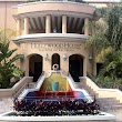
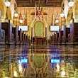
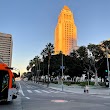
1Los Angeles City Hall
200 N Spring St, Los Angeles, CA 90012, United States View details
Phone: +12134733231 | Website available

Where to Eat in Los Angeles
1Hollywood Hotel ®
District of Hollywood, 1160 N Vermont Ave, Los Angeles, CA 90029, United States View details
Phone: +13237460444 | Website available
2Hotel Normandie LA
605 Normandie Ave, Los Angeles, CA 90005, United States View details
Phone: +12133888138 | Website available

3Hotel Oxford palace
745 S Oxford Ave, Los Angeles, CA 90005, United States View details
Phone: +12133898000 | Website available
4The Hoxton, Downtown LA
1060 S Broadway, Los Angeles, CA 90015, United States View details
Phone: +12137255900 | Website available

5Soho Warehouse
1000 S Santa Fe Ave, Los Angeles, CA 90021, United States View details
Phone: +12132051000 | Website available
Where to Stay in Los Angeles
1Hilton Los Angeles Airport
5711 W Century Blvd, Los Angeles, CA 90045, United States View details
Phone: +13104104000 | Website available

2The Westin Bonaventure Hotel & Suites, Los Angeles
404 S Figueroa St, Los Angeles, CA 90071, United States View details
Phone: +12136241000 | Website available

3JW Marriott Los Angeles L.A. LIVE
900 W Olympic Blvd, Los Angeles, CA 90015, United States View details
Phone: +12137658600 | Website available

4Los Angeles Airport Marriott
5855 W Century Blvd, Los Angeles, CA 90045, United States View details
Phone: +13106415700 | Website available

5The Westin Los Angeles Airport
5400 W Century Blvd, Los Angeles, CA 90045, United States View details
Phone: +13102165858 | Website available

Services and Civic Places in Los Angeles
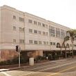
1LAC+USC Medical Center
2051 Marengo St, Los Angeles, CA 90033, United States View details
Phone: +13234091000 | Website available
2L.A. City Office of Finance
1828 Sawtelle Blvd # 102, Los Angeles, CA 90025, United States View details
Phone: +18446634411 | Website available

3Gil Cedillo LA City Council Campaign
5577 N Figueroa St, Los Angeles, CA 90042, United States View details
Phone: +13235501538 | Website available

4Los Angeles City Clerk
200 N Spring St hall room 395, Los Angeles, CA 90012, United States View details
Phone: +12139781020 | Website available
5Los Angeles Department of Building and Safety
1828 Sawtelle Blvd, Los Angeles, CA 90025, United States View details
Phone: +12134733231 | Website available

6City of Los Angeles Department of City Planning
201 N Figueroa St, Los Angeles, CA 90012, United States View details
Phone: +12134827077 | Website available
7City of Los Angeles Department of Recreation and Parks
221 N Figueroa St, Los Angeles, CA 90012, United States View details
Phone: +12132022700 | Website available

8Los Angeles Council District Eight Constituent Service Center
8475 Vermont Ave, Los Angeles, CA 90044, United States View details
Phone: +12134857616 | Website available

9City Hall South
111 E 1st St, Los Angeles, CA 90012, United States View details
Website available
10City Hall Office of Finance
201-287 N Main St, Los Angeles, CA 90012, United States View details

People born in Los Angeles (299)
People born in Los Angeles, including comedian, actor and writer Cheech Marin, Comedian George Lopez, mechanical engineer, president of Rensselaer Polytechnic Institute Richard G. Folsom, .
More notable people
- Jack McBean (American soccer player) he was born in 15/12/1994
- Eugene Meyer (American financier, first president of the World Bank) he was born in 31/10/1875
- Ronald Allen (American professional basketball player) he was born in 12/09/1984
- Cosma Shiva Hagen (German actress) she was born in 17/05/1981
- Bobby Brown (American professional basketball player) he was born in 24/09/1984
- Matt Barela (American professional wrestler) he was born in 12/03/1974
- Zema Ion (American professional wrestler) he was born in 05/10/1986
- Emma Schweiger (German actress) she was born in 26/10/2002
- Larry Wall (American computer programmer and author) he was born in 27/09/1954
- David Luenberger (American mathematical scientist) he was born in 01/01/1937
- Austin Peralta (American jazz pianist) he was born in 25/10/1990
- Christopher Paolini (American writer) he was born in 17/11/1983
- Mackenzie Foy (American actress) she was born in 10/11/2000
- Glen H. GoodKnight (American teacher) he was born in 01/10/1941
- Kenneth Lee Spencer (American opera singer (1913-1964)) he was born in 25/04/1913
- Diane Keaton (American film actress, director, producer and screenwriter) she was born in 05/01/1946
- Charlie Sheen (American film and television actor) he was born in 03/09/1965
- James Horner (film composer and conductor) he was born in 14/08/1953
Nearby Schools and Colleges
Schools and campuses linked to Los Angeles, CA. Select a name to open its map and contact details.
| Code | Name | City | ZIP |
|---|---|---|---|
| 123952 | Southern California Institute of Architecture | Los Angeles (CA) | 90013-1822 |
| 455664 | The Chicago School of Professional Psychology at Los Angeles | Los Angeles (CA) | 90017 |
| 114354 | FIDM-Fashion Institute of Design & Merchandising-Los Angeles | Los Angeles (CA) | 90015-1421 |
| 486965 | Hussian College-Los Angeles | Los Angeles (CA) | 90017-2019 |
| 109721 | Associated Technical College-Los Angeles | Los Angeles (CA) | 90017-1604 |
Nearby Transit Stations (44)
Rail and bus stations connected to Los Angeles, CA. Select a station to open its map and address details.
| Code | Name | Address | Type |
|---|---|---|---|
| LAX | Los Angeles Union Station | 800 North Alameda Street | RAIL |
| GDL | Glendale Transportation Center | 400 West Cerritos Avenue | RAIL |
| PAS | Pasadena, California | 150 South Los Robles Ave. | BUS |
| WCH | Westchester, CA | 6860 Park Terrace Drive | BUS |
| WES | Westwood-UCLA, CA | 592 Gayley Ave. | BUS |
Closest post offices linked to Los Angeles.
| Post Office Name | City | ZIP |
|---|---|---|
| Federal Los Angel Post Office | Los Angeles (CA) | 90012 |
| Alameda Carrier Annex Post Office | Los Angeles (CA) | 90012 |
| Arcad Post Office | Los Angeles (CA) | 90013 |
| Ar Post Office | Los Angeles (CA) | 90071 |
| Bunker Hill Post Office | Los Angeles (CA) | 90071 |
Other cities in Los Angeles County
Cities, towns, neighborhoods & other populated places in Los Angeles County , CA. (more)
| City Name | Population | Title |
|---|---|---|
| Long Beach | 454,681 | The second most populous city in California, Long Beach is a major center for business, manufacturing, and tourism. |
| Santa Clarita | 209,990 | The second most populous city in Los Angeles County, California. |
| Glendale | 197,747 | The second most populous city in Los Angeles County, California. |
| Lancaster | 155,822 | The most populous city in Los Angeles County, California. |
| Palmdale | 150,498 | The most populous city in Los Angeles County, California. |
| Pomona | 149,212 | The sixth most populous city in Los Angeles County, California. |
| Torrance | 141,553 | The third most populous city in Los Angeles County, California. |
| Pasadena | 141,045 | The second most populous city in Los Angeles County, California. |
| East Los Angeles | 126,496 | Census-designated place in Los Angeles County, California, United States |
| El Monte | 112,344 | The most populous city in Los Angeles County, California. |
| Downey | 109,202 | The most populous city in Los Angeles County, California. |
| Inglewood | 107,203 | The most populous city in Los Angeles County, California. |
| Santa Maria | 105,851 | The third most populous city in Santa Barbara County, California. |
| West Covina | 103,656 | The most populous city in Los Angeles County, California. |
| Norwalk | 102,635 | The most populous city in Los Angeles County, California. |
| Burbank | 101,866 | The most populous city in Los Angeles County, California. |
Distance to Other Cities
Los Angeles distances to largest California cities