Lille Metro Suburban Metro Map
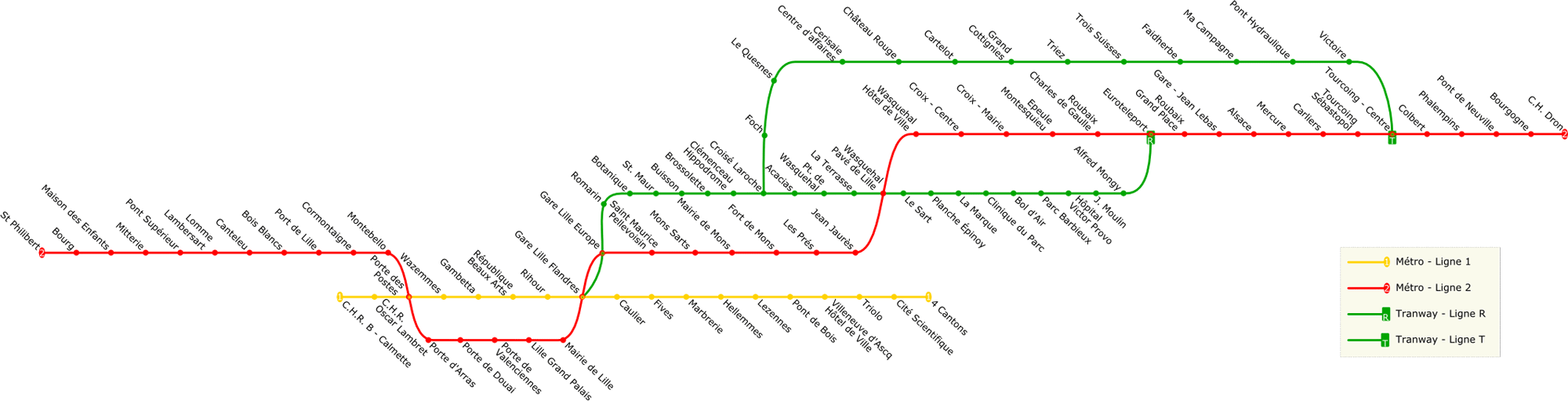
Click on the Lille Metro Suburban Metro Map to view it full screen. File Type: png, File size: 79989 bytes (78.11 KB), Map Dimensions: 2000px x 511px (256 colors)
More Lille Static Maps
Lille Metro Suburban Metro Map
2000 x 511 - 79,989k - png
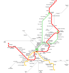
Lille Metro Map
950 x 1000 - 19,968k - png