Latvia (Republic of Latvia), LV
Latvia: Situated in the Baltic region of Northern Europe, this country is bordered by Estonia, Lithuania, Russia, and Belarus.
About

Country Snapshot
Republic of Latvia at a glance
Republic of Latvia currently has 67 quality-checked populated place pages and 104 state or regional pages linked on MapSof.
Mapped cities & towns
67
These counts use a stricter populated-place filter so the main lists stay focused on real city and town pages.
States & regions
104
Open related pagesLargest city
RigaPopulation 742,572
Top linked places
Quick Facts about Republic of Latvia
| Population | 1,829,000 |
| Country | Latvia |
| Plate code | LV |
| Area | 64589 km2 |
| Official name | Latvijas Republika, Läti Vabariik, la République de Lettonie |
| Water as percent of area | 1.5% |
| Land as percent of area | 98.5% |
| Continent | Europe |
| Easternmost point | Point(28.24140787 56.27805488) |
| Northernmost point | Point(25.2 58.08) |
| Latitude & Longitude | 57.0000,25.0000 |
| Legislative body | Saeima |
| Official language | Latvian |
| Capital | Riga |
| Establishment | November 18, 1918 (107 years ago) |
| Time Zone | Europe/Riga, UTC+02:00, UTC+03:00 |
| Local time | 14:48:36 (15th June 2026) |

Geography
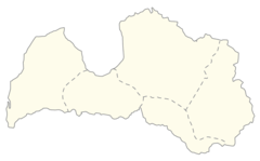
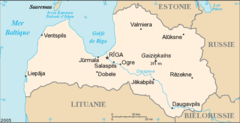
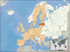
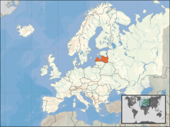
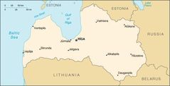
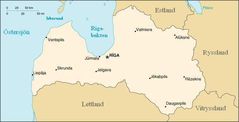
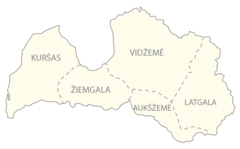
Republic of Latvia is located at 57°0'0"N 25°0'0"E (57.0000000, 25.0000000). It has 6 neighbors: Estonia, Lithuania, Belarus, Poland, Russia and Sweden.
Latvia map
The largest city of Republic of Latvia is Riga with a population of 742,572. Other cities include, Daugavpils population 82,604, Jelgava population 55,972, Jūrmala population 49,325 and Ventspils population 34,377. See all Republic of Latvia cities & populated places.
Official website of Republic of Latvia
Official WebsiteCompare Republic of Latvia with
- Vecpiebalga Municipality
- Aknīste Municipality
- Līvāni Municipality
- Lielvārde Municipality
- Ventspils Municipality
- Priekule Municipality
- Carnikava Municipality
- Madona Municipality
- Dundaga Municipality
- Olaine Municipality
- Sēja Municipality
- Limbaži Municipality
- Mērsrags Municipality
- Nereta Municipality
- Baldone Municipality
- Liepāja
- Salaspils Municipality
- Skrīveri Municipality
- Jēkabpils
- Vārkava Municipality
- Cēsis Municipality
- Ropaži Municipality
- Pļaviņas Municipality
- Amata Municipality
- Ludza Municipality
- Kuldīga Municipality
- Inčukalns Municipality
- Rūjiena Municipality
- Alsunga Municipality
- Vaiņode Municipality
- Krustpils Municipality
- Aloja Municipality
- Krimulda Municipality
- Viļaka Municipality
- Saldus Municipality
- Ērgļi Municipality
- Sala Municipality
- Sigulda Municipality
- Auce Municipality
- Tukums Municipality
- Saulkrasti Municipality
- Ogre Municipality
- Dagda Municipality
- Jelgava Municipality
- Līgatne Municipality
- Valka Municipality
- Viļāni Municipality
- Kocēni Municipality
- Salacgrīva Municipality
- Riebiņi Municipality
- Viesīte Municipality
- Beverīna Municipality
- Pārgauja Municipality
- Valmiera
- Jūrmala
- Preiļi Municipality
- Zilupe Municipality
- Jaunjelgava Municipality
- Ķegums Municipality
- Jaunpils Municipality
- Dobele Municipality
- Ādaži Municipality
- Tērvete Municipality
- Mālpils Municipality
- Pāvilosta Municipality
- Ozolnieki Municipality
- Nīca Municipality
- Durbe Municipality
- Priekuļi Municipality
- Garkalne Municipality
- Roja Municipality
- Rēzekne Municipality
- Burtnieki Municipality
- Skrunda Municipality
- Aglona Municipality
- Rucava Municipality
- Koknese Municipality
- Stopiņi Municipality
- Balvi Municipality
- Rundāle Municipality
- Rugāji Municipality
- Alūksne Municipality
- Gulbene Municipality
- Rēzekne
- Brocēni Municipality
- Talsi Municipality
- Varakļāni Municipality
- Ventspils
- Cesvaine Municipality
- Rauna Municipality
- Baltinava Municipality
- Cibla Municipality
- Ilūkste Municipality
- Lubāna Municipality
- Iecava Municipality
- Daugavpils
- Vecumnieki Municipality
- Ikšķile Municipality
- Ape Municipality
- Babīte Municipality
- Jēkabpils Municipality
- Strenči Municipality
- Mārupe Municipality
- Aizpute Municipality
- Ķekava Municipality
- Engure Municipality
- Aizkraukle Municipality
- Daugavpils Municipality
- Jaunpiebalga Municipality
- Naukšēni Municipality
- Jelgava
- Mazsalaca Municipality
- Smiltene Municipality
- Kandava Municipality
- Bauska Municipality
- Grobiņa Municipality
- Krāslava Municipality
- Kārsava Municipality
- Riga
Demographics
| Year | Population | % Change | Method |
|---|---|---|---|
| 1960 | 2,120,979 | - | (Worldbank) |
| 1961 | 2,152,681 | 1.47% | (Worldbank) |
| 1962 | 2,181,586 | 1.32% | (Worldbank) |
| 1963 | 2,210,919 | 1.33% | (Worldbank) |
| 1964 | 2,240,623 | 1.33% | (Worldbank) |
| 1965 | 2,265,919 | 1.12% | (Worldbank) |
| 1966 | 2,283,217 | 0.76% | (Worldbank) |
| 1967 | 2,301,220 | 0.78% | (Worldbank) |
| 1968 | 2,323,619 | 0.96% | (Worldbank) |
| 1969 | 2,343,173 | 0.83% | (Worldbank) |
| 1970 | 2,359,164 | 0.68% | (Worldbank) |
| 1971 | 2,376,389 | 0.72% | (Worldbank) |
| 1972 | 2,395,674 | 0.8% | (Worldbank) |
| 1973 | 2,415,819 | 0.83% | (Worldbank) |
| 1974 | 2,437,186 | 0.88% | (Worldbank) |
| 1975 | 2,456,130 | 0.77% | (Worldbank) |
| 1976 | 2,470,989 | 0.6% | (Worldbank) |
| 1977 | 2,485,073 | 0.57% | (Worldbank) |
| 1978 | 2,497,921 | 0.51% | (Worldbank) |
| 1979 | 2,505,953 | 0.32% | (Worldbank) |
| 1980 | 2,511,701 | 0.23% | (Worldbank) |
| 1981 | 2,519,421 | 0.31% | (Worldbank) |
| 1982 | 2,531,080 | 0.46% | (Worldbank) |
| 1983 | 2,546,011 | 0.59% | (Worldbank) |
| 1984 | 2,562,047 | 0.63% | (Worldbank) |
| 1985 | 2,578,873 | 0.65% | (Worldbank) |
| 1986 | 2,599,892 | 0.81% | (Worldbank) |
| 1987 | 2,626,583 | 1.02% | (Worldbank) |
| 1988 | 2,653,434 | 1.01% | (Worldbank) |
| 1989 | 2,666,955 | 0.51% | (Worldbank) |
| 1990 | 2,663,151 | -0.14% | (Worldbank) |
| 1991 | 2,650,581 | -0.47% | (Worldbank) |
| 1992 | 2,614,338 | -1.39% | (Worldbank) |
| 1993 | 2,563,290 | -1.99% | (Worldbank) |
| 1994 | 2,520,742 | -1.69% | (Worldbank) |
| 1995 | 2,485,056 | -1.44% | (Worldbank) |
| 1996 | 2,457,222 | -1.13% | (Worldbank) |
| 1997 | 2,432,851 | -1% | (Worldbank) |
| 1998 | 2,410,019 | -0.95% | (Worldbank) |
| 1999 | 2,390,482 | -0.82% | (Worldbank) |
| 2000 | 2,367,550 | -0.97% | (Worldbank) |
| 2001 | 2,337,170 | -1.3% | (Worldbank) |
| 2002 | 2,310,173 | -1.17% | (Worldbank) |
| 2003 | 2,287,955 | -0.97% | (Worldbank) |
| 2004 | 2,263,122 | -1.1% | (Worldbank) |
| 2005 | 2,238,799 | -1.09% | (Worldbank) |
| 2006 | 2,218,357 | -0.92% | (Worldbank) |
| 2007 | 2,200,325 | -0.82% | (Worldbank) |
| 2008 | 2,177,322 | -1.06% | (Worldbank) |
| 2009 | 2,141,669 | -1.66% | (Worldbank) |
| 2010 | 2,097,555 | -2.1% | (Worldbank) |
| 2011 | 2,059,709 | -1.84% | (Worldbank) |
| 2012 | 2,034,319 | -1.25% | (Worldbank) |
| 2013 | 2,012,647 | -1.08% | (Worldbank) |
| 2014 | 1,989,500 | -1.16% | census |
| 2015 | 1,977,527 | -0.61% | (Worldbank) |
| 2016 | 1,959,537 | -0.92% | (Worldbank) |
| 2017 | 1,953,000 | -0.33% | census |
| 2018 | 1,929,900 | -1.2% | census |
| 2019 | 1,909,000 | -1.09% | census |
| 2026 | 1,829,000 | -4.37% |
Map & Images (more maps)
Carte De Lettonie
Eu Location Lat
Europe Location Lat
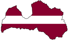
Flag Map of Latvia
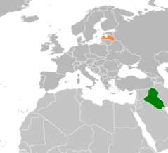
Iraq Latvia Locator
Kaart Letland
Karta Lettland
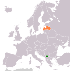
Kosovo Latvia Locator 1
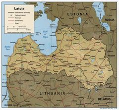
Latvia 1998 Cia Map
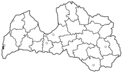
Latvia Districts Blank
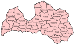
Latvia Districts Named
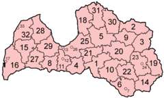
Latvia Districts Numbered
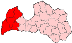
Latvia Region Kurzeme
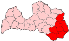
Latvia Region Latgale
Latvia Region Riga
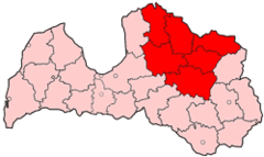
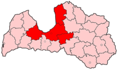
Latvia Region Vidzeme
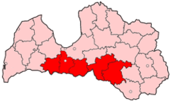
Latvia Region Zemgale
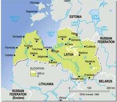
Latvia Topographic Map
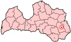
Latvia Rezekne City
Latvia Hist Regions (lt)