Laconia, New Hampshire
Laconia: city in New Hampshire, United States
About
Laconia is a city located in the county of Belknap in the U.S. state of New Hampshire. Its population at the 2010 census was 15,951 and a population density of 236 people per km². After 10 years in 2020 city had an estimated population of 16,646 inhabitants.
The city was created 171 years ago in 1854.

Quick Facts about Laconia
| Population | 16,646 (2020) |
| Country | United States of America |
| State | New Hampshire (United States) |
| County | Belknap County |
| Postal code | 03246, 03247, 03249 |
| Phone Area Codes | 603 |
| Area | 67.63 km2 |
| Latitude & Longitude | 43.5279,-71.4704 |
| Altitude | 502 feet / 153 meters |
| Capital city | Laconia is capital of Belknap County |
| Establishment | January 01, 1855 (171 years ago) |
| Time Zone | America/New_York |
| Local time | 17:13:59 (9th June 2026) |
| Density | 246 Pop. per km² as of 2020 |
| Population growth | 4.18% (2010-2020) |
| Weather | 54℉ Mostly Clear 7-days weather |

Geography
Laconia is located at 43°31'40"N 71°28'13"W (43.5278500, -71.4703500).
Laconia map
Weather
Mostly clear, with a low around 54. West wind around 5 mph.
7-Day ForecastOfficial website of Laconia
Official WebsiteDemographics
The population of Laconia increased by 4.18% in 10 years.
| Year | Population | % Change | Method |
|---|---|---|---|
| 2010 | 15,951 | - | census |
| 2011 | 16,054 | 0.64% | estimation process |
| 2012 | 16,122 | 0.42% | estimation process |
| 2013 | 16,065 | -0.35% | estimation process |
| 2014 | 16,119 | 0.34% | estimation process |
| 2015 | 16,209 | 0.56% | estimation process |
| 2016 | 16,477 | 1.63% | estimation process |
| 2017 | 16,497 | 0.12% | estimation process |
| 2018 | 16,582 | 0.51% | estimation process |
| 2019 | 16,581 | -0.01% | estimation process |
| 2020 | 16,646 | 0.39% | estimation process |
Demographic Facts
| Estimated population as of July 1, 2019 : | 12,985 |
| Based on demographic estimates as of April 1, 2010 : | 11,043 |
| Based on demographic estimates as of 1 April 2010 : | 17.6% |
| April 1, 2020 Population : | 11,292 |
| April 1, 2010 Population : | 10,966 |
| People under 5 years old, percentage : | 5.7% |
| People under 18 years old, percentage : | 21.6% |
| People over 65 (%) : | 21.8% |
| Female persons, % : | 54.6% |
| White only, percent : | 68.9% |
| Black or African American alone, percent : | 25.9% |
| American Indian and Alaska Native only, % : | 0.2% |
| Asians alone % : | 0.4% |
| Only Native Hawaiians and Other Pacific Islanders, % : | 0.0% |
| % of people who have participated in two or more races : | 1.6% |
| % of Hispanic or Latino : | 21.1% |
| White people, not Hispanic or Latino people, make up the majority of the population. : | 51.7% |
| 2015-2019 Veterans : | 1,054 |
| Percentage of foreign-born people, 2015-2019 : | 11.2% |
| Rate of owner-occupied housing units, 2015-2019 : | 53.8% |
Economic Facts
| Rate of owner-occupied housing units, 2015-2019 : | 53.8% |
| Owner-occupied housing unit median value, 2015-2019 : | $142,200 |
| From 2015 to 2019, the median selected monthly owner costs - with a mortgage : | $1,201 |
| Monthly owner costs, without a mortgage, at the median, 2015-2019 : | $453 |
| 2015-2019 median gross rent : | $688 |
| 2015-2019 Households : | 4,951 |
| Population per household, 2015-2019 : | 2.38 |
| Living in the same house a year ago, percentage of people aged one year and up, 2015-2019 : | 87.6% |
| Languages other than English spoken at home, as a percentage of people aged 5 and up, 2015-2019 : | 19.3% |
| Households with computers, %, 2015-2019 : | 83.5% |
| Percentage of households with a broadband Internet subscription, 2015-2019 : | 66.7% |
| Percentage of people aged 25 and up with a high school diploma or higher, 2015-2019 : | 77.1% |
| Bachelor's degree or higher, proportion of people aged 25 and up, 2015-2019 : | 20.7% |
| Percentage of people under the age of 65 who have a disability, 2015-2019 : | 14.1% |
| Persons under the age of 65 who do not have health insurance, as a percentage : | 21.5% |
| Total civilian labor force, percent of population aged 16 and up, 2015-2019 : | 51.6% |
| Female labor force participation in the civilian labor force, as a percentage of the population aged 16 and up, 2015-2019 : | 48.0% |
| Total sales of lodging and food services in 2012 ($1,000) : | 70,836 |
| Total receipts/revenue for health care and social assistance in 2012 ($1,000) : | 242,089 |
| Manufacturers' total shipments in 2012 ($1,000) : | 250,546 |
| 2012 total retail sales ($1,000) : | 676,893 |
| 2012 total retail sales per capita : | $59,696 |
| Mean commute time to work (in minutes), workers aged 16 and up, 2015-2019 : | 20.9 |
| 2015-2019 median household income (in 2019 dollars) : | $36,335 |
| Income per capita in the previous 12 months (in 2019 dollars), 2015-2019 : | $23,974 |
| Percentage of people living in poverty : | 22.1% |
| Total number of businesses in 2012 : | 1,167 |
| Men-owned businesses in 2012 : | 527 |
| Women-owned businesses in 2012 : | 345 |
| Minority-owned businesses in 2012 : | 299 |
| Non-minority-owned businesses in 2012 : | 721 |
| Veteran-owned businesses in 2012 : | 111 |
| Nonveteran-owned businesses in 2012 : | 900 |
| 2010 population per square mile : | 904.7 |
| 2010 land area in square miles : | 12.12 |
| Rate of owner-occupied housing units, 2015-2019 : | 89.7% |
| Owner-occupied housing unit median value, 2015-2019 : | $250,300 |
| From 2015 to 2019, the median selected monthly owner costs - with a mortgage : | $1,548 |
| Monthly owner costs, without a mortgage, at the median, 2015-2019 : | $464 |
| 2015-2019 median gross rent : | $1,464 |
| 2015-2019 Households : | 5,443 |
| Population per household, 2015-2019 : | 2.86 |
| Living in the same house a year ago, percentage of people aged one year and up, 2015-2019 : | 86.1% |
| Languages other than English spoken at home, as a percentage of people aged 5 and up, 2015-2019 : | 15.1% |
| Households with computers, %, 2015-2019 : | 96.8% |
| Percentage of households with a broadband Internet subscription, 2015-2019 : | 93.8% |
| Percentage of people aged 25 and up with a high school diploma or higher, 2015-2019 : | 92.4% |
| Bachelor's degree or higher, proportion of people aged 25 and up, 2015-2019 : | 45.2% |
| Percentage of people under the age of 65 who have a disability, 2015-2019 : | 5.7% |
| Persons under the age of 65 who do not have health insurance, as a percentage : | 6.7% |
| Total civilian labor force, percent of population aged 16 and up, 2015-2019 : | 68.6% |
| Female labor force participation in the civilian labor force, as a percentage of the population aged 16 and up, 2015-2019 : | 61.8% |
| Total sales of lodging and food services in 2012 ($1,000) : | 11,805 |
| Manufacturers' total shipments in 2012 ($1,000) : | 169,843 |
| 2012 total retail sales ($1,000) : | 103,327 |
| 2012 total retail sales per capita : | $7,186 |
| Mean commute time to work (in minutes), workers aged 16 and up, 2015-2019 : | 30.1 |
| 2015-2019 median household income (in 2019 dollars) : | $85,193 |
| Income per capita in the previous 12 months (in 2019 dollars), 2015-2019 : | $36,329 |
| Percentage of people living in poverty : | 4.4% |
| Total number of businesses in 2012 : | 1,070 |
| Men-owned businesses in 2012 : | 680 |
| Women-owned businesses in 2012 : | 300 |
| Minority-owned businesses in 2012 : | 149 |
| Non-minority-owned businesses in 2012 : | 897 |
| Veteran-owned businesses in 2012 : | 46 |
| Nonveteran-owned businesses in 2012 : | 998 |
| 2010 population per square mile : | 1,748.8 |
| 2010 land area in square miles : | 7.91 |
| Residential units, July 1, 2019 : | 11,293 |
| Rate of owner-occupied housing units, 2015-2019 : | 74.5% |
| Owner-occupied housing unit median value, 2015-2019 : | $148,900 |
| From 2015 to 2019, the median selected monthly owner costs - with a mortgage : | $1,132 |
| Monthly owner costs, without a mortgage, at the median, 2015-2019 : | $419 |
| 2015-2019 median gross rent : | $673 |
| Permits for construction, 2020 : | 34 |
| 2015-2019 Households : | 9,372 |
| Population per household, 2015-2019 : | 2.60 |
| Living in the same house a year ago, percentage of people aged one year and up, 2015-2019 : | 91.8% |
| Languages other than English spoken at home, as a percentage of people aged 5 and up, 2015-2019 : | 10.2% |
| Households with computers, %, 2015-2019 : | 79.2% |
| Percentage of households with a broadband Internet subscription, 2015-2019 : | 73.8% |
| Percentage of people aged 25 and up with a high school diploma or higher, 2015-2019 : | 83.3% |
| Bachelor's degree or higher, proportion of people aged 25 and up, 2015-2019 : | 14.5% |
| Percentage of people under the age of 65 who have a disability, 2015-2019 : | 7.7% |
| Persons under the age of 65 who do not have health insurance, as a percentage : | 11.4% |
| Total civilian labor force, percent of population aged 16 and up, 2015-2019 : | 59.0% |
| Female labor force participation in the civilian labor force, as a percentage of the population aged 16 and up, 2015-2019 : | 50.1% |
| Total sales of lodging and food services in 2012 ($1,000) : | 15,390 |
| Total receipts/revenue for health care and social assistance in 2012 ($1,000) : | 37,264 |
| Manufacturers' total shipments in 2012 ($1,000) : | 337,098 |
| 2012 total retail sales ($1,000) : | 204,433 |
| 2012 total retail sales per capita : | $8,209 |
| Mean commute time to work (in minutes), workers aged 16 and up, 2015-2019 : | 32.2 |
| 2015-2019 median household income (in 2019 dollars) : | $53,879 |
| Income per capita in the previous 12 months (in 2019 dollars), 2015-2019 : | $26,239 |
| Percentage of people living in poverty : | 10.4% |
| Total number of employer establishments, 2019 : | 490 |
| 2019 total employment : | 6,156 |
| 2019 total annual payroll ($1,000) : | 201,856 |
| Total employment, change in percentage terms, 2018-2019 : | 1.9% |
| 2018 total non-employer establishments : | 1,813 |
| Total number of businesses in 2012 : | 2,276 |
| Men-owned businesses in 2012 : | 1,374 |
| Women-owned businesses in 2012 : | 662 |
| Minority-owned businesses in 2012 : | F |
| Non-minority-owned businesses in 2012 : | 2,201 |
| Veteran-owned businesses in 2012 : | 162 |
| Nonveteran-owned businesses in 2012 : | 2,030 |
| 2010 population per square mile : | 63.0 |
| 2010 land area in square miles : | 391.35 |
Best Things to Do in Laconia
1Funspot
579 Endicott St N, Laconia, NH 03246, United States View details
Phone: +16033664377 | Website available

2Weirs Beach
Lakeside Ave, Laconia, NH 03246, United States View details
Website available

3Endicott Rock State Historic Site
Lakeside Ave, Laconia, NH 03246, United States View details
Phone: +16032713556

4Opechee Park
915 N Main St, Laconia, NH 03246, United States View details
Phone: +16035245046 | Website available

5The Escape Room Experience
555 Main St, Laconia, NH 03246, United States View details
Phone: +16033666296 | Website available

Where to Eat in Laconia
1Mount Washington Cruises
211 Lakeside Ave, Laconia, NH 03246, United States View details
Phone: +16033665531 | Website available

2Sal's Pizza Laconia
360 Union Ave, Laconia, NH 03246, United States View details
Phone: +16035240097 | Website available

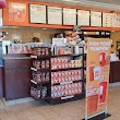
3Dunkin'
369 S Main St, Laconia, NH 03246, United States View details
Phone: +16035245010 | Website available

4Dunkin'
1106 Union Ave, Laconia, NH 03246, United States View details
Phone: +16035242206 | Website available
5Subway
585 Union Ave Unit 4, Laconia, NH 03246, United States View details
Phone: +16035276222 | Website available

Where to Stay in Laconia
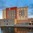
1Best Western Plus Landmark Inn
480 Main St, Laconia, NH 03246, United States View details
Phone: +16035248000 | Website available
Services and Civic Places in Laconia
1Laconia City Hall
45 Beacon St E, Laconia, NH 03246 View details
Phone: +16035271270 | Website available

People born in Laconia (1)
Greek military officer, politician, and Olympic foil fencer (1863-1938) Periklis Pierrakos-Mavromichalis was born in Laconia
Nearby Schools and Colleges
Schools and campuses linked to Laconia, NH. Select a name to open its map and contact details.
| Code | Name | City | ZIP |
|---|---|---|---|
| 182704 | Empire Beauty School-Laconia | Laconia (NH) | 03246 |
Nearby Transit Stations (30)
Rail and bus stations connected to Laconia, NH. Select a station to open its map and address details.
| Code | Name | Address | Type |
|---|---|---|---|
| TLT | Tilton, New Hampshire | I-93 and US hwy 3 | BUS |
| NHN | New Hampton, New Hampshire | 325 Route 104 | BUS |
| PMO | Plymouth, New Hampshire | 83 Main St. | BUS |
| CNH | Concord, New Hampshire | 30 Stickney Ave. | BUS |
| CAY | Conway, New Hampshire | 392 West Main St. | BUS |
Closest post offices linked to Laconia.
| Post Office Name | City | ZIP |
|---|---|---|
| Laconia Post Office | Laconia (NH) | 03246 |
Other places with the same name (1)
- Laconia, Indiana town with a population of 56 people.
Other cities in Belknap County
Cities, towns, neighborhoods & other populated places in Belknap County , NH.
| City Name | Population | Title |
|---|---|---|
| Belmont | 7,314 | Town in New Hampshire, United States |
| Gilford | 7,278 | Town of the United States |
| Meredith | 6,476 | Town in Belknap County, New Hampshire, United States of America |
| Alton | 5,364 | Town in New Hampshire (United States) |
| Barnstead | 4,777 | City in Belknap County, New Hampshire, United States of America |
| Gilmanton | 3,797 | Town in Belknap County, New Hampshire, United States |
| Tilton | 3,556 | Town located in New Hampshire, United States |
| Sanbornton | 3,012 | Town in New Hampshire |
| New Hampton | 2,234 | Human settlement in Belknap County, New Hampshire, United States of America |
Distance to Other Cities
Laconia distances to largest New Hampshire cities