Jamaica, JM
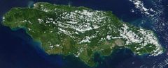
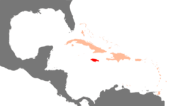
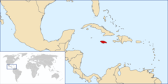
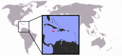
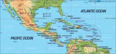
Jamaica: Situated in the Caribbean Sea, south of Cuba and west of Hispaniola, this island nation is known for its lush topography of mountains, rainforests, and reef-lined beaches.
About

Country Snapshot
Jamaica at a glance
Jamaica currently has 33 quality-checked populated place pages and 14 state or regional pages linked on MapSof.
Mapped cities & towns
33
These counts use a stricter populated-place filter so the main lists stay focused on real city and town pages.
States & regions
14
Open related pagesLargest city
KingstonPopulation 937,700
Top linked places
Quick Facts about Jamaica
| Population | 2,825,544 |
| Country | Jamaica |
| Plate code | JA |
| Area | 10991.91 km2 |
| Official name | la Jamaïque, Jamaica |
| Continent | North America |
| Easternmost point | Point(-76.188169444 17.914919444) |
| Northernmost point | Point(-77.8469 18.52493) |
| Latitude & Longitude | 18.1667,-77.2500 |
| Legislative body | Parliament of Jamaica |
| Official language | English |
| Capital | Kingston |
| Establishment | January 01, 1962 (64 years ago) |
| Time Zone | UTC−05:00 |
| Local time | 08:58:11 (17th July 2026) |

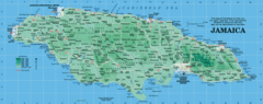
Geography
Jamaica is located at 18°10'0"N 77°15'0"W (18.1666700, -77.2500000).
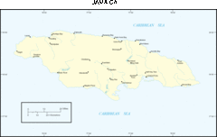
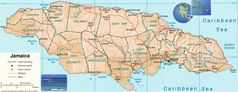
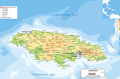
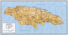
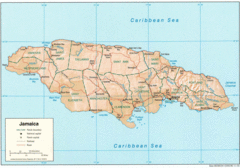
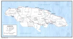
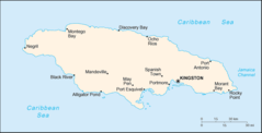
Jamaica map
The largest city of Jamaica is Kingston with a population of 937,700. Other cities include, Portmore population 102,861, May Pen population 44,755, Old Harbour population 26,024 and Half Way Tree population 18,552. See all Jamaica cities & populated places.
Official website of Jamaica
Official Website- Middlesex County
- Surrey County
- Cornwall County
Demographics
| Year | Population | % Change | Method |
|---|---|---|---|
| 1960 | 1,628,520 | - | (Worldbank) |
| 1961 | 1,651,073 | 1.37% | (Worldbank) |
| 1962 | 1,676,501 | 1.52% | (Worldbank) |
| 1963 | 1,703,651 | 1.59% | (Worldbank) |
| 1964 | 1,730,738 | 1.57% | (Worldbank) |
| 1965 | 1,756,511 | 1.47% | (Worldbank) |
| 1966 | 1,780,518 | 1.35% | (Worldbank) |
| 1967 | 1,803,319 | 1.26% | (Worldbank) |
| 1968 | 1,825,879 | 1.24% | (Worldbank) |
| 1969 | 1,849,662 | 1.29% | (Worldbank) |
| 1970 | 1,875,642 | 1.39% | (Worldbank) |
| 1971 | 1,904,276 | 1.5% | (Worldbank) |
| 1972 | 1,935,100 | 1.59% | (Worldbank) |
| 1973 | 1,966,974 | 1.62% | (Worldbank) |
| 1974 | 1,998,309 | 1.57% | (Worldbank) |
| 1975 | 2,028,016 | 1.46% | (Worldbank) |
| 1976 | 2,055,365 | 1.33% | (Worldbank) |
| 1977 | 2,080,831 | 1.22% | (Worldbank) |
| 1978 | 2,105,907 | 1.19% | (Worldbank) |
| 1979 | 2,132,785 | 1.26% | (Worldbank) |
| 1980 | 2,162,846 | 1.39% | (Worldbank) |
| 1981 | 2,196,921 | 1.55% | (Worldbank) |
| 1982 | 2,234,057 | 1.66% | (Worldbank) |
| 1983 | 2,271,736 | 1.66% | (Worldbank) |
| 1984 | 2,306,366 | 1.5% | (Worldbank) |
| 1985 | 2,335,510 | 1.25% | (Worldbank) |
| 1986 | 2,358,161 | 0.96% | (Worldbank) |
| 1987 | 2,375,393 | 0.73% | (Worldbank) |
| 1988 | 2,389,411 | 0.59% | (Worldbank) |
| 1989 | 2,403,464 | 0.58% | (Worldbank) |
| 1990 | 2,419,906 | 0.68% | (Worldbank) |
| 1991 | 2,439,334 | 0.8% | (Worldbank) |
| 1992 | 2,461,049 | 0.88% | (Worldbank) |
| 1993 | 2,484,581 | 0.95% | (Worldbank) |
| 1994 | 2,509,043 | 0.97% | (Worldbank) |
| 1995 | 2,533,711 | 0.97% | (Worldbank) |
| 1996 | 2,558,637 | 0.97% | (Worldbank) |
| 1997 | 2,583,916 | 0.98% | (Worldbank) |
| 1998 | 2,608,873 | 0.96% | (Worldbank) |
| 1999 | 2,632,675 | 0.9% | (Worldbank) |
| 2000 | 2,654,701 | 0.83% | (Worldbank) |
| 2001 | 2,674,702 | 0.75% | (Worldbank) |
| 2002 | 2,692,845 | 0.67% | (Worldbank) |
| 2003 | 2,709,437 | 0.61% | (Worldbank) |
| 2004 | 2,725,015 | 0.57% | (Worldbank) |
| 2005 | 2,740,003 | 0.55% | (Worldbank) |
| 2006 | 2,754,407 | 0.52% | (Worldbank) |
| 2007 | 2,768,227 | 0.5% | (Worldbank) |
| 2008 | 2,781,876 | 0.49% | (Worldbank) |
| 2009 | 2,795,837 | 0.5% | (Worldbank) |
| 2010 | 2,810,460 | 0.52% | (Worldbank) |
| 2011 | 2,825,929 | 0.55% | (Worldbank) |
| 2012 | 2,842,132 | 0.57% | (Worldbank) |
| 2013 | 2,858,709 | 0.58% | (Worldbank) |
| 2014 | 2,875,136 | 0.57% | (Worldbank) |
| 2015 | 2,950,210 | 2.54% | estimation process |
| 2016 | 2,906,238 | -1.51% | (Worldbank) |
| 2017 | 2,890,299 | -0.55% | census |
| 2018 | 2,934,855 | 1.52% | (Worldbank) |
| 2019 | 2,948,279 | 0.46% | (Worldbank) |
| 2026 | 2,825,544 | -4.34% |
Map & Images (more maps)

Caribbean Map
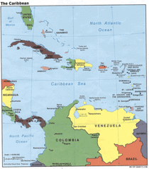
Caribbean Map Large
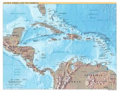
Central America And the Caribbean
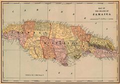
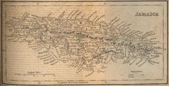
Historical Map Jamaica 1901
Jamaica
Jamaica 1
Jamaica 1882
Jamaica Map
Jamaica Map 1
Jamaica Map 2
Jamaica Roads
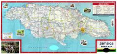
Jamaica Road Map
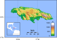
Jamaica Topography
Jm Map
Karibik Jamaika Position
Location Jamaica
Location of Jamaica

Map Jamaica
Map of Central America
Map of Jamaica