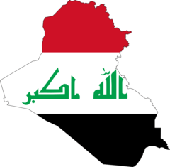
Iraq (Republic of Iraq), IQ
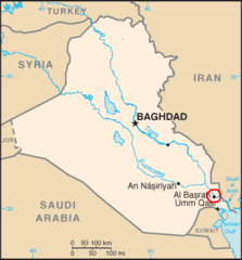
Iraq: This West Asian nation is bordered by Turkey to the north, Iran to the east, Kuwait and Saudi Arabia to the south, and Jordan and Syria to the west.
About

Country Snapshot
Republic of Iraq at a glance
Republic of Iraq currently has 49 quality-checked populated place pages and 22 state or regional pages linked on MapSof.
Mapped cities & towns
49
These counts use a stricter populated-place filter so the main lists stay focused on real city and town pages.
States & regions
22
Open related pagesLargest city
BaghdadPopulation 6,960,000
Top linked places
Quick Facts about Republic of Iraq
| Population | 46,118,793 |
| Country | Iraq |
| Plate code | IRQ |
| Area | 437072 km2 |
| Official name | la République d’Irak |
| Continent | Asia |
| Easternmost point | Point(48.47 29.98) |
| Northernmost point | Point(42.8 37.38) |
| Latitude & Longitude | 33.0000,44.0000 |
| Legislative body | Council of Representatives of Iraq |
| Official language | Arabic, Kurdish |
| Capital | Baghdad |
| Establishment | January 01, 1932 (94 years ago) |
| Time Zone | UTC+04:00, UTC+03:00 |
| Local time | 07:44:34 (10th June 2026) |

Geography
Republic of Iraq is located at 33°0'0"N 44°0'0"E (33.0000000, 44.0000000). It has 6 neighbors: Saudi Arabia, Iran, Syria, Jordan, Kuwait and Turkey.
Iraq map
The largest city of Republic of Iraq is Baghdad with a population of 6,960,000. Other cities include, Mosul population 1,694,000, Najaf population 724,700, Al Ḩillah population 541,034 and Al Kūt population 377,600. See all Republic of Iraq cities & populated places.
Official website of Republic of Iraq
Official Website- Nineveh Governorate
- Maysan Governorate
- Sulaymaniyah Governorate
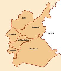
- Diyala Governorate
- Karbala Governorate
- Al Anbar Governorate
- Najaf Governorate
- Kirkuk Governorate
- Dohuk Governorate
- Babylon Governorate
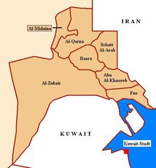
- Basra Governorate
- Al Muthanna Governorate
- Al-Qādisiyyah Governorate
- Saladin Governorate
- Baghdad Governorate
- Wasit Governorate
- Erbil Governorate
- Dhi Qar Governorate
Demographics
| Year | Population | % Change | Method |
|---|---|---|---|
| 1960 | 7,289,759 | - | |
| 1961 | 7,475,354 | 2.48% | |
| 1962 | 7,674,220 | 2.59% | |
| 1963 | 7,888,914 | 2.72% | |
| 1964 | 8,122,200 | 2.87% | |
| 1965 | 8,375,791 | 3.03% | |
| 1966 | 8,651,167 | 3.18% | |
| 1967 | 8,947,399 | 3.31% | |
| 1968 | 9,260,685 | 3.38% | |
| 1969 | 9,585,576 | 3.39% | |
| 1970 | 9,917,982 | 3.35% | |
| 1971 | 10,255,904 | 3.29% | |
| 1972 | 10,599,846 | 3.24% | |
| 1973 | 10,951,169 | 3.21% | |
| 1974 | 11,312,304 | 3.19% | |
| 1975 | 11,684,585 | 3.19% | |
| 1976 | 12,068,300 | 3.18% | |
| 1977 | 12,461,337 | 3.15% | |
| 1978 | 12,859,762 | 3.1% | |
| 1979 | 13,258,367 | 3.01% | |
| 1980 | 13,653,358 | 2.89% | |
| 1981 | 14,045,450 | 2.79% | |
| 1982 | 14,435,914 | 2.7% | |
| 1983 | 14,822,565 | 2.61% | |
| 1984 | 15,202,850 | 2.5% | |
| 1985 | 15,576,396 | 2.4% | |
| 1986 | 15,941,197 | 2.29% | |
| 1987 | 16,301,879 | 2.21% | |
| 1988 | 16,672,907 | 2.23% | |
| 1989 | 17,073,500 | 2.35% | |
| 1990 | 17,517,521 | 2.53% | |
| 1991 | 18,009,865 | 2.73% | |
| 1992 | 18,547,047 | 2.9% | |
| 1993 | 19,123,947 | 3.02% | |
| 1994 | 19,731,733 | 3.08% | |
| 1995 | 20,363,138 | 3.1% | |
| 1996 | 21,017,108 | 3.11% | |
| 1997 | 21,693,597 | 3.12% | |
| 1998 | 22,387,179 | 3.1% | |
| 1999 | 23,091,408 | 3.05% | |
| 2000 | 23,801,156 | 2.98% | |
| 2001 | 24,516,842 | 2.92% | |
| 2002 | 25,238,267 | 2.86% | |
| 2003 | 25,959,531 | 2.78% | |
| 2004 | 26,673,536 | 2.68% | |
| 2005 | 27,377,045 | 2.57% | |
| 2006 | 28,064,095 | 2.45% | |
| 2007 | 28,740,630 | 2.35% | |
| 2008 | 29,429,829 | 2.34% | |
| 2009 | 30,163,199 | 2.43% | |
| 2010 | 30,962,380 | 2.58% | |
| 2011 | 31,760,020 | 2.51% | |
| 2012 | 32,578,209 | 2.51% | |
| 2013 | 33,417,476 | 2.51% | |
| 2014 | 34,411,951 | 2.89% | (Worldbank) |
| 2015 | 35,572,261 | 3.26% | (Worldbank) |
| 2016 | 37,202,572 | 4.38% | |
| 2017 | 38,274,618 | 2.8% | |
| 2018 | 38,433,600 | 0.41% | (Worldbank) |
| 2019 | 39,309,783 | 2.23% | (Worldbank) |
| 2026 | 46,118,793 | 14.76% |
Map & Images (more maps)
Al Anbar Arabic
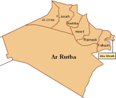
Al Anbar English
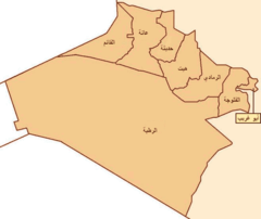
At Tamin Arabic
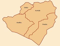
At Tamin Kurdish
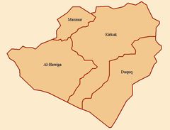
At Tamin
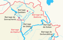
Barrages Irakiens (cropped)
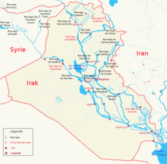
Barrages Irakiens
Basra Location
Basra
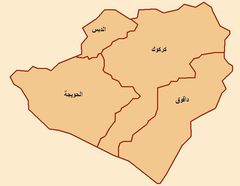
Diyala Province
Flag Map of Iraq
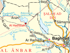
Haditha Location Map
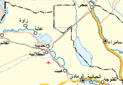
Hadiyah
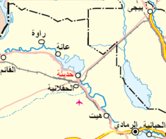
Hadiyah2
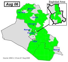
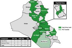
Isf Battlespace Aug7 2006
Isf Battlespace Aug9 2006
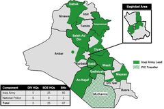
Isf Battlespace Aug9 2006corrected
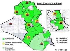
Isf Battlespace December01 2006
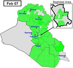
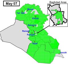
Isf Battlespace Feb 2007
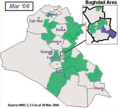
Isf Battlespace Mar30 2006