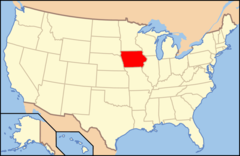
Iowa, US
Iowa: Located in the Midwestern United States, this state is known for its fertile farmlands and significant role in agriculture.
About
Iowa is a state located in the Midwestern United States within the Great Plains region. It is bordered by Minnesota, South Dakota, Nebraska, Missouri, Illinois, and Wisconsin. Iowa is considered an agricultural powerhouse.
Some key facts about Iowa:
- Capital: Des Moines
- Population: Around 3.2 million
- Area: 56,273 square miles
- Nickname: The Hawkeye State
Iowa’s landscape consists of gently rolling plains and farmland, with the Missouri River and Mississippi River forming western borders. The state also contains larger cities along the rivers as well as small, rural towns. Iowa has a humid continental climate with four distinct seasons.
Agriculture plays a pivotal role in Iowa’s economy and culture. The state leads the nation in corn and soybean production as well as hog and egg farming. Other industries include manufacturing, insurance, and renewable energy.
Culturally, Iowa is rooted in its heartland heritage but also home to urban centers. The capital Des Moines serves as a business and cultural hub. The University of Iowa and Iowa State University are major research institutions.
Iowa has been a politically influential state, hosting the first presidential nominating caucuses. It was an early leader in civil rights and recognizing gay marriage. The state has a "first in the nation" caucus status.
In summary, Iowa exemplifies the agricultural tradition, heartland values, and political significance of America’s breadbasket states while also offering urban amenities. Iowa’s mix of rural charm and cosmopolitan assets make it a unique Midwestern destination.

State Snapshot
Iowa at a glance
Iowa currently has 947 quality-checked populated place pages and 99 county pages linked on MapSof.
Mapped cities & towns
947
These counts use a stricter populated-place filter so the main lists stay focused on real city and town pages.
County pages
99
Open related pagesLargest city
Des MoinesPopulation 212,312
Top linked places
Quick Facts about Iowa
| Population | 3,163,561 |
| Country | United States of America |
| Area | 145746 km2 |
| Water as percent of area | 0.74% |
| Land as percent of area | 99.26% |
| Easternmost point | Point(-96.639344 42.737176) |
| Northernmost point | Point(-96.453285 43.500349) |
| Latitude & Longitude | 42.0003,-93.5005 |
| Legislative body | Iowa General Assembly |
| Named for | Iowa people |
| Official language | English |
| Altitude | 958 feet / 292 meters |
| Capital | Des Moines |
| Establishment | December 28, 1846 (179 years ago) |
| Time Zone | America/Chicago, UTC−06:00, Central Time Zone |
| Local time | 13:35:11 (30th June 2026) |
| Weather | 94℉ Chance Showers And Thunderstorms 7-days weather |

Geography
Iowa is located at 42°0'1"N 93°30'2"W (42.0002654, -93.5004916). It has 6 neighbors: Missouri, Illinois, Minnesota, Nebraska, Wisconsin and South Dakota.
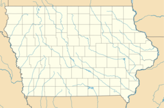
Iowa map
The largest city of Iowa is Des Moines with a population of 212,312. Other cities include, Cedar Rapids population 134,027, Davenport population 101,799, Sioux City population 82,651 and Iowa City population 75,130. See all Iowa cities & populated places.
Largest Cities in Iowa (more)
Cities, Towns, Villages, Neighborhoods & Other Populated Places in Iowa.
| City Name | County | Population |
|---|---|---|
| Des Moines | Polk | 212,312 |
| Cedar Rapids | Linn | 134,027 |
| Davenport | Scott | 101,799 |
| Sioux City | Woodbury | 82,651 |
| Iowa City | Johnson | 75,130 |
| Ankeny | Polk | 70,068 |
| West Des Moines | Polk | 69,057 |
| Waterloo | Black Hawk | 67,292 |
| Ames | Story | 67,033 |
| Council Bluffs | Pottawattamie | 62,216 |
| Dubuque | Dubuque | 57,781 |
| Urbandale | Polk | 44,650 |
| Marion | Linn | 40,780 |
| Cedar Falls | Black Hawk | 40,231 |
| Bettendorf | Scott | 36,665 |
| Mason City | Cerro Gordo | 26,931 |
Show more Iowa cities and populated places
Weather
A chance of showers and thunderstorms. Mostly sunny, with a high near 94. Chance of precipitation is 30%.
7-Day ForecastOfficial website of Iowa
Official Website- Polk County
- Audubon County
- Muscatine County
- Sac County
- Greene County
- Chickasaw County
- Cass County
- Clinton County
- Butler County
- Ida County
- Webster County
- Black Hawk County
- Benton County
- Hancock County
- Calhoun County
- Tama County
- Lee County
- Des Moines County
- Guthrie County
- Madison County
- Poweshiek County
- Decatur County
- Lyon County
- Ringgold County
- Lucas County
- Dubuque County
- Hardin County
- Story County
- Monona County
- Delaware County
- Davis County
- Winnebago County
- Wayne County
- Montgomery County
- Floyd County
- Emmet County
- Humboldt County
- Mahaska County
- Warren County
- Buena Vista County
- Adair County
- Wapello County
- Howard County
- Harrison County
- Union County
- Monroe County
- Adams County
- Winneshiek County
- Woodbury County
- Cerro Gordo County
- Van Buren County
- Scott County
- Crawford County
- Pocahontas County
- Linn County
- Appanoose County
- Franklin County
- Jones County
- Clay County
- Jackson County
- Carroll County
- Louisa County
- Hamilton County
- Palo Alto County
- Marshall County
- Plymouth County
- Allamakee County
- Mitchell County
- Worth County
- Buchanan County
- Page County
- Boone County
- Cherokee County
- Kossuth County
- Marion County
- Henry County
- Jasper County
- Osceola County
- Cedar County
- Jefferson County
- Mills County
- Dickinson County
- Washington County
- Sioux County
- Shelby County
- Taylor County
- Clayton County
- O'Brien County
- Iowa County
- Dallas County
- Fayette County
- Fremont County
- Bremer County
- Johnson County
- Clarke County
- Grundy County
- Keokuk County
- Pottawattamie County
- Wright County
Demographics
| Year | Population | % Change | Method |
|---|---|---|---|
| 1910 | 2,224,771 | - | census |
| 1920 | 2,404,021 | 7.46% | census |
| 1930 | 2,470,939 | 2.71% | census |
| 1940 | 2,538,268 | 2.65% | census |
| 1950 | 2,621,073 | 3.16% | census |
| 1960 | 2,757,537 | 4.95% | census |
| 1970 | 2,824,376 | 2.37% | census |
| 1980 | 2,913,808 | 3.07% | census |
| 1990 | 2,776,755 | -4.94% | census |
| 2000 | 2,926,324 | 5.11% | census |
| 2010 | 3,046,355 | 3.94% | census |
| 2011 | 3,066,336 | 0.65% | estimation process |
| 2012 | 3,076,190 | 0.32% | estimation process |
| 2013 | 3,092,997 | 0.54% | estimation process |
| 2014 | 3,109,350 | 0.53% | estimation process |
| 2015 | 3,120,960 | 0.37% | estimation process |
| 2016 | 3,131,371 | 0.33% | estimation process |
| 2017 | 3,141,550 | 0.32% | estimation process |
| 2018 | 3,148,618 | 0.22% | estimation process |
| 2019 | 3,155,070 | 0.2% | estimation process |
| 2020 | 3,163,561 | 0.27% | estimation process |
People born in Iowa (199)
People born in Iowa, including tractor developer John Froelich, Olympic wrestler Glen Brand, writer Marlo Morgan, .
More notable people
- A. Wallis Lloyd (German-American writer) he was born in 04/05/1962
- Rex Taylor (screenwriter) he was born in 01/11/1889
- Winton Hoch (cinematographer) he was born in 31/07/1905
- Kiersten Warren (American actress) she was born in 04/11/1965
- Sarah Utterback (American actress) she was born in 12/01/1982
- Thomas Braden (American journalist) he was born in 22/02/1917
- Marilyn Eastman (American actress) she was born in 17/12/1933
- Carl Magee (American lawyer and publisher) he was born in 01/01/1872
- Amotz Plessner (American composer) he was born in 20/12/1962
- Paul McCracken (American economist) he was born in 29/12/1915
- Eugene Burton Ely (American aviation pioneer) he was born in 21/10/1886
- Edwin H. Colbert (American paleontologist) he was born in 28/09/1905
- Archie Stout (American cinematographer) he was born in 30/03/1886
- Lawrence Sullivan Ross (Governor of Texas, Confederate States of America general, Texas A&M University president (1838-1898)) he was born in 27/09/1838
- Patty Waters (American jazz musician) she was born in 11/03/1946
- Charles Edward Merriam (American political scientist) he was born in 15/11/1874
- John H. Morehead (American politician (1861-1942)) he was born in 03/12/1861
- Eddie Barefield (American musician) he was born in 12/12/1909
Other places with the same name (1)
- Iowa, Louisiana town in Louisiana, United States with a population of 3,109 people.
Iowa Counties (more)
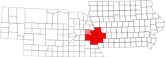
Polk County

county in Iowa, United States
Linn County

county in Oregon, United States
Scott County

county in Tennessee, United States
| County Name | Population |
|---|---|
| Polk County | 494,281 |
| Linn County | 227,854 |
| Scott County | 173,216 |
| Johnson County | 153,740 |
| Black Hawk County | 130,786 |
| Woodbury County | 103,138 |
| Story County | 98,237 |
| Dubuque County | 97,590 |
| Dallas County | 96,963 |
| Pottawattamie County | 93,328 |
| Warren County | 52,265 |
| Clinton County | 46,392 |
| Muscatine County | 42,394 |
| Cerro Gordo County | 42,103 |
| Marshall County | 39,495 |
| Des Moines County | 38,708 |
Show more Iowa counties
Map & Images (more maps)
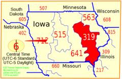
Area Code 319
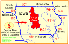
Area Code 515
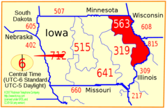
Area Code 563
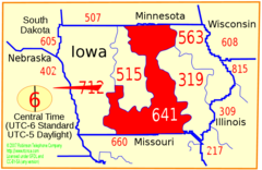
Area Code 641
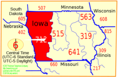
Area Code 712
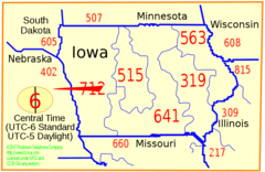
Area Code Ia
I 129 (ia Ne) Map
I 235 (ia) Map
I 29 (ia) Map
I 35 (ia) Map
I 380 (ia) Map
I 480 (ia Ne) Map
I 680 (ia Ne) Map
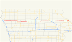
I 80 (ia) Map
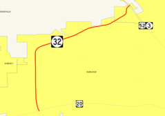
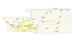
Iowa 32 Map
Map of Usa Ia
Omaha Council Bluffs Msa
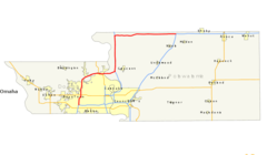
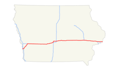
Us 20 Map (iowa)
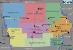
Iowa Regions Map
Usa Iowa Location Map