Germany (Federal Republic of Germany), DE
Germany: Located in Central Europe, this country is a federal parliamentary republic with a significant economic and political presence on the continent and globally.
About

Country Snapshot
Federal Republic of Germany at a glance
Federal Republic of Germany currently has 4,936 quality-checked populated place pages and 16 state or regional pages linked on MapSof.
Mapped cities & towns
4,936
These counts use a stricter populated-place filter so the main lists stay focused on real city and town pages.
States & regions
16
Open related pagesLargest city
SachsenPopulation 4,077,937
Top linked places
Quick Facts about Federal Republic of Germany
| Population | 83,491,249 |
| Country | Germany |
| Different from | Germany |
| Plate code | D |
| Area | 357400 km2 |
| Official name | جمهورية ألمانيا الاتحادية, République fédérale d'Allemagne, Deutschland, Федерална република Германия, Republika Federalna Niemiec, Ομοσπονδιακή Δημοκρατία της Γερμανίας, Zwjazkowa republika Němska, Republica Federală Germania, Савезна Република Немачка, Федеративная Республика Германия, Bundesrepublik Deutschland, República Federal da Alemanha, Zwězkowa republika Nimska, Federacia Respubliko Germanujo, Saksan liittotasavalta, Федеративна Республіка Німеччина, Spolková republika Německo, Saksamaa Liitvabariik, 德意志联邦共和国, Federal Republic of Germany, Repubblica Federale di Germania, הרפובליקה הפדרלית של גרמניה, გერმანიის ფედერალური რესპუბლიკა, la République fédérale d’Allemagne |
| Water as percent of area | 2.3% |
| Land as percent of area | 97.7% |
| Speed limit | 100, 50 |
| Drainage basin | Danube basin, Oder Basin, Rhine basin, Weser Basin, Elbe Basin |
| Continent | Europe |
| Easternmost point | Point(15.04178122 51.27279981) |
| Northernmost point | Point(8.66919994 54.91120841) |
| Latitude & Longitude | 51.5000,10.5000 |
| Patron saint | Michael the Archangel |
| Legislative body | Bundesrat, Bundestag of Germany |
| Named for | Saxons, Prussia, mutism, theodisk, Alamanni, foreigner, Germania |
| Official language | German |
| Capital | Bonn, Berlin |
| Time Zone | UTC+02:00, UTC+01:00, Europe/Berlin, Central European Time Zone |
| Local time | 11:05:41 (15th June 2026) |

Geography
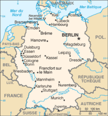
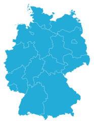
Federal Republic of Germany is located at 51°30'0"N 10°30'0"E (51.5000000, 10.5000000). It has 9 neighbors: Poland, Denmark, Switzerland, Netherlands, Austria, Belgium, Luxembourg, France and Czech Republic.
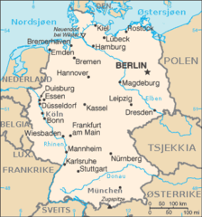
Germany map
The largest city of Federal Republic of Germany is Berlin with a population of 3,644,826. Other cities include, Köln population 1,085,664, Frankfurt am Main population 753,056, Dortmund population 587,010 and Essen population 583,109. See all Federal Republic of Germany cities & populated places.
Official website of Federal Republic of Germany
Official WebsiteCompare Federal Republic of Germany with
- Saxony
- Brandenburg
- Mecklenburg-Vorpommern
- Berlin
- Baden-Württemberg
- Thuringia
- Saarland
- Saxony-Anhalt
- North Rhine-Westphalia
- Schleswig-Holstein
- Lower Saxony
- Free Hanseatic City of Bremen
- Bavaria
- Hesse
- Hamburg
- Rhineland-Palatinate
Demographics
| Year | Population | % Change | Method |
|---|---|---|---|
| 1954 | 70,945,000 | - | 2015-01-01T00:00:00Z |
| 1956 | 70,943,000 | -0% | 2015-01-01T00:00:00Z |
| 1958 | 72,031,000 | 1.51% | 2015-01-01T00:00:00Z |
| 1960 | 73,147,000 | 1.53% | 2015-01-01T00:00:00Z |
| 1961 | 73,377,632 | 0.31% | (Worldbank) |
| 1962 | 74,383,000 | 1.35% | 2015-01-01T00:00:00Z |
| 1963 | 74,714,353 | 0.44% | (Worldbank) |
| 1964 | 75,591,000 | 1.16% | 2015-01-01T00:00:00Z |
| 1965 | 75,963,695 | 0.49% | (Worldbank) |
| 1966 | 76,864,000 | 1.17% | 2015-01-01T00:00:00Z |
| 1967 | 76,951,336 | 0.11% | (Worldbank) |
| 1968 | 77,550,000 | 0.77% | 2015-01-01T00:00:00Z |
| 1969 | 77,909,682 | 0.46% | (Worldbank) |
| 1970 | 78,069,000 | 0.2% | 2015-01-01T00:00:00Z |
| 1971 | 78,312,842 | 0.31% | (Worldbank) |
| 1972 | 78,821,000 | 0.64% | 2015-01-01T00:00:00Z |
| 1973 | 78,936,666 | 0.15% | (Worldbank) |
| 1974 | 78,882,000 | -0.07% | 2015-01-01T00:00:00Z |
| 1975 | 78,673,554 | -0.26% | (Worldbank) |
| 1976 | 78,209,000 | -0.59% | 2015-01-01T00:00:00Z |
| 1977 | 78,159,814 | -0.06% | (Worldbank) |
| 1978 | 78,073,000 | -0.11% | 2015-01-01T00:00:00Z |
| 1979 | 78,126,350 | 0.07% | (Worldbank) |
| 1980 | 78,397,000 | 0.35% | 2015-01-01T00:00:00Z |
| 1981 | 78,407,907 | 0.01% | (Worldbank) |
| 1982 | 78,248,000 | -0.2% | 2015-01-01T00:00:00Z |
| 1983 | 78,128,282 | -0.15% | (Worldbank) |
| 1984 | 77,709,000 | -0.54% | 2015-01-01T00:00:00Z |
| 1985 | 77,684,873 | -0.03% | (Worldbank) |
| 1986 | 77,780,000 | 0.12% | 2015-01-01T00:00:00Z |
| 1987 | 77,839,920 | 0.08% | (Worldbank) |
| 1988 | 78,390,000 | 0.7% | 2015-01-01T00:00:00Z |
| 1989 | 78,751,283 | 0.46% | (Worldbank) |
| 1990 | 79,753,000 | 1.26% | 2015-01-01T00:00:00Z |
| 1991 | 80,013,896 | 0.33% | (Worldbank) |
| 1992 | 80,975,000 | 1.19% | 2015-01-01T00:00:00Z |
| 1993 | 81,156,363 | 0.22% | (Worldbank) |
| 1994 | 81,539,000 | 0.47% | 2015-01-01T00:00:00Z |
| 1995 | 81,678,051 | 0.17% | (Worldbank) |
| 1996 | 82,012,000 | 0.41% | 2015-01-01T00:00:00Z |
| 1997 | 82,034,771 | 0.03% | (Worldbank) |
| 1998 | 82,037,000 | 0% | 2015-01-01T00:00:00Z |
| 1999 | 82,100,243 | 0.08% | (Worldbank) |
| 2000 | 82,260,000 | 0.19% | 2015-01-01T00:00:00Z |
| 2001 | 82,349,925 | 0.11% | (Worldbank) |
| 2002 | 82,537,000 | 0.23% | 2015-01-01T00:00:00Z |
| 2003 | 82,534,176 | -0% | (Worldbank) |
| 2004 | 82,501,000 | -0.04% | 2015-01-01T00:00:00Z |
| 2005 | 82,469,422 | -0.04% | (Worldbank) |
| 2006 | 82,315,000 | -0.19% | 2015-01-01T00:00:00Z |
| 2007 | 82,266,372 | -0.06% | (Worldbank) |
| 2008 | 82,002,000 | -0.32% | 2015-01-01T00:00:00Z |
| 2009 | 81,902,307 | -0.12% | (Worldbank) |
| 2010 | 81,752,000 | -0.18% | 2015-01-01T00:00:00Z |
| 2011 | 80,274,983 | -1.84% | (Worldbank) |
| 2012 | 80,500,000 | 0.28% | 2015-01-01T00:00:00Z |
| 2013 | 80,645,605 | 0.18% | (Worldbank) |
| 2014 | 81,083,600 | 0.54% | 2015-01-01T00:00:00Z |
| 2015 | 82,175,700 | 1.33% | 2015-01-01T00:00:00Z |
| 2016 | 82,521,653 | 0.42% | 2015-01-01T00:00:00Z |
| 2017 | 82,695,000 | 0.21% | 2015-01-01T00:00:00Z |
| 2018 | 82,979,100 | 0.34% | 2015-01-01T00:00:00Z |
| 2019 | 83,149,300 | 0.2% | 2015-01-01T00:00:00Z |
| 2026 | 83,491,249 | 0.41% |
Map & Images (more maps)
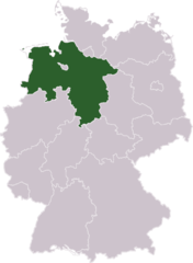
Germany Laender Niedersachsen
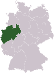
Germany Laender Nordrhein Westfalen
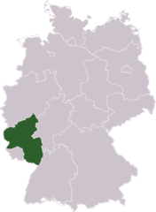
Germany Laender Rheinland Pfalz
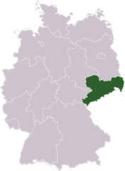
Germany Laender Sachsen
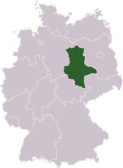
Germany Laender Sachsen Anhalt
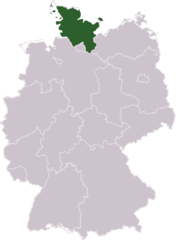
Germany Laender Schleswig Holstein
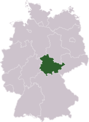
Germany Laender Thueringen
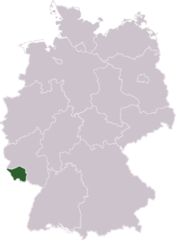
Germany Laender Saarland
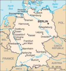
Germany Cia Wfb Map
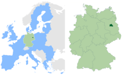
Berlin In Germany And Eu
Tyskland Kart
Deutschland Bundeslaender 1990
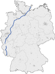
Bundesautobahn 1 Map
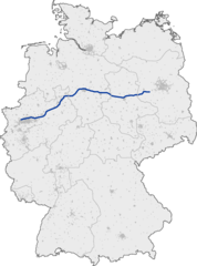
Bundesautobahn 2 Map
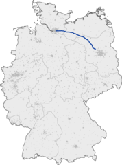
Bundesautobahn 24 Map
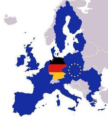
Map Europe With Europe And German Flag
000 Gjermania Harta
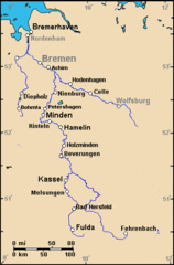
A Weser Watershed Closer
Ard Karte
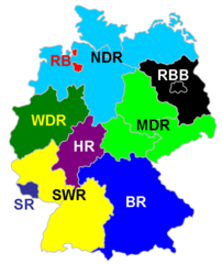
Ard