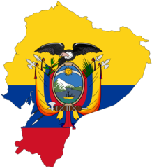
Ecuador (Republic of Ecuador), EC
Ecuador: Located in western South America, this equatorial nation boasts diverse landscapes, from Amazonian rainforests to Andean highlands and the Galápagos Islands.
About

Country Snapshot
Republic of Ecuador at a glance
Republic of Ecuador currently has 88 quality-checked populated place pages and 22 state or regional pages linked on MapSof.
Mapped cities & towns
88
These counts use a stricter populated-place filter so the main lists stay focused on real city and town pages.
States & regions
22
Open related pagesLargest city
CañarPopulation 2,127,685
Top linked places
Quick Facts about Republic of Ecuador
| Population | 18,103,660 |
| Country | Ecuador |
| Plate code | EC |
| Area | 283560 km2 |
| Official name | Republiek Ecuador, Repubblica dell'Ecuador, República do Equador, Republic of Ecuador, República do Equador, Republik Ecuador, 厄瓜多共和國, Republika Ekvador, 에콰도르 공화국, Republika Ekwadoru, República del Ecuador, Ikwayur Runaq Imayka, la République d’Équateur, جمهورية الإكوادور, Cộng hòa Ecuador, எக்வடோர் குடியரசு, جمهوری اکوادور, Res Publica Aequatoriae, ईक्वाडोर गणराज्य, ইকুয়েডর প্রজাতন্ত্র, República de l'Equador, République de l'Équateur, Ecuador, República del Ecuador, Republic of Ecuador, エクアドル共和国, جمہوریہ ایکواڈور, Республика Эквадор, Республіка Еквадор, Republic of Ecuador, Republik Ekuador |
| Continent | South America |
| Northernmost point | Point(-78.87 1.45), Point(-91.998611111 1.6675) |
| Latitude & Longitude | -2.0000,-77.5000 |
| Legislative body | National Assembly |
| Named for | equator |
| Official language | Shuar, Kichwa, Spanish |
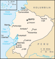
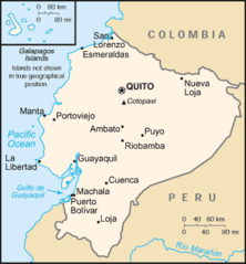
| Capital | Quito |
| Time Zone | UTC−06:00, UTC−05:00 |
| Local time | 08:10:13 (13th June 2026) |

Geography
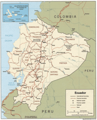
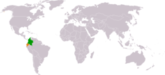
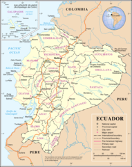
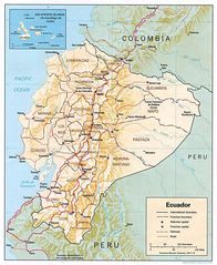
Republic of Ecuador is located at 2°0'0"S 77°30'0"W (-2.0, -77.5). It has 2 neighbors: Colombia and Peru.
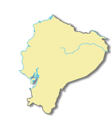
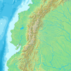
Ecuador map
The largest city of Republic of Ecuador is Quito with a population of 2,011,388. Other cities include, Guayaquil population 1,952,029, Santo Domingo de los Colorados population 200,421, Machala population 198,123 and Manta population 183,166. See all Republic of Ecuador cities & populated places.
Official website of Republic of Ecuador
Go to Official Website Go to Official Website Go to Official Website Go to Official Website Go to Official WebsiteCompare Republic of Ecuador with
- Los Ríos Province
- Guayas Province
- Galápagos Province
- Pichincha Province
- Tungurahua Province
- Azuay Province
- Santo Domingo de los Tsáchilas Province
- Loja Province
- El Oro Province
- Chimborazo Province
- Morona-Santiago Province
- Manabí Province
- Zamora Chinchipe
- Esmeraldas
- Cotopaxi Province
- Carchi Province
- Sucumbíos Province
- Santa Elena Province
- Orellana Province
- Napo Province
- Bolívar Province
- Imbabura Province
- Cañar Province
- Pastaza Province
Demographics
| Year | Population | % Change | Method |
|---|---|---|---|
| 1910 | 1,500,000 | - | |
| 1960 | 4,514,593 | 66.77% | |
| 1961 | 4,644,682 | 2.8% | |
| 1962 | 4,779,559 | 2.82% | |
| 1963 | 4,919,224 | 2.84% | |
| 1964 | 5,063,645 | 2.85% | |
| 1965 | 5,212,760 | 2.86% | |
| 1966 | 5,366,554 | 2.87% | |
| 1967 | 5,524,930 | 2.87% | |
| 1968 | 5,687,634 | 2.86% | |
| 1969 | 5,854,337 | 2.85% | |
| 1970 | 6,024,764 | 2.83% | |
| 1971 | 6,198,787 | 2.81% | |
| 1972 | 6,376,333 | 2.78% | |
| 1973 | 6,557,257 | 2.76% | |
| 1974 | 6,741,417 | 2.73% | |
| 1975 | 6,928,694 | 2.7% | |
| 1976 | 7,119,087 | 2.67% | |
| 1977 | 7,312,553 | 2.65% | |
| 1978 | 7,508,899 | 2.61% | |
| 1979 | 7,707,895 | 2.58% | |
| 1980 | 7,909,432 | 2.55% | |
| 1981 | 8,113,200 | 2.51% | |
| 1982 | 8,319,351 | 2.48% | |
| 1983 | 8,528,791 | 2.46% | |
| 1984 | 8,742,761 | 2.45% | |
| 1985 | 8,962,049 | 2.45% | |
| 1986 | 9,186,995 | 2.45% | |
| 1987 | 9,417,031 | 2.44% | |
| 1988 | 9,650,906 | 2.42% | |
| 1989 | 9,886,866 | 2.39% | |
| 1990 | 10,123,593 | 2.34% | |
| 1991 | 10,360,630 | 2.29% | |
| 1992 | 10,598,168 | 2.24% | |
| 1993 | 10,836,327 | 2.2% | |
| 1994 | 11,075,454 | 2.16% | |
| 1995 | 11,315,800 | 2.12% | |
| 1996 | 11,557,151 | 2.09% | |
| 1997 | 11,799,289 | 2.05% | |
| 1998 | 12,042,454 | 2.02% | |
| 1999 | 12,286,995 | 1.99% | |
| 2000 | 12,533,087 | 1.96% | |
| 2001 | 12,780,869 | 1.94% | |
| 2002 | 13,030,041 | 1.91% | |
| 2003 | 13,279,806 | 1.88% | |
| 2004 | 13,529,091 | 1.84% | |
| 2005 | 13,777,131 | 1.8% | |
| 2006 | 14,023,503 | 1.76% | |
| 2007 | 14,268,397 | 1.72% | |
| 2008 | 14,512,402 | 1.68% | |
| 2009 | 14,756,424 | 1.65% | |
| 2010 | 15,001,072 | 1.63% | |
| 2011 | 15,246,481 | 1.61% | |
| 2012 | 15,492,264 | 1.59% | |
| 2013 | 15,737,878 | 1.56% | |
| 2014 | 15,951,838 | 1.34% | (Worldbank) |
| 2015 | 16,212,020 | 1.6% | (Worldbank) |
| 2016 | 16,491,115 | 1.69% | (Worldbank) |
| 2017 | 16,624,858 | 0.8% | |
| 2018 | 17,084,357 | 2.69% | (Worldbank) |
| 2019 | 17,373,662 | 1.67% | (Worldbank) |
| 2026 | 18,103,660 | 4.03% |
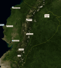
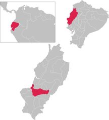
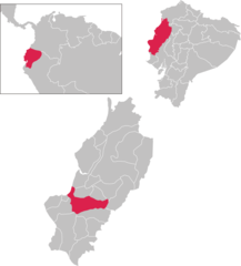
Map & Images (more maps)
Colombia Ecuador Locator
Ec Map Hr
Ec Map
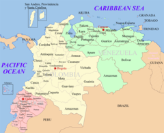
Ecuador Colombia Venezuela Map 1
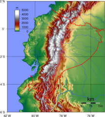
Ecuador Topography
Ecuador Cantons
Ecuador Locatorv2
Ecuadormapa
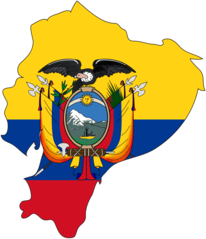
Flag Map of Ecuador
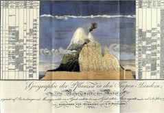
Humboldt1805 Chimborazo
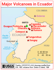
Majorvolcanoesinecuador Usgs
Map of Ecuador Demis
Mapa Portoviejo
Mapa Portoviejo 1

Provinces of Ecuador
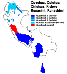
Quechua Subgroups 1
Un Ecuador
Ecuador Flag Map

Ecuador Map
Ecuador Shaded Relief Map