Delhi, Delhi
Delhi: Located in northern India, this sprawling metropolis is one of the oldest continually inhabited cities in the world.
About
Quick Facts about Delhi
| Population | 26,495,000 |
| Country | Mughal Empire, Sur Empire, India, Tomara dynasty, Delhi Sultanate, Chahamanas of Shakambhari, British India, Mughal Empire, Ghurid Empire |
| State | Delhi (India) |
| Different from | National Capital Territory of Delhi |
| Area | 1484 km2 |
| Official name | दिल्ली |
| Continent | Asia |
| Latitude & Longitude | 28.6520,77.2315 |
| Legislative body | Delhi Legislative Assembly |
| Male population | 8987326 |
| Official language | Urdu, Punjabi, Hindi, English |
| Female population | 7800615 |
| Altitude | 656 feet / 200 meters |
| Capital | New Delhi |
| Capital city | Delhi is capital of Khalji dynasty, Lodi dynasty, Sur Empire, Sayyid dynasty, Delhi Sultanate, Tughlaq dynasty, Mamluk sultanate |
| Establishment | January 01, -0500 (2526 years ago) |
| Time Zone | UTC+05:30 |
| Local time | 23:02:59 (10th June 2026) |
Geography
Delhi is located at 28°39'7"N 77°13'53"E (28.6519500, 77.2314900).
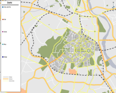
Delhi map
Click "full screen"  icon to open full mode. View satellite images
Official website of Delhi
Official Website- Beijing
- Chicago (2001 )
- Fukuoka Prefecture (2007 )
- Karachi
- Kuala Lumpur
- London (2002 )
- Moscow (2002 )
- Seoul
- Tokyo
- Ulaanbaatar (2002 )
- Yerevan
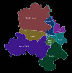
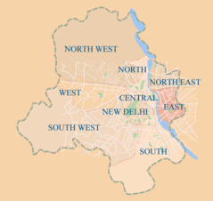
- North West Delhi district
- North Delhi district
- West Delhi district
- New Delhi
- East Delhi district
- Central Delhi district
- South Delhi district
- South West Delhi district
- North East Delhi district
Demographics
| Year | Population | % Change | Method |
|---|---|---|---|
| 2011 | 16,787,941 | - | census |
| 2016 | 26,495,000 | 36.64% | census |
Map of countries with a smaller population than Delhi
DEL, Daehli, Dehli, Dehlī, Delchi, Delhio, Delhí, Delhî, Deli, Delis, Delkhi, Dellium, Delí, Dilhi, Dilli, Dillí, Dillī, Dähli, Déhli, Faritani Delhi, New Delhi, Old Delhi, Sahdzahanabad, Stare Deli, de li, dehali, delli, deri, dhilli, dhly, dhly qdym, dil'hi, dili, dlhy, dly, dlھy, dylhy, na'i dilli, prany dہly, tilli, Šáhdžahanabád, Δελχί, Дели, Делхи, Делі, Деҳли, Дэлі, Старе Делі, Դելի, דלהי, דעלהי, دلهي, دلھی, دلی, دهلي, دهلی قدیم, ديلهى, دہلی, دێھلی, پرانی دہلی, ډېلي, ދިއްލީ, दिल्ली, देहली, नई दिल्ली, দিল্লি, দিল্লী, ਦਿੱਲੀ, દિલ્હી, ଦିଲ୍ଲୀ, தில்லி, ఢిల్లీ, ದೆಹಲಿ, ഡെൽഹി, เดลี, დელი, デリー, 德里, 델리
Other places with the same name (5)
- Delhi, Ohio township in Hamilton County, Ohio with a population of 29,764 people.
- Delhi, New York city in Delaware County, Iowa with a population of 4,745 people.
- Delhi, Louisiana town in Richland Parish, Louisiana with a population of 2,753 people.
- Delhi, Iowa city in Delaware County, Iowa with a population of 470 people.
- Delhi, Minnesota city in Redwood County, Minnesota with a population of 279 people.
Map & Images (more maps)
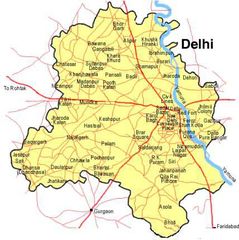
Delhimap
428 x 429
- 47,591k -
jpg
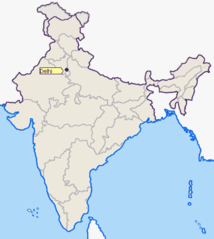
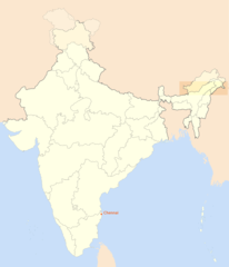
Locationofdelhi
400 x 447
- 17,398k -
png
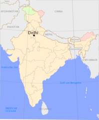
Overzichtskaart Delhi
1165 x 1415
- 64,984k -
png
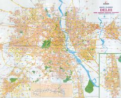
New Delhi Map
920 x 798
- 79,649k -
png
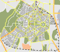
Delhi Map 2
428 x 433
- 9,161k -
png
Delhi Map India
1024 x 824
- 133,883k -
png
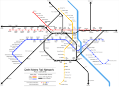
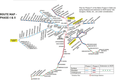
Delhi Metro Rail Map
1024 x 754
- 61,224k -
png
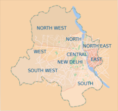
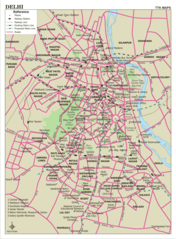
Delhi Districts Map
1500 x 1418
- 108,655k -
png
Delhi Metro Map
1678 x 1143
- 198,982k -
png
Delhi City Map
900 x 1223
- 292,851k -
png
Delhi Metro Rail
2400 x 1977
- 606,562k -
jpg
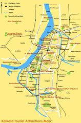
City Map of Kolkata
598 x 907
- 89,813k -
jpg

Delhi Political Map
2000 x 1648
- 608,141k -
jpg
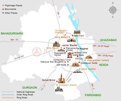
Delhi Tourism Map
600 x 503
- 26,607k -
jpg
Districts Map of Delhi
1800 x 1699
- 163,578k -
png
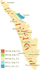
Hazard Map of Kerala
600 x 1054
- 40,760k -
png
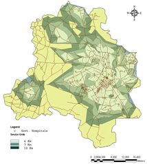
Health Map Delhi
806 x 900
- 86,888k -
jpg
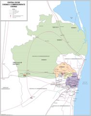
Location Map of Chennai
1714 x 2000
- 94,543k -
png
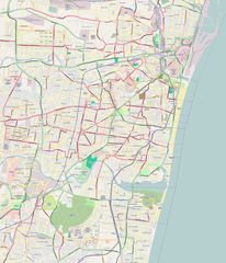
Map Chennai
1566 x 2000
- 235,935k -
jpg
Map of Chennai
1713 x 2000
- 592,266k -
jpg
Map of Delhi
2200 x 1792
- 680,468k -
jpg