Costa Rica (Republic of Costa Rica), CR
Costa Rica: This Central American nation is bordered by Nicaragua to the north and Panama to the south, with coastlines on both the Caribbean Sea and the Pacific Ocean.
About

Country Snapshot
Republic of Costa Rica at a glance
Republic of Costa Rica currently has 76 quality-checked populated place pages and 7 state or regional pages linked on MapSof.
Mapped cities & towns
76
These counts use a stricter populated-place filter so the main lists stay focused on real city and town pages.
States & regions
7
Open related pagesLargest city
San JoséPopulation 335,007
Top linked places
Quick Facts about Republic of Costa Rica
| Population | 5,309,625 |
| Country | Costa Rica |
| Plate code | CR |
| Area | 51100 km2 |
| Official name | Costa Rica, la République du Costa Rica |
| Continent | North America |
| Easternmost point | Point(-87.09442 5.51879) |
| Northernmost point | Point(-85.62 11.22) |
| Latitude & Longitude | 10.0000,-84.0000 |
| Patron saint | Virgin of the Angels |
| Legislative body | Legislative Assembly of Costa Rica |
| Official language | Spanish |
| Capital | San José |
| Establishment | January 01, 1821 (205 years ago) |
| Time Zone | UTC−06:00 |
| Local time | 01:11:18 (10th June 2026) |

Geography
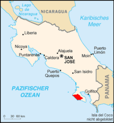
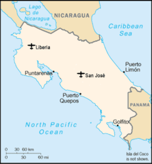
Republic of Costa Rica is located at 10°0'0"N 84°0'0"W (10.0000000, -84.0000000). It has 2 neighbors: Nicaragua and Panama.
Costa Rica map
The largest city of Republic of Costa Rica is San José with a population of 335,007. Other cities include, San Isidro population 43,595 and Puntarenas population 35,650. See all Republic of Costa Rica cities & populated places.
Official website of Republic of Costa Rica
Official WebsiteCompare Republic of Costa Rica with
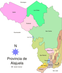
- Alajuela Province
- Limón Province
- San José Province
- Provincia de Cartago
- Puntarenas Province
- Guanacaste Province
- Heredia Province
Demographics
| Year | Population | % Change | Method |
|---|---|---|---|
| 1960 | 1,334,044 | - | 2128999 |
| 1961 | 1,381,532 | 3.44% | 2128999 |
| 1962 | 1,431,088 | 3.46% | 2128999 |
| 1963 | 1,481,890 | 3.43% | 2128999 |
| 1964 | 1,532,828 | 3.32% | 2128999 |
| 1965 | 1,583,078 | 3.17% | 2128999 |
| 1966 | 1,632,500 | 3.03% | 2128999 |
| 1967 | 1,681,241 | 2.9% | 2128999 |
| 1968 | 1,729,135 | 2.77% | 2128999 |
| 1969 | 1,776,076 | 2.64% | 2128999 |
| 1970 | 1,822,106 | 2.53% | 2128999 |
| 1971 | 1,867,044 | 2.41% | 2128999 |
| 1972 | 1,911,212 | 2.31% | 2128999 |
| 1973 | 1,955,790 | 2.28% | 2128999 |
| 1974 | 2,002,358 | 2.33% | 2128999 |
| 1975 | 2,052,076 | 2.42% | 2128999 |
| 1976 | 2,105,377 | 2.53% | 2128999 |
| 1977 | 2,162,047 | 2.62% | 2128999 |
| 1978 | 2,221,800 | 2.69% | 2128999 |
| 1979 | 2,284,076 | 2.73% | 2128999 |
| 1980 | 2,348,427 | 2.74% | 2128999 |
| 1981 | 2,414,832 | 2.75% | 2128999 |
| 1982 | 2,483,355 | 2.76% | 2128999 |
| 1983 | 2,553,714 | 2.76% | 2128999 |
| 1984 | 2,625,561 | 2.74% | 2128999 |
| 1985 | 2,698,616 | 2.71% | 2128999 |
| 1986 | 2,772,823 | 2.68% | 2128999 |
| 1987 | 2,848,141 | 2.64% | 2128999 |
| 1988 | 2,924,348 | 2.61% | 2128999 |
| 1989 | 3,001,196 | 2.56% | 2128999 |
| 1990 | 3,078,551 | 2.51% | 2128999 |
| 1991 | 3,155,979 | 2.45% | 2128999 |
| 1992 | 3,233,568 | 2.4% | 2128999 |
| 1993 | 3,312,307 | 2.38% | 2128999 |
| 1994 | 3,393,575 | 2.39% | 2128999 |
| 1995 | 3,478,197 | 2.43% | 2128999 |
| 1996 | 3,566,605 | 2.48% | 2128999 |
| 1997 | 3,658,020 | 2.5% | 2128999 |
| 1998 | 3,750,585 | 2.47% | 2128999 |
| 1999 | 3,841,734 | 2.37% | 2128999 |
| 2000 | 3,929,588 | 2.24% | 2128999 |
| 2001 | 4,013,488 | 2.09% | 2128999 |
| 2002 | 4,093,840 | 1.96% | 2128999 |
| 2003 | 4,171,145 | 1.85% | 2128999 |
| 2004 | 4,246,336 | 1.77% | 2128999 |
| 2005 | 4,320,130 | 1.71% | 2128999 |
| 2006 | 4,392,493 | 1.65% | 2128999 |
| 2007 | 4,463,226 | 1.58% | 2128999 |
| 2008 | 4,532,711 | 1.53% | 2128999 |
| 2009 | 4,601,424 | 1.49% | 2128999 |
| 2010 | 4,669,685 | 1.46% | 2128999 |
| 2011 | 4,737,680 | 1.44% | 2128999 |
| 2012 | 4,805,295 | 1.41% | 2128999 |
| 2013 | 4,872,166 | 1.37% | 2128999 |
| 2014 | 4,795,396 | -1.6% | (Worldbank) |
| 2015 | 4,847,804 | 1.08% | (Worldbank) |
| 2016 | 4,899,345 | 1.05% | (Worldbank) |
| 2017 | 4,905,769 | 0.13% | 2128999 |
| 2018 | 4,999,441 | 1.87% | (Worldbank) |
| 2019 | 5,047,561 | 0.95% | (Worldbank) |
| 2026 | 5,309,625 | 4.94% |
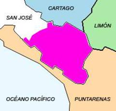
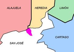
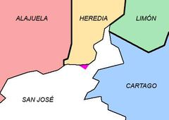
Map & Images (more maps)
Alajuela Map1
Areas Conservacion Cr
Cr Airports
Cantonalajuelita
Cantoncoronado
Cantoncurridabat
Cantondesamparados
Cantonescazu
Cantongoicoechea
Cantonmdo
Cantonmontes De Oro
Cantonpz

Cantonsjo
Cantonsanta Ana
Cantontibas
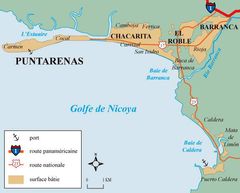
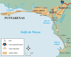
Carte De Puntarenas 3
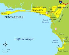
Carte De Puntarenas 3 4
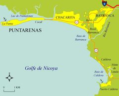
Carte De Puntarenas
Carte De Puntarenas2
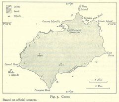
Cocos