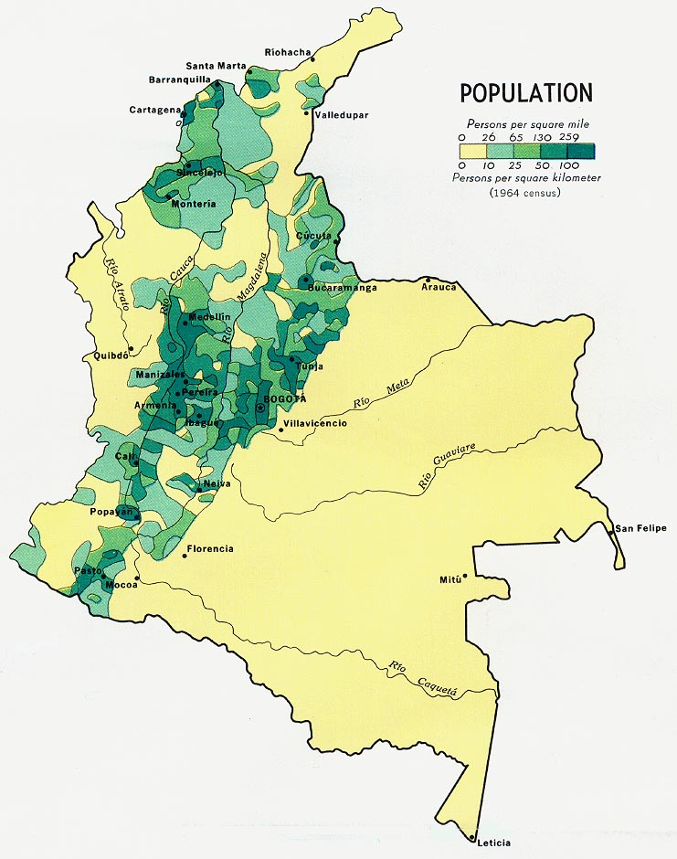
Colombia Population Map 1970
Click on the Colombia Population Map 1970 to view it full screen. File Type: jpg, File size: 141484 bytes (138.17 KB), Map Dimensions: 741px x 940px (16777216 colors)