Cambodia (Kingdom of Cambodia), KH
Cambodia: Located in the southern part of the Indochinese Peninsula in Southeast Asia, this kingdom is known for its low-lying plains, the Mekong Delta, mountains, and the Thai coastline.
About

Country Snapshot
Kingdom of Cambodia at a glance
Kingdom of Cambodia currently has 20 quality-checked populated place pages and 24 state or regional pages linked on MapSof.
Mapped cities & towns
20
These counts use a stricter populated-place filter so the main lists stay focused on real city and town pages.
States & regions
24
Open related pagesLargest city
Phnom PenhPopulation 2,129,371
Top linked places
Quick Facts about Kingdom of Cambodia
| Population | 17,577,760 |
| Country | Cambodia |
| Plate code | K |
| Area | 181035 km2 |
| Official name | កម្ពុជា, le Royaume du Cambodge |
| Continent | Asia |
| Easternmost point | Point(107.62762785 13.36703242) |
| Northernmost point | Point(107.55 14.68) |
| Latitude & Longitude | 13.0000,105.0000 |
| Legislative body | Parliament of Cambodia |
| Official language | Khmer |
| Capital | Phnom Penh |
| Establishment | November 09, 1953 (72 years ago) |
| Time Zone | UTC+07:00 |
| Local time | 17:23:01 (10th June 2026) |

Geography
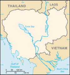
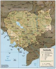
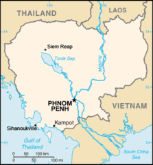
Kingdom of Cambodia is located at 13°0'0"N 105°0'0"E (13.0000000, 105.0000000). It has 3 neighbors: Vietnam, Thailand and Laos.
Cambodia map
The largest city of Kingdom of Cambodia is Phnom Penh with a population of 2,129,371. Other cities include, Kampong Chhnang population 75,244 and Sisophon population 23,218. See all Kingdom of Cambodia cities & populated places.
Official website of Kingdom of Cambodia
Official WebsiteCompare Kingdom of Cambodia with
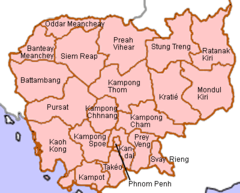
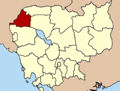
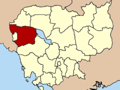
- Banteay Meanchey Province
- Phnom Penh
- Kampong Thom Province
- Siem Reap Province
- Battambang Province
- Takéo Province
- Kratié Province
- Pursat Province
- Svay Rieng Province
- Preah Vihear Province
- Ratanakiri Province
- Kampong Speu Province
- Kandal Province
- Prey Veng Province
- Kep Province
- Kampong Chhnang Province
- Sihanoukville Province
- Mondulkiri Province
- Kampong Cham Province
- Stung Treng Province
- Koh Kong Province
- Pailin Province
- Oddar Meanchey Province
- Kampot Province
Demographics
| Year | Population | % Change | Method |
|---|---|---|---|
| 1960 | 5,720,019 | - | |
| 1961 | 5,869,843 | 2.55% | |
| 1962 | 6,024,281 | 2.56% | |
| 1963 | 6,178,752 | 2.5% | |
| 1964 | 6,327,099 | 2.34% | |
| 1965 | 6,464,999 | 2.13% | |
| 1966 | 6,586,874 | 1.85% | |
| 1967 | 6,693,369 | 1.59% | |
| 1968 | 6,793,560 | 1.47% | |
| 1969 | 6,900,525 | 1.55% | |
| 1970 | 7,021,559 | 1.72% | |
| 1971 | 7,168,725 | 2.05% | |
| 1972 | 7,334,436 | 2.26% | |
| 1973 | 7,483,408 | 1.99% | |
| 1974 | 7,567,314 | 1.11% | |
| 1975 | 7,555,928 | -0.15% | |
| 1976 | 7,430,726 | -1.68% | |
| 1977 | 7,214,262 | -3% | |
| 1978 | 6,967,562 | -3.54% | |
| 1979 | 6,775,751 | -2.83% | |
| 1980 | 6,699,273 | -1.14% | |
| 1981 | 6,761,653 | 0.92% | |
| 1982 | 6,943,097 | 2.61% | |
| 1983 | 7,207,649 | 3.67% | |
| 1984 | 7,499,331 | 3.89% | |
| 1985 | 7,777,235 | 3.57% | |
| 1986 | 8,030,211 | 3.15% | |
| 1987 | 8,271,042 | 2.91% | |
| 1988 | 8,510,817 | 2.82% | |
| 1989 | 8,768,664 | 2.94% | |
| 1990 | 9,057,339 | 3.19% | |
| 1991 | 9,378,185 | 3.42% | |
| 1992 | 9,721,775 | 3.53% | |
| 1993 | 10,077,404 | 3.53% | |
| 1994 | 10,430,268 | 3.38% | |
| 1995 | 10,769,198 | 3.15% | |
| 1996 | 11,090,611 | 2.9% | |
| 1997 | 11,395,958 | 2.68% | |
| 1998 | 11,685,332 | 2.48% | |
| 1999 | 11,960,467 | 2.3% | |
| 2000 | 12,222,871 | 2.15% | |
| 2001 | 12,472,586 | 2% | |
| 2002 | 12,709,336 | 1.86% | |
| 2003 | 12,934,369 | 1.74% | |
| 2004 | 13,149,386 | 1.64% | |
| 2005 | 13,356,424 | 1.55% | |
| 2006 | 13,555,054 | 1.47% | |
| 2007 | 13,747,288 | 1.4% | |
| 2008 | 13,940,518 | 1.39% | |
| 2009 | 14,144,225 | 1.44% | |
| 2010 | 14,364,931 | 1.54% | |
| 2011 | 14,605,862 | 1.65% | |
| 2012 | 14,864,646 | 1.74% | |
| 2013 | 15,135,169 | 1.79% | |
| 2014 | 15,274,503 | 0.91% | (Worldbank) |
| 2015 | 15,521,436 | 1.59% | (Worldbank) |
| 2016 | 15,766,293 | 1.55% | (Worldbank) |
| 2017 | 16,005,373 | 1.49% | |
| 2018 | 16,249,798 | 1.5% | (Worldbank) |
| 2019 | 16,486,542 | 1.44% | (Worldbank) |
| 2026 | 17,577,760 | 6.21% |
Map & Images (more maps)
Cambodge Carte Provinces
Cambodia 1997 Cia Map
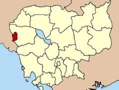
Cambodia Banteay Meanchey
Cambodia Battambang
Cambodia Diocese Battambang
Cambodia Diocese Kompong Cham
Cambodia Diocese Phnom Penh
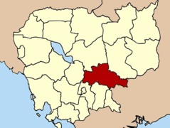
Cambodia Kampong Cham
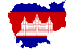
Cambodia Mapflag

Cambodia Pailin Small
Cambodia Pailin
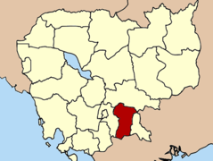
Cambodia Prey Veng
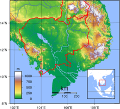
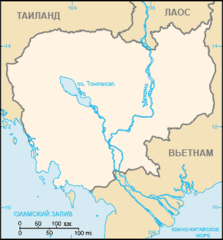
Cambodia Topography
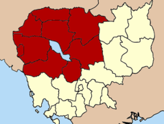
Cambodia Admin Level1
Cambodia Locator Sihanoukville
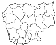
Cambodia Provinces Blank
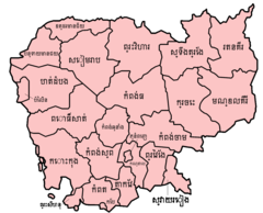
Cambodia Provinces Khmer
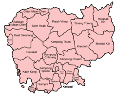
Cambodia Provinces Named

Cambodia Provinces Numbered
Cambodia Map Blank Russian