Botswana (Republic of Botswana), BW
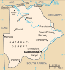
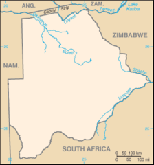
Botswana: Located in Southern Africa, this landlocked nation is defined by the Kalahari Desert and the Okavango Delta, a vast inland delta known for its rich wildlife.
About

Country Snapshot
Republic of Botswana at a glance
Republic of Botswana currently has 50 quality-checked populated place pages and 13 state or regional pages linked on MapSof.
Mapped cities & towns
50
These counts use a stricter populated-place filter so the main lists stay focused on real city and town pages.
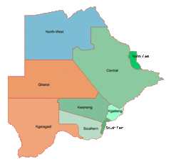
States & regions
13
Open related pagesLargest city
GaboronePopulation 208,411
Top linked places
Quick Facts about Republic of Botswana
| Population | 2,359,609 |
| Country | Botswana |
| Different from | Bophuthatswana |
| Plate code | BW |
| Area | 581737 km2 |
| Official name | Lefatshe la Botswana, la République du Botswana, Botswana, Botswana |
| Water as percent of area | 2.5% |
| Land as percent of area | 97.5% |
| Continent | Africa |
| Easternmost point | Point(29.3733 -22.19552) |
| Northernmost point | Point(25.17 -17.78) |
| Latitude & Longitude | -22.0000,24.0000 |
| Legislative body | National Assembly of Botswana |
| Named for | Tswana people |
| Official language | English |
| Capital | Gaborone |
| Establishment | January 01, 1966 (60 years ago) |
| Time Zone | UTC+02:00, Central Africa Time |
| Local time | 23:49:22 (9th June 2026) |

Geography
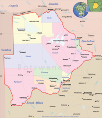
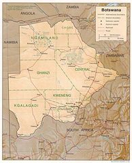
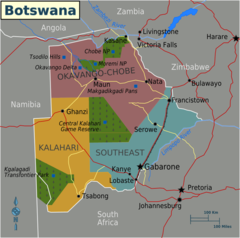
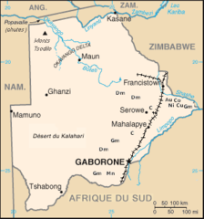
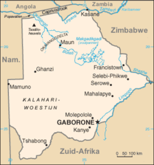
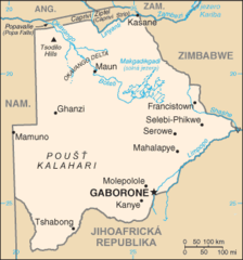
Republic of Botswana is located at 22°0'0"S 24°0'0"E (-22.0000000, 24.0000000). It has 4 neighbors: Zimbabwe, Zambia, South Africa and Namibia.
Botswana map
The largest city of Republic of Botswana is Gaborone with a population of 208,411. Other cities include, Francistown population 89,979, Selebi-Phikwe population 53,727, Serowe population 47,419 and Mogoditshane population 43,394. See all Republic of Botswana cities & populated places.
Compare Republic of Botswana with
- Kgatleng District
- Kweneng District
- Ghanzi District
- North-East District
- South-East District
- Southern District
- Central District
- Kgalagadi District
- North-West District
Demographics
| Year | Population | % Change | Method |
|---|---|---|---|
| 1960 | 524,173 | - | demographic balance |
| 1961 | 536,728 | 2.34% | demographic balance |
| 1962 | 550,152 | 2.44% | demographic balance |
| 1963 | 564,484 | 2.54% | demographic balance |
| 1964 | 579,729 | 2.63% | demographic balance |
| 1965 | 595,904 | 2.71% | demographic balance |
| 1966 | 613,097 | 2.8% | demographic balance |
| 1967 | 631,398 | 2.9% | demographic balance |
| 1968 | 650,835 | 2.99% | demographic balance |
| 1969 | 671,416 | 3.07% | demographic balance |
| 1970 | 693,176 | 3.14% | demographic balance |
| 1971 | 716,052 | 3.19% | demographic balance |
| 1972 | 740,118 | 3.25% | demographic balance |
| 1973 | 765,685 | 3.34% | demographic balance |
| 1974 | 793,164 | 3.46% | demographic balance |
| 1975 | 822,806 | 3.6% | demographic balance |
| 1976 | 854,746 | 3.74% | demographic balance |
| 1977 | 888,776 | 3.83% | demographic balance |
| 1978 | 924,373 | 3.85% | demographic balance |
| 1979 | 960,807 | 3.79% | demographic balance |
| 1980 | 997,534 | 3.68% | demographic balance |
| 1981 | 1,034,324 | 3.56% | demographic balance |
| 1982 | 1,071,254 | 3.45% | demographic balance |
| 1983 | 1,108,461 | 3.36% | demographic balance |
| 1984 | 1,146,205 | 3.29% | demographic balance |
| 1985 | 1,184,657 | 3.25% | demographic balance |
| 1986 | 1,223,738 | 3.19% | demographic balance |
| 1987 | 1,263,269 | 3.13% | demographic balance |
| 1988 | 1,303,192 | 3.06% | demographic balance |
| 1989 | 1,343,440 | 3% | demographic balance |
| 1990 | 1,383,912 | 2.92% | demographic balance |
| 1991 | 1,424,513 | 2.85% | demographic balance |
| 1992 | 1,465,072 | 2.77% | demographic balance |
| 1993 | 1,505,303 | 2.67% | demographic balance |
| 1994 | 1,544,865 | 2.56% | demographic balance |
| 1995 | 1,583,453 | 2.44% | demographic balance |
| 1996 | 1,620,989 | 2.32% | demographic balance |
| 1997 | 1,657,349 | 2.19% | demographic balance |
| 1998 | 1,692,148 | 2.06% | demographic balance |
| 1999 | 1,724,924 | 1.9% | demographic balance |
| 2000 | 1,755,375 | 1.73% | demographic balance |
| 2001 | 1,783,349 | 1.57% | demographic balance |
| 2002 | 1,808,976 | 1.42% | demographic balance |
| 2003 | 1,832,602 | 1.29% | demographic balance |
| 2004 | 1,854,739 | 1.19% | demographic balance |
| 2005 | 1,875,805 | 1.12% | demographic balance |
| 2006 | 1,895,944 | 1.06% | demographic balance |
| 2007 | 1,915,187 | 1% | demographic balance |
| 2008 | 1,933,719 | 0.96% | demographic balance |
| 2009 | 1,951,715 | 0.92% | demographic balance |
| 2010 | 1,969,341 | 0.9% | demographic balance |
| 2011 | 1,986,701 | 0.87% | demographic balance |
| 2012 | 2,003,910 | 0.86% | demographic balance |
| 2013 | 2,021,144 | 0.85% | demographic balance |
| 2014 | 2,088,614 | 3.23% | (Worldbank) |
| 2015 | 2,120,716 | 1.51% | (Worldbank) |
| 2016 | 2,159,944 | 1.82% | (Worldbank) |
| 2017 | 2,291,661 | 5.75% | demographic balance |
| 2018 | 2,254,126 | -1.67% | (Worldbank) |
| 2019 | 2,303,697 | 2.15% | (Worldbank) |
| 2026 | 2,359,609 | 2.37% |
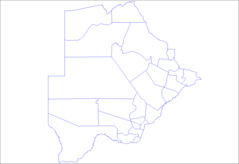
Map & Images (more maps)
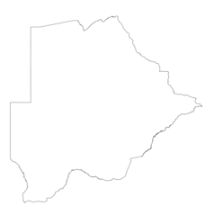
Bc Map
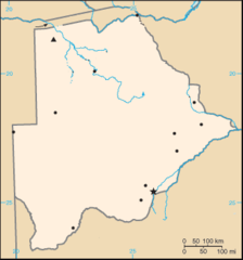
Botswana Locator
Botswana Map
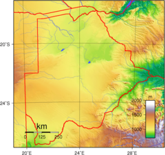
Botswana Topography
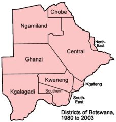
Botswana Districts 1980 2003
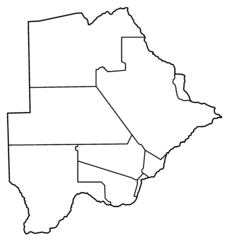
Botswana Districts Blank
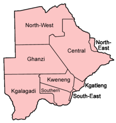
Botswana Districts Named
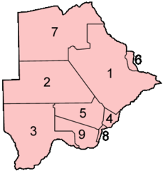
Botswana Districts Numbered
Botswana Map Notext
Botswana Map 1
Botswana Mine
Botswana Sub Districts
Botswana Blank
Botswana Geohive
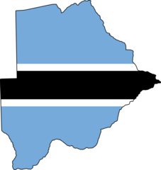
Flag Map of Botswana
Kaart Botswana Nl

Kaart Botswana
Mapa Botswany
Svg Koort Botswana
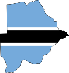
Botswana Flag Map