Bombay (Mumbai), Maharashtra
Bombay: Located on India's west coast, this bustling metropolis is the financial and entertainment capital of the country.
About
Quick Facts about Mumbai
| Population | 15,414,288 |
| Country | Portuguese Empire, British India, Kingdom of England, Company rule in Ind, India |
| State | Maharashtra (India) |
| Postal code | 400001 |
| Plate code | MH-01, MH-03, MH-02 |
| Phone Area Codes | 0022 |
| Area | 603 km2 |
| Official name | Мумбаи, Бомбей, Bombey |
| Continent | Asia |
| Latitude & Longitude | 19.0728,72.8826 |
| Altitude | 46 feet / 14 meters |
| Capital city | Mumbai is capital of Maharashtra, Bombay Presidency, Bombay State, Mumbai City district |
| Establishment | January 01, 1507 (519 years ago) |
| Time Zone | Indian Standard Time |
| Local time | 10:15:41 (10th June 2026) |
Geography
Mumbai is located at 19°4'22"N 72°52'57"E (19.0728300, 72.8826100).
Bombay map
Click "full screen"  icon to open full mode. View satellite images
Official website of Mumbai
Official Website- Berlin
- Busan
- Durango
- Espoo
- Honolulu County
- Jakarta
- London
- Los Angeles
- Manila
- Saint Petersburg
- Stuttgart (1968 )
- Yokohama
- İzmir (1997 )
Demographics
| Year | Population | % Change | Method |
|---|---|---|---|
| 2011 | 12,442,373 | - | census |
| 2018 | 15,414,288 | 19.28% | census |
Map of countries with a smaller population than Mumbai
Asumumbay, BOM, Bombai, Bombaim, Bombaj, Bombaya, Bombej, Bombejus, Bombėjus, Bumbaj, Bůmbaj, Dakbayan sa Bombay, Lungsod ng Mumbai, Moembaai, Mumbai - मुम़बई, Mumbaj, Mumbaja, Mumbajo, Mumbajus, Mumbay, Mumbaî, Numbai, Vomvai, bamba'i, bmbyy, bwmbay, gretara mumba'i, meng mai, mmbay, mmbyy, mu0bai, muba'i, mum bi, mumba'i, mumpai, munbai, mwmbay, mwmbyy, mymbais, pullapa mumba'i, Βομβάη, Бомбай, Бомбей, Мумбаи, Мумбай, Мумбаі, Мумбаї, Мумбај, Մումբայ, מומבאי, מומביי, بمبئی, بومباي, بَمبَے, ممبئي, ممبئی, ممبای, مومباى, مومباي, مومبای, މުންބާއީ, ग्रेटर मुम्बई, बम्बई, मुंबई, मुम्बई, পুল্লাপ মুম্বাই, মুম্বই, মুম্বাই, ਮੁੰਬਈ, મુંબઈ, ମୁମ୍ବାଇ, மும்பை, ముంబై, ಮುಂಬೈ, ಮು೦ಬೈ, മുംബൈ, มุมไบ, འབོམ་སྦེ, မွမ်ဘိုင်းမြို့, მუმბაი, ムンバイ, 孟买, 뭄바이
Map & Images (more maps)
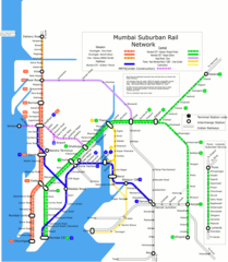
Mumbai Suburban Rail Map
1200 x 1377
- 109,891k -
png
City Map of Mumbai
902 x 1400
- 162,475k -
jpg
City Map of Mumbai 2
752 x 1000
- 139,566k -
jpg
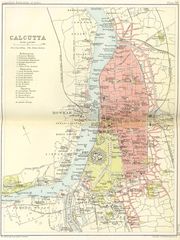
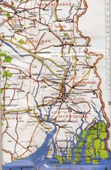
Historical Map Kolkata
1276 x 1700
- 385,974k -
jpg
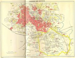
Historical Map of Lucknow
1400 x 1093
- 269,692k -
jpg
Hydrographic Map of Maharashtra
1272 x 853
- 205,294k -
jpg
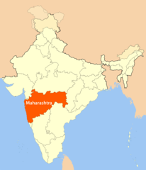
Location Map of Maharashtra
1716 x 2000
- 106,112k -
png
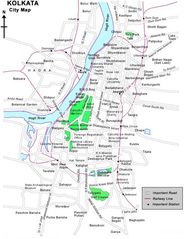
Map Kolkata
600 x 779
- 80,252k -
jpg
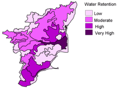
Mudslide Map of Tamil Nadu
900 x 677
- 36,825k -
png
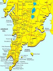
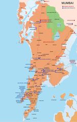
Mumbai City Map
700 x 935
- 99,826k -
jpg
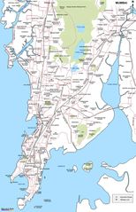
Mumbai Map
649 x 1000
- 102,225k -
png
Mumbai Map 2
755 x 1200
- 95,732k -
jpg
Physical Map Kolkata
1181 x 1800
- 351,691k -
jpg
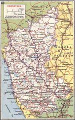
Physical Map of Karnataka
999 x 1594
- 463,990k -
jpg
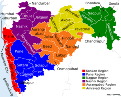
Political Map Maharashtra
1600 x 1281
- 183,849k -
png
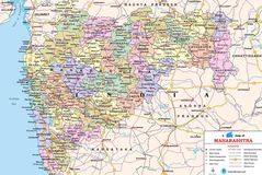
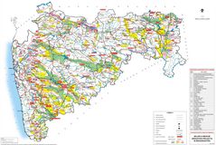
Political Map of Maharashtra
1300 x 870
- 291,796k -
jpg
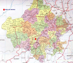
Political Map of Rajasthan
762 x 653
- 99,682k -
png
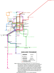
Subway Map of Kolkata
870 x 1166
- 38,418k -
png
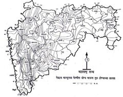
Topographic Map of Maharashtra
974 x 771
- 137,641k -
jpg
Transport Map Chennai
1364 x 1840
- 120,853k -
png
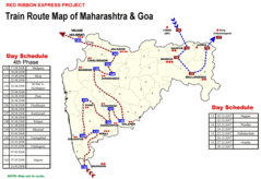
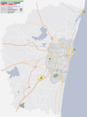
Transport Map of Maharashtra
1600 x 1100
- 194,331k -
png