Antwerp, Flanders
Antwerp: Located in northern Belgium, this port city on the Scheldt River is the capital of Antwerp province.
About

Quick Facts about Antwerp
| Population | 529,247 |
| Country | Belgium, Dutch Republic, Habsburg Netherlands |
| State | Flanders (Belgium) |
| County | Provincie Antwerpen |
| Postal code | 2140, 2180, 2660, 2600, 2610, 2100, 2030, 2050, 2040, 2060, 2170, 2020, 2018, 2000 |
| Phone Area Codes | 03 |
| Official name | Antwerpen |
| Annual number of weddings | 2071 |
| Latitude & Longitude | 51.2167,4.4167 |
| Capital | Antwerp |
| Capital city | Antwerp is capital of Antwerp, Deux-Nèthes |
| Time Zone | UTC+01:00 |
| Local time | 16:57:16 (9th June 2026) |
Antwerpen Antwerp Belgium Map locator map image
Geography
Antwerp is located at 51°13'0"N 4°25'0"E (51.2166667, 4.4166667). It has 14 neighbors: Woensdrecht, Gemeente Reimerswaal, Gemeente Hulst, Wommelgem, Wijnegem, Stabroek, Schoten, Mortsel, Kapellen, Hemiksem, Edegem, Brasschaat, Borsbeek and Aartselaar.
Antwerp map
Click "full screen"  icon to open full mode. View satellite images
Official website of Antwerp
Official Website- Akhisar (1988 )
- Barcelona (1997 )
- Cape Town (1996 )
- Chongqing
- Durban
- Haifa (1995 )
- Ludwigshafen (1998 )
- Marseille (1958 )
- Mulhouse (1956 )
- Oslo
- Paramaribo
- Rostock (1963 )
- Rotterdam (1940 )
- Saint Petersburg (1958 )
- Shanghai (1984 )
- Borgerhout
- Hoboken
- Berchem
- Deurne, Antwerp
- Merksem
- Wilrijk
- Berendrecht-Zandvliet-Lillo
- Antwerp
- Ekeren
Demographics
| Year | Population | % Change | Method |
|---|---|---|---|
| 2014 | 510,610 | - | census |
| 2016 | 510,610 | 0% | census |
| 2017 | 520,504 | 1.9% | census |
| 2018 | 523,248 | 0.52% | census |
| 2020 | 529,247 | 1.13% | census |
2000, Amberes, Antuerpen - Antwerpen, Antuerpia, Antuérpia, Antverpen, Antverpenas, Antverpene, Antverpeno, Antverpia, Antverpy, Antwerp'n, Antwerpe, Antwerpen, Antwerpia, Antwerpium, Anvers, Anversa, Kota Antwerpen, Антверпен, אנטוורפן, アントウェルペン, アントワープ, 安特卫普, 안트베르펀
Map & Images (more maps)
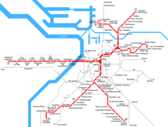
Antwerpen Metro Map
950 x 719
- 19,353k -
png