South Africa (Republic of South Africa), ZA
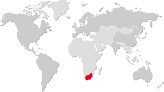
South Africa: Located at the southern tip of Africa, this nation boasts diverse landscapes, a multicultural society, and significant economic influence on the continent.
About

Country Snapshot
Republic of South Africa at a glance
Republic of South Africa currently has 188 quality-checked populated place pages and 9 state or regional pages linked on MapSof.
Mapped cities & towns
188
These counts use a stricter populated-place filter so the main lists stay focused on real city and town pages.
States & regions
9
Open related pagesLargest city
VirginiaPopulation 8,590,563
Top linked places
Quick Facts about Republic of South Africa
| Population | 63,100,945 |
| Country | South Africa |
| Different from | Southern Africa |
| Plate code | ZA |
| Area | 1221037 km2 |
| Official name | Republiek van Suid-Afrika, Riphabliki ra Afrika Dzonga, Riphabuḽiki ya Afrika Tshipembe, iRiphabhulikhi yeNingizimu Afrika, Rephaboliki ya Afrika Borwa, Repabliki ya Afrika Borwa, iRiphabhuliki yaseNingizimu Afrika, iRiphablikhi yoMzantsi-Afrika, iRiphabliki yeSewula Afrika, Rephaboliki ya Aforika Borwa, Republic of South Africa |
| Continent | Africa |
| Easternmost point | Point(32.890833333 -26.858888888) |
| Northernmost point | Point(29.658333333 -22.127777777) |
| Latitude & Longitude | -29.0000,24.0000 |
| Legislative body | Parliament of South Africa |
| Named for | south, Africa |
| Official language | Northern Sotho, Afrikaans, Zulu, Tsonga, Swazi, Southern Ndebele, Sesotho, Tswana, Xhosa, Venda, English |
| Capital | Cape Town, Bloemfontein, Pretoria |
| Establishment | May 31, 1910 (116 years ago) |
| Time Zone | Africa/Johannesburg, UTC+02:00, UTC+03:00 |
| Local time | 21:41:43 (10th June 2026) |

Geography
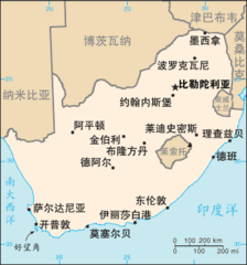
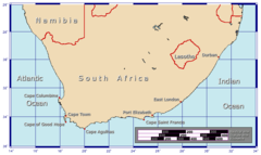
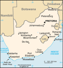
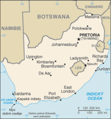
Republic of South Africa is located at 29°0'0"S 24°0'0"E (-29.0000000, 24.0000000). It has 6 neighbors: Zimbabwe, Lesotho, Botswana, Swaziland, Mozambique and Namibia.
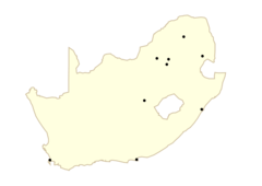
South Africa map
The largest city of Republic of South Africa is Johannesburg with a population of 4,434,827. Other cities include, Cape Town population 3,433,441, Durban population 3,120,282, Pretoria population 1,619,438 and Port Elizabeth population 967,677. See all Republic of South Africa cities & populated places.
Official website of Republic of South Africa
Official WebsiteCompare Republic of South Africa with
- Limpopo
- KwaZulu-Natal
- Northern Cape
- Western Cape
- Gauteng
- Free State
- Eastern Cape
- North West
- Mpumalanga
Demographics
| Year | Population | % Change | Method |
|---|---|---|---|
| 1960 | 17,099,840 | - | (Worldbank) |
| 1961 | 17,524,533 | 2.42% | (Worldbank) |
| 1962 | 17,965,725 | 2.46% | (Worldbank) |
| 1963 | 18,423,161 | 2.48% | (Worldbank) |
| 1964 | 18,896,307 | 2.5% | (Worldbank) |
| 1965 | 19,384,841 | 2.52% | (Worldbank) |
| 1966 | 19,888,250 | 2.53% | (Worldbank) |
| 1967 | 20,406,864 | 2.54% | (Worldbank) |
| 1968 | 20,942,145 | 2.56% | (Worldbank) |
| 1969 | 21,496,075 | 2.58% | (Worldbank) |
| 1970 | 22,069,776 | 2.6% | (Worldbank) |
| 1971 | 22,665,271 | 2.63% | (Worldbank) |
| 1972 | 23,281,508 | 2.65% | (Worldbank) |
| 1973 | 23,913,099 | 2.64% | (Worldbank) |
| 1974 | 24,552,540 | 2.6% | (Worldbank) |
| 1975 | 25,195,187 | 2.55% | (Worldbank) |
| 1976 | 25,836,888 | 2.48% | (Worldbank) |
| 1977 | 26,480,913 | 2.43% | (Worldbank) |
| 1978 | 27,138,965 | 2.42% | (Worldbank) |
| 1979 | 27,827,320 | 2.47% | (Worldbank) |
| 1980 | 28,556,769 | 2.55% | (Worldbank) |
| 1981 | 29,333,103 | 2.65% | (Worldbank) |
| 1982 | 30,150,448 | 2.71% | (Worldbank) |
| 1983 | 30,993,758 | 2.72% | (Worldbank) |
| 1984 | 31,841,593 | 2.66% | (Worldbank) |
| 1985 | 32,678,874 | 2.56% | (Worldbank) |
| 1986 | 33,495,953 | 2.44% | (Worldbank) |
| 1987 | 34,297,727 | 2.34% | (Worldbank) |
| 1988 | 35,100,909 | 2.29% | (Worldbank) |
| 1989 | 35,930,050 | 2.31% | (Worldbank) |
| 1990 | 36,800,509 | 2.37% | (Worldbank) |
| 1991 | 37,718,950 | 2.43% | (Worldbank) |
| 1992 | 38,672,607 | 2.47% | (Worldbank) |
| 1993 | 39,633,750 | 2.43% | (Worldbank) |
| 1994 | 40,564,059 | 2.29% | (Worldbank) |
| 1995 | 41,435,758 | 2.1% | (Worldbank) |
| 1996 | 42,241,011 | 1.91% | (Worldbank) |
| 1997 | 42,987,461 | 1.74% | (Worldbank) |
| 1998 | 43,682,260 | 1.59% | (Worldbank) |
| 1999 | 44,338,543 | 1.48% | (Worldbank) |
| 2000 | 44,967,708 | 1.4% | (Worldbank) |
| 2001 | 45,571,274 | 1.32% | (Worldbank) |
| 2002 | 46,150,913 | 1.26% | (Worldbank) |
| 2003 | 46,719,196 | 1.22% | (Worldbank) |
| 2004 | 47,291,610 | 1.21% | (Worldbank) |
| 2005 | 47,880,601 | 1.23% | (Worldbank) |
| 2006 | 48,489,459 | 1.26% | (Worldbank) |
| 2007 | 49,119,759 | 1.28% | (Worldbank) |
| 2008 | 49,779,471 | 1.33% | (Worldbank) |
| 2009 | 50,477,011 | 1.38% | (Worldbank) |
| 2010 | 51,216,964 | 1.44% | (Worldbank) |
| 2011 | 51,770,560 | 1.07% | census |
| 2012 | 52,834,005 | 2.01% | (Worldbank) |
| 2013 | 53,689,236 | 1.59% | (Worldbank) |
| 2014 | 54,545,991 | 1.57% | (Worldbank) |
| 2015 | 55,386,367 | 1.52% | (Worldbank) |
| 2016 | 55,653,654 | 0.48% | sample |
| 2017 | 55,445,000 | -0.38% | estimation process |
| 2018 | 57,725,600 | 3.95% | estimation process |
| 2019 | 58,558,270 | 1.42% | (Worldbank) |
| 2020 | 59,622,350 | 1.78% | estimation process |
| 2026 | 63,100,945 | 5.51% |
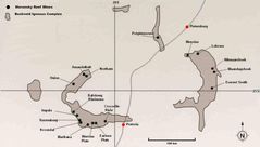
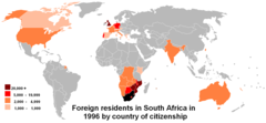
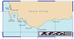
Map & Images (more maps)
800px South Africa 2010 Fifa World Cup
Africa Mapa
Afrikaansdistrib
Bic00
Cob Data South Africa
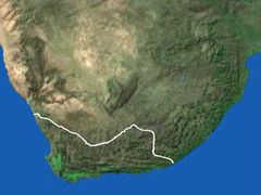
Capehopedetail
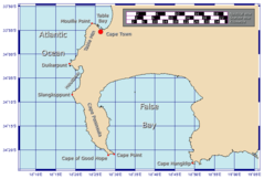
Capehopeoverview
Capehopepeninsulamap
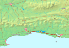
George Knysna Map
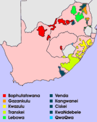
Homelands
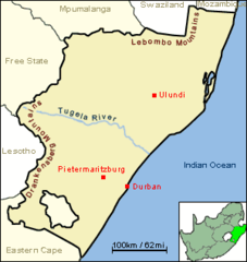
Jcw Map Natal Tugela
Kaart Suid Afrika
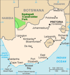
Kgalagadi Transfrontier Park Map
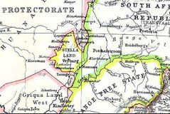
Map Stellaland
Map of South Africa (1818)
Mapa Jar
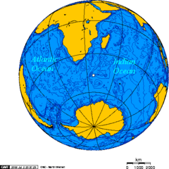
Orthographic Projection Centered On the Prince Edward Island
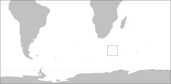
Pr Edward Isl Pos
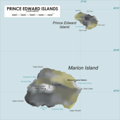
Predwisl Map
Sesothodistrib