Peru (Republic of Peru), PE
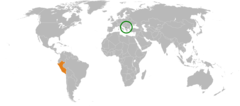
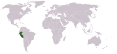
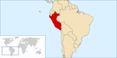
Peru: Located in western South America, it is bordered by Ecuador, Colombia, Brazil, Bolivia, and Chile.
About

Country Snapshot
Republic of Peru at a glance
Republic of Peru currently has 243 quality-checked populated place pages and 26 state or regional pages linked on MapSof.
Mapped cities & towns
243
These counts use a stricter populated-place filter so the main lists stay focused on real city and town pages.
States & regions
26
Open related pagesLargest city
LimaPopulation 7,737,002
Top linked places
Quick Facts about Republic of Peru
| Population | 34,350,244 |
| Country | Peru |
| Different from | PE |
| Plate code | PE |
| Area | 1285216 km2 |
| Official name | République du Pérou, Perú |
| Water as percent of area | 8.8% |
| Land as percent of area | 91.2% |
| Continent | South America |
| Easternmost point | Point(-68.652361111 -12.498138888) |
| Northernmost point | Point(-75.17 -0.03) |
| Latitude & Longitude | -10.0000,-75.2500 |
| Legislative body | Congress of the Republic of Peru |
| Official language | Aymara, Quechua, Spanish |
| Capital | Lima |
| Establishment | July 28, 1821 (204 years ago) |
| Time Zone | Peru Time Zone, UTC−05:00 |
| Local time | 03:49:25 (10th June 2026) |

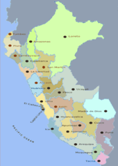
Geography
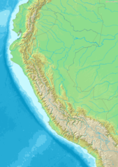
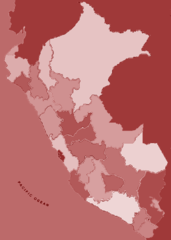
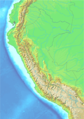
Republic of Peru is located at 10°0'0"S 75°15'0"W (-10.0000000, -75.2500000). It has 5 neighbors: Brazil, Ecuador, Colombia, Chile and Bolivia.
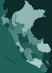
Peru map
The largest city of Republic of Peru is Lima with a population of 7,737,002. Other cities include, Trujillo population 919,899, Callao population 813,264, Chiclayo population 552,508 and Iquitos population 377,609. See all Republic of Peru cities & populated places.
Official website of Republic of Peru
Official WebsiteCompare Republic of Peru with
- Tacna
- Ayacucho
- Lima region
- Cusco Departament
- Junín
- Amazonas
- Pasco
- Huancavelica
- Madre de Dios
- Piura
- Lambayeque
- Ica
- Moquegua
- Huanuco
- La Libertad
- Arequipa
- Cajamarca
- Loreto
- Apurímac
- Callao Constitutional Province
- Puno
- Áncash
- Ucayali
- Tumbes
- San Martín
Demographics
| Year | Population | % Change | Method |
|---|---|---|---|
| 1960 | 9,931,518 | - | 2017-01-01T00:00:00Z |
| 1961 | 10,218,174 | 2.81% | 2017-01-01T00:00:00Z |
| 1962 | 10,517,047 | 2.84% | census |
| 1963 | 10,826,459 | 2.86% | census |
| 1964 | 11,144,018 | 2.85% | 2017-01-01T00:00:00Z |
| 1965 | 11,468,043 | 2.83% | 2017-01-01T00:00:00Z |
| 1966 | 11,797,803 | 2.8% | 2017-01-01T00:00:00Z |
| 1967 | 12,133,895 | 2.77% | census |
| 1968 | 12,477,560 | 2.75% | census |
| 1969 | 12,830,677 | 2.75% | census |
| 1970 | 13,194,548 | 2.76% | 2017-01-01T00:00:00Z |
| 1971 | 13,569,097 | 2.76% | census |
| 1972 | 13,953,601 | 2.76% | 2017-01-01T00:00:00Z |
| 1973 | 14,347,881 | 2.75% | census |
| 1974 | 14,751,618 | 2.74% | 2017-01-01T00:00:00Z |
| 1975 | 15,164,288 | 2.72% | 2017-01-01T00:00:00Z |
| 1976 | 15,585,924 | 2.71% | 2017-01-01T00:00:00Z |
| 1977 | 16,015,737 | 2.68% | census |
| 1978 | 16,451,352 | 2.65% | 2017-01-01T00:00:00Z |
| 1979 | 16,889,710 | 2.6% | census |
| 1980 | 17,328,542 | 2.53% | census |
| 1981 | 17,766,418 | 2.46% | 2017-01-01T00:00:00Z |
| 1982 | 18,203,502 | 2.4% | 2017-01-01T00:00:00Z |
| 1983 | 18,641,054 | 2.35% | census |
| 1984 | 19,081,183 | 2.31% | 2017-01-01T00:00:00Z |
| 1985 | 19,525,200 | 2.27% | census |
| 1986 | 19,973,258 | 2.24% | census |
| 1987 | 20,424,055 | 2.21% | census |
| 1988 | 20,875,714 | 2.16% | 2017-01-01T00:00:00Z |
| 1989 | 21,325,690 | 2.11% | 2017-01-01T00:00:00Z |
| 1990 | 21,772,035 | 2.05% | 2017-01-01T00:00:00Z |
| 1991 | 22,213,359 | 1.99% | census |
| 1992 | 22,649,612 | 1.93% | census |
| 1993 | 23,081,735 | 1.87% | census |
| 1994 | 23,511,358 | 1.83% | census |
| 1995 | 23,939,261 | 1.79% | 2017-01-01T00:00:00Z |
| 1996 | 24,365,985 | 1.75% | census |
| 1997 | 24,789,855 | 1.71% | 2017-01-01T00:00:00Z |
| 1998 | 25,206,817 | 1.65% | 2017-01-01T00:00:00Z |
| 1999 | 25,611,482 | 1.58% | 2017-01-01T00:00:00Z |
| 2000 | 26,000,080 | 1.49% | 2017-01-01T00:00:00Z |
| 2001 | 26,372,358 | 1.41% | census |
| 2002 | 26,729,909 | 1.34% | census |
| 2003 | 27,073,334 | 1.27% | census |
| 2004 | 27,403,845 | 1.21% | census |
| 2005 | 27,723,281 | 1.15% | census |
| 2006 | 28,030,688 | 1.1% | 2017-01-01T00:00:00Z |
| 2007 | 28,328,410 | 1.05% | 2017-01-01T00:00:00Z |
| 2008 | 28,625,628 | 1.04% | 2017-01-01T00:00:00Z |
| 2009 | 28,934,303 | 1.07% | census |
| 2010 | 29,262,830 | 1.12% | census |
| 2011 | 29,614,887 | 1.19% | census |
| 2012 | 29,987,800 | 1.24% | census |
| 2013 | 30,375,603 | 1.28% | 2017-01-01T00:00:00Z |
| 2014 | 30,090,359 | -0.95% | (Worldbank) |
| 2015 | 30,470,734 | 1.25% | (Worldbank) |
| 2016 | 30,926,032 | 1.47% | (Worldbank) |
| 2017 | 29,381,884 | -5.26% | census |
| 2018 | 32,162,184 | 8.64% | 2017-01-01T00:00:00Z |
| 2019 | 32,510,453 | 1.07% | (Worldbank) |
| 2026 | 34,350,244 | 5.36% |
Other places with the same name (10)
- Peru, Indiana city in Indiana, United States with a population of 10,937 people.
- Peru, Illinois city in Illinois, United States with a population of 9,612 people.
- Peru, New York town in New York, United States with a population of 6,882 people.
- Peru, Ohio township in Morrow County, Ohio with a population of 1,531 people.
- Peru, Maine town in Maine, United States with a population of 1,509 people.
- Peru, Massachusetts town in Massachusetts, United States with a population of 833 people.
- Peru, Nebraska city in Nebraska, United States with a population of 792 people.
- Peru, Vermont town in Vermont, United States with a population of 355 people.
- Peru, Wisconsin town in Wisconsin, United States with a population of 251 people.
- Peru, Kansas city in Kansas, United States with a population of 125 people.
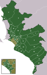
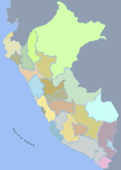
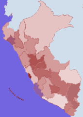
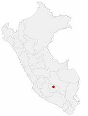
Map & Images (more maps)
0 Lima Div Num
2 Jmk Peru Blue
4 Jmk Peru Red Blue
5 Jmk Peru Red
6 Jmk Peru Green
Ancash Div Big Num

Distrito De Huancano, En La Provincia De Pisco, Ica
Distrito De Paracas , En La Provincia De Pisco, Ica
Distrito De Pisco , En La Provincia De Pisco, Ica
First Division Peru 2008
Geoperumap
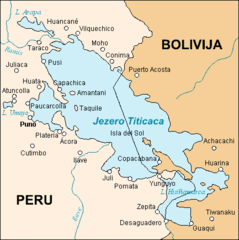
Jezero Titicaca Z 1
Kosovo Peru Locator 1
Labelled Jmk Peru Colorcoded Labelled 2
Labelled Jmk Peru Colorcoded Labelled

Lago Titicaca 001 2
Location of the City of Abancay In Peru
Location of the Province Alto Amazonas In Loreto
Locationperu(world)
Locationperu