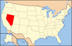
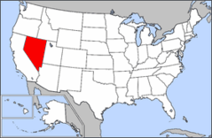
Nevada, US
Nevada: Located in the Western United States, it is characterized by its largely desert and semi-arid climate.
About
Nevada is a state located in the western United States, best known for the city of Las Vegas. Nevada is bordered by Oregon, Idaho, Utah, Arizona, and California. Nevada is the most mountainous state in the continental U.S.
Some key facts about Nevada:
- Capital: Carson City
- Population: Around 3 million
- Area: 110,567 square miles (7th largest state)
- Nickname: The Silver State
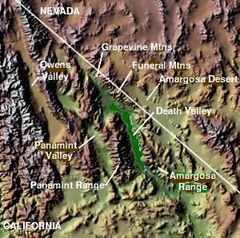
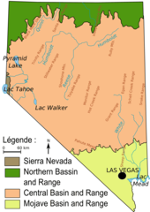
Nevada's landscape consists of rugged mountains, lakes, and deserts. The Sierra Nevada and Great Basin mountain ranges span the state. Lake Tahoe, Lake Mead, and the Black Rock Desert are iconic natural features. Death Valley National Park contains some of the hottest, driest points in North America.
Las Vegas and Reno are Nevada's two major cities. Las Vegas is world-famous for casinos, entertainment, and nightlife along the Las Vegas Strip. Reno has casinos plus outdoor recreation. Mining has been central to Nevada's history and economy.
Nevada is largely a rural state with most land owned by the federal government. It has a reputation for libertarian laws and policies. There is no personal income tax and regulations are relaxed on issues like gambling, marriage laws, alcohol and firearms.
Nevada experiences seasonal weather patterns - hot summers, pleasant falls, cold winters with snow in the mountains, and warm springs. Tourism and entertainment are major industries today.
In summary, Nevada is a uniquely scenic and libertarian-leaning state. It offers both world-famous indulgence in Las Vegas as well as remote deserts, mountains, and wilderness to explore.

State Snapshot
Nevada at a glance
Nevada currently has 46 quality-checked populated place pages and 17 county pages linked on MapSof.
Mapped cities & towns
46
These counts use a stricter populated-place filter so the main lists stay focused on real city and town pages.
County pages
17
Open related pagesLargest city
Las VegasPopulation 646,790
Top linked places
Quick Facts about Nevada
| Population | 3,138,259 |
| Country | United States of America |
| Area | 286380 km2 |
| Water as percent of area | 0.72% |
| Land as percent of area | 99.28% |
| Continent | North America |
| Latitude & Longitude | 39.2502,-116.7512 |
| Legislative body | Nevada Legislature |
| Named for | Sierra Nevada |
| Altitude | 5,499 feet / 1676 meters |
| Capital | Carson City |
| Establishment | October 31, 1864 (161 years ago) |
| Time Zone | Pacific Time Zone, Mountain Time Zone, America/Los_Angeles |
| Local time | 15:37:03 (2nd August 2026) |
| Weather | 64℉ Mostly Clear 7-days weather |

Geography
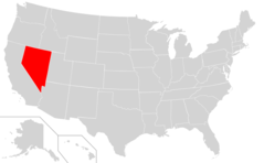
Nevada is located at 39°15'1"N 116°45'4"W (39.2502100, -116.7511900). It has 5 neighbors: California, Utah, Arizona, Idaho and Oregon.
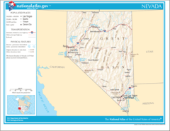
Nevada map
The largest city of Nevada is Las Vegas with a population of 646,790. Other cities include, Henderson population 329,172, North Las Vegas population 260,098, Reno population 259,290 and Paradise population 223,167. See all Nevada cities & populated places.
Largest Cities in Nevada (more)
Cities, Towns, Villages, Neighborhoods & Other Populated Places in Nevada.
| City Name | County | Population |
|---|---|---|
| Las Vegas | Clark | 646,790 |
| Henderson | Clark | 329,172 |
| North Las Vegas | Clark | 260,098 |
| Reno | Washoe | 259,290 |
| Paradise | Clark | 223,167 |
| Sunrise Manor | Clark | 189,372 |
| Spring Valley | Clark | 178,395 |
| Sparks | Washoe | 106,900 |
| Carson City | Carson City | 56,034 |
| Whitney | Clark | 38,585 |
| Pahrump | Nye | 36,441 |
| Winchester | Clark | 27,978 |
| Fernley | Lyon | 21,926 |
| Elko | Elko | 20,531 |
| Mesquite | Clark | 20,438 |
| Boulder City | Clark | 16,207 |
Show more Nevada cities and populated places
Weather
Mostly clear, with a low around 64. South southwest wind 0 to 10 mph.
7-Day ForecastOfficial website of Nevada
Official Website- Douglas County
- Churchill County
- Washoe County
- Lyon County
- Clark County
- Storey County
- Nye County
- Humboldt County
- Lander County
- Mineral County
- White Pine County
- Lincoln County
- Eureka County
- Carson City
- Esmeralda County
- Elko County
- Pershing County
Demographics
| Year | Population | % Change | Method |
|---|---|---|---|
| 1910 | 81,875 | - | census |
| 1920 | 77,407 | -5.77% | census |
| 1930 | 91,058 | 14.99% | census |
| 1940 | 110,247 | 17.41% | census |
| 1950 | 160,083 | 31.13% | census |
| 1960 | 285,278 | 43.89% | census |
| 1970 | 488,738 | 41.63% | census |
| 1980 | 800,493 | 38.95% | census |
| 1990 | 1,201,833 | 33.39% | census |
| 2000 | 1,998,257 | 39.86% | census |
| 2010 | 2,700,551 | 26.01% | census |
| 2011 | 2,712,730 | 0.45% | estimation process |
| 2012 | 2,743,996 | 1.14% | estimation process |
| 2013 | 2,775,970 | 1.15% | estimation process |
| 2014 | 2,817,628 | 1.48% | estimation process |
| 2015 | 2,866,939 | 1.72% | estimation process |
| 2016 | 2,917,563 | 1.74% | estimation process |
| 2017 | 2,969,905 | 1.76% | estimation process |
| 2018 | 3,027,341 | 1.9% | estimation process |
| 2019 | 3,080,156 | 1.71% | estimation process |
| 2020 | 3,138,259 | 1.85% | estimation process |
People born in Nevada (38)
People born in Nevada, including politician Richard Kirman, Sr., screenwriter and director C. Jay Cox, musician Ralph Peña, .
More notable people
- Hal Patino (American musician) he was born in 01/01/2000
- James E. Casey (American businessman) he was born in 29/03/1888
- James Fife, Jr. (United States Navy admiral) he was born in 22/01/1897
- Thomas N. Heffron (American actor (1872-1951)) he was born in 13/06/1872
- Robert Joseph Bandoni (Canadian mycologist (1926-2009)) he was born in 09/11/1926
- Buster Warenski (Custom knifemaker) he was born in 05/06/1942
- Chris Cox (American DJ and musician)
- Doris Dawson (American actress) she was born in 16/04/1909
- Elijah Carson Hart (American politician) he was born in 01/01/1854
- Frank Gomez (American martial artist) he was born in 31/03/1986
- Frankie Sue Del Papa (Nevada politician) she was born in 21/09/1949
- Kandi Cox (American movie actress) she was born in 23/05/1965
- Olinto M. Barsanti (Recipient of the Purple Heart medal) he was born in 11/11/1917
- Pete Sorenson (American politician) he was born in 01/01/1951
- Reno Browne (American actress (1921-1991)) she was born in 20/04/1921
- Ronald J. Bath (U.S. Air Force general) he was born in 04/11/1944
- Timmy Cruz (singer) she was born in 01/01/1976
- Zane Floyd (Mass murderer) he was born in 20/09/1975
Other places with the same name (5)
- Nevada, Missouri town in Vernon County, Missouri, United States with a population of 8,196 people.
- Nevada, Iowa town in Story County, Iowa, United States with a population of 6,682 people.
- Nevada, Texas city in Collin County, Texas, United States with a population of 1,327 people.
- Nevada, Ohio village in Ohio, United States with a population of 727 people.
- Nevada, Illinois human settlement in United States of America with a population of 215 people.
Nevada Counties (more)
Clark County

county in Nevada, United States
Washoe County

county in Nevada, United States
Lyon County

county in Nevada, United States
| County Name | Population |
|---|---|
| Clark County | 2,315,963 |
| Washoe County | 477,082 |
| Lyon County | 58,319 |
| Elko County | 53,006 |
| Douglas County | 49,088 |
| Nye County | 48,054 |
| Churchill County | 25,363 |
| Humboldt County | 16,962 |
| White Pine County | 9,466 |
| Pershing County | 6,573 |
| Lander County | 5,514 |
| Lincoln County | 5,159 |
| Mineral County | 4,518 |
| Storey County | 4,207 |
| Eureka County | 2,065 |
| Esmeralda County | 886 |
Show more Nevada counties
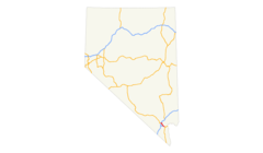
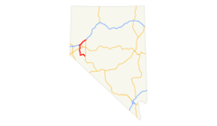
Map & Images (more maps)
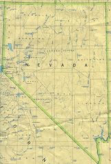
Map of Nevada Na 1
Ecoregion Nevada 2
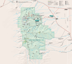
Great Basin National Park Map 2007 04

I 215 (nv) Map
I 515 (nv) Map
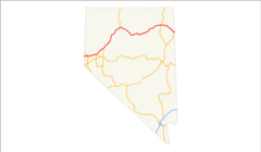
I 80 (nv) Map
Map of Usa Nv
Map of Usa Highlighting Nevada
Map of Usa Highlighting Prostitution
Nevada 90
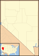
Nevada Locator Map With Us
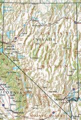
Nevada Geography
Us 50 Alt (nv) Map
Us 6 (nv) Map
Us 93 (nv) Map
Us 93 Alt (nv) Map
Us 95 Alt (nv) Map
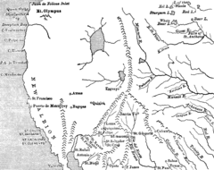
Utah And Nevada 1795 Bhou P27a
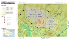
Wfm Area51 Map En
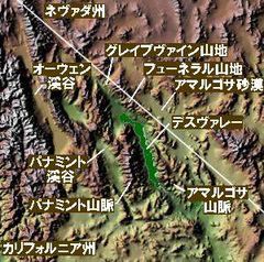
Wpdms Shdrlfi020l Death Valley Ja