Lille, Hauts-de-France
Lille: commune in Nord, France
About
Quick Facts about Lille
| Population | 232,787 |
| Country | France |
| State | Hauts-de-France (France) |
| County | North |
| Twitter username | lillefrance |
| Postal code | 59260, 59777, 59000, 59800, 59160 |
| Area | 34.83 km2 |
| Official name | Lille |
| Latitude & Longitude | 50.6330,3.0586 |
| Male population | 112316 |
| Female population | 120471 |
| Altitude | 151 feet / 46, 21 meters |
| Capital city | Lille is capital of Q88521111, Lille metropolis, Nord, Nord-Pas-de-Calais, arrondissement of Lille, canton of Lille-Centre, canton of Lille-2, canton of Lille-6, canton of Lille-Sud-Ouest, canton of Lille-Nord-Est, canton of Lille-Sud, canton of Lille-1, canton of Lille-Est, canton of Lille-5, canton of Lille-Nord, canton of Lille-Sud-Est, canton of Lille-4, canton of Lille-Ouest, canton of Lille-3 |
| Time Zone | UTC+02:00, UTC+01:00 |
| Local time | 15:30:29 (9th June 2026) |
Geography
Lille is located at 50°37'59"N 3°3'31"E (50.6329700, 3.0585800). It has 15 neighbors: Wattignies, Sequedin, Ronchin, Premesques, Perenchies, Marcq en Baroeul, Loos, Lompret, Lezennes, Lambersart, La Madeleine, Faches Thumesnil, Ennetieres en Weppes, Capinghem and Villeneuve d Ascq.
Lille map
Click "full screen"  icon to open full mode. View satellite images
- Buffalo
- Cologne
- Erfurt (1988 )
- Esch-sur-Alzette
- Kharkiv
- Leeds
- Leeds
- Liège
- Nablus
- Oujda
- Rotterdam
- Safed
- Saint-Louis
- Shanghai
- Turin
- Valladolid
- Wrocław
- Hellemmes-Lille
- Lomme
Demographics
| Year | Population | % Change | Method |
|---|---|---|---|
| 2012 | 228,652 | - | census |
| 2013 | 231,491 | 1.23% | census |
| 2015 | 232,741 | 0.54% | census |
| 2016 | 232,440 | -0.13% | census |
| 2017 | 232,787 | 0.15% | census |
Insula, LIL, Lil', Lila, Lile, Lilis, Lill, Lill', Lilla, Lillo, Rijsel, Risel, Rysel, li er, lil., lili, lly, lyl, riru, Λιλ, Лил, Лилль, Лілль, Ліль, Լիլ, ליל, للی, ليل, لیل, लील, ਲੀਲ, லீல், ลีล, ლილი, リール, 里尔, 里爾, 릴
Map & Images (more maps)
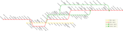
Lille Metro Suburban Metro Map
2000 x 511
- 79,989k -
png
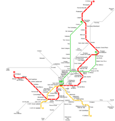
Lille Metro Map
950 x 1000
- 19,968k -
png