Australia (Commonwealth of Australia), AU
Australia: Island country in the Southern hemisphere
About

Quick Facts about Commonwealth of Australia
| Population : | 25,671,900 |
| Country : | Australia |
| Different from : | Australia, Q13431386 |
| Head of government : | Prime Minister of Australia |
| Plate code : | AUS |
| Official name : | Commonwealth of Australia, Australia, Австралийский союз, Australské společenství, Cymanwlad Awstralia, Австралійський Союз, le Commonwealth d’Australie |
| Speed limit : | 100, 50 |
| Continent : | Oceania |
| Easternmost point : | Point(153.637222222 -28.6375) |
| Northernmost point : | Point(142.530555555 -10.689166666), Point(142.53151 -10.68717) |
| Legislative body : | Parliament of Australia |
| Named for : | Terra Australis |
| Official language : | English |
| Capital : | Canberra, Melbourne |
| Establishment : | January 01, 1901 (123 years ago) |
| Time Zone : | UTC+11:30, UTC+09:30, UTC+08:00, UTC+09:30, UTC+07:00, UTC+06:30, UTC+10:30, UTC+05:00, UTC+10:30, UTC+10:00, UTC+10:00, UTC+11:00 |
| Local time : | 01:17:16 (19th April 2024) |

Geography
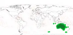
Commonwealth of Australia is located at 25°0'0"S 135°0'0"E (-25.0000000, 135.0000000). It has 4 neighbors: Indonesia, East Timor, Papua New Guinea and New Zealand.
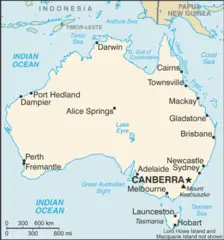
Australia map
Click "full screen"  icon to open full mode. View satellite images
The largest city of Commonwealth of Australia is Canberra with a population of 381,488. Other cities include, Newcastle population 300,196, Wollongong population 289,236, Hobart population 216,656 and Townsville population 196,219. See all Commonwealth of Australia cities & populated places.
- Go to Official Website
- Go to Official Website
Official website of Commonwealth of Australia
- John McEwen , 23 John Gorton Harold Holt 10 January, 1968 1967-12-19T00:00:00Z
- Harold Holt , 22 John McEwen Robert Menzies 19 December, 1967 1966-01-26T00:00:00Z
- Gough Whitlam , 26 Malcolm Fraser William McMahon 11 November, 1975 1972-12-05T00:00:00Z
- Joseph Cook , 9 Andrew Fisher Andrew Fisher 17 September, 1914 1913-06-24T00:00:00Z
- Kevin Rudd , 31 Julia Gillard John Howard 24 June, 2010 2007-03-12T00:00:00Z
- Joseph Lyons , 14 Earle Page James Scullin 7 April, 1939 1932-01-06T00:00:00Z
- John Howard , 30 Kevin Rudd Paul Keating 12 March, 2007 1996-03-11T00:00:00Z
- Robert Menzies , 16 Arthur Fadden Earle Page 29 August, 1941 1939-04-26T00:00:00Z
- Andrew Fisher , 6 Alfred Deakin Alfred Deakin 2 June, 1909 1908-11-13T00:00:00Z
- Earle Page , 15 Robert Menzies Joseph Lyons 26 April, 1939 1939-04-07T00:00:00Z
- Billy Hughes , 11 Stanley Bruce Andrew Fisher 9 February, 1923 1915-10-27T00:00:00Z
- Alfred Deakin , 2 Chris Watson Edmund Barton 27 April, 1904 1903-09-24T00:00:00Z
- Chris Watson , 3 George Reid Alfred Deakin 17 August, 1904 1904-04-27T00:00:00Z
- Bob Hawke , 28 Paul Keating Malcolm Fraser 20 December, 1991 1983-03-11T00:00:00Z
- Frank Forde , 19 Ben Chifley John Curtin 13 July, 1945 1945-07-06T00:00:00Z
- Tony Abbott , 34 Malcolm Turnbull Kevin Rudd 15 September, 2015 2013-09-18T00:00:00Z
- Arthur Fadden , 17 John Curtin Robert Menzies 7 October, 1941 1941-08-29T00:00:00Z
- Stanley Bruce , 12 James Scullin Billy Hughes 22 October, 1929 1923-02-09T00:00:00Z
- Edmund Barton , 1 Alfred Deakin 24 September, 1903 1901-01-01T00:00:00Z
- Andrew Fisher , 10 Billy Hughes Joseph Cook 27 October, 1915 1914-09-17T00:00:00Z
- George Reid , 4 Alfred Deakin Chris Watson 5 July, 1905 1904-08-18T00:00:00Z
- Malcolm Fraser , 27 Bob Hawke Gough Whitlam 11 March, 1983 1975-11-11T00:00:00Z
- Scott Morrison , 36 Malcolm Turnbull 2018-08-24T00:00:00Z
- Alfred Deakin , 7 Andrew Fisher Andrew Fisher 29 April, 1910 1909-06-02T00:00:00Z
- James Scullin , 13 Joseph Lyons Stanley Bruce 6 January, 1932 1929-10-22T00:00:00Z
- Ben Chifley , 20 Harold Holt Frank Forde 19 December, 1949 1945-07-13T00:00:00Z
- John Curtin , 18 Frank Forde Arthur Fadden 5 July, 1945 1941-10-07T00:00:00Z
- Paul Keating , 29 John Howard Bob Hawke 11 March, 1996 1991-12-20T00:00:00Z
- Andrew Fisher , 8 Joseph Cook Alfred Deakin 24 June, 1913 1910-04-29T00:00:00Z
- Kevin Rudd , 33 Tony Abbott Julia Gillard 18 September, 2013 2013-06-27T00:00:00Z
- Julia Gillard , 32 Kevin Rudd Kevin Rudd 27 June, 2013 2010-06-24T00:00:00Z
- John Gorton , 24 William McMahon John McEwen 10 March, 1971 1968-01-10T00:00:00Z
- Robert Menzies , 21 Ben Chifley Harold Holt 26 January, 1966 1949-12-19T00:00:00Z
- Alfred Deakin , 5 Andrew Fisher George Reid 13 November, 1908 1905-07-05T00:00:00Z
- Malcolm Turnbull , 35 Scott Morrison Tony Abbott 24 August, 2018 2015-09-15T00:00:00Z
- William McMahon , 25 Gough Whitlam John Gorton 5 December, 1972 1971-03-10T00:00:00Z
Commonwealth of Australia has 4 neighbours.
- Republic of Indonesia Independent country in Southeast Asia situated on more than 17,000 islands
- Democratic Republic of Timor-Leste Independent country situated on several islands in Southeast Asia
- Independent State of Papua New Guinea island sovereign state in Oceania
- New Zealand Independent country in Oceania, situated on two main and around 600 smaller islands in the southwestern Pacific Ocean
- Norfolk Island
- Heard Island and McDonald Islands
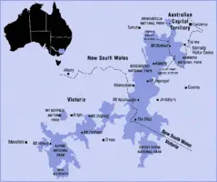
- New South Wales
- Queensland
- Cocos (Keeling) Islands
- Victoria
- Tasmania
- Coral Sea Islands
- Northern Territory
- Australian Antarctic Territory
- Australian Capital Territory
- Western Australia
- Christmas Island
- South Australia
- Jervis Bay Territory
- Ashmore and Cartier Islands
Demographics
| Year | Population | % Change | Method |
| 1960 | 10,276,477 | - | |
| 1961 | 10,483,000 | 1.97% | |
| 1962 | 10,742,000 | 2.41% | |
| 1963 | 10,950,000 | 1.9% | |
| 1964 | 11,167,000 | 1.94% | |
| 1965 | 11,388,000 | 1.94% | |
| 1966 | 11,651,000 | 2.26% | |
| 1967 | 11,799,000 | 1.25% | |
| 1968 | 12,009,000 | 1.75% | |
| 1969 | 12,263,000 | 2.07% | |
| 1970 | 12,507,000 | 1.95% | |
| 1971 | 12,937,000 | 3.32% | |
| 1972 | 13,177,000 | 1.82% | |
| 1973 | 13,380,000 | 1.52% | |
| 1974 | 13,723,000 | 2.5% | |
| 1975 | 13,893,000 | 1.22% | |
| 1976 | 14,033,000 | 1% | |
| 1977 | 14,192,000 | 1.12% | |
| 1978 | 14,358,000 | 1.16% | |
| 1979 | 14,514,000 | 1.07% | |
| 1980 | 14,692,000 | 1.21% | |
| 1981 | 14,927,000 | 1.57% | |
| 1982 | 15,178,000 | 1.65% | |
| 1983 | 15,369,000 | 1.24% | |
| 1984 | 15,544,000 | 1.13% | |
| 1985 | 15,758,000 | 1.36% | |
| 1986 | 16,018,400 | 1.63% | |
| 1987 | 16,263,900 | 1.51% | |
| 1988 | 16,532,200 | 1.62% | |
| 1989 | 16,814,400 | 1.68% | |
| 1990 | 17,065,100 | 1.47% | |
| 1991 | 17,284,000 | 1.27% | |
| 1992 | 17,495,000 | 1.21% | |
| 1993 | 17,667,000 | 0.97% | |
| 1994 | 17,855,000 | 1.05% | |
| 1995 | 18,072,000 | 1.2% | |
| 1996 | 18,311,000 | 1.31% | |
| 1997 | 18,517,000 | 1.11% | |
| 1998 | 18,711,000 | 1.04% | |
| 1999 | 18,926,000 | 1.14% | |
| 2000 | 19,153,000 | 1.19% | |
| 2001 | 19,413,000 | 1.34% | |
| 2002 | 19,651,400 | 1.21% | |
| 2003 | 19,895,400 | 1.23% | |
| 2004 | 20,127,400 | 1.15% | |
| 2005 | 20,394,800 | 1.31% | |
| 2006 | 20,697,900 | 1.46% | |
| 2007 | 20,827,600 | 0.62% | |
| 2008 | 21,249,200 | 1.98% | |
| 2009 | 21,691,700 | 2.04% | |
| 2010 | 22,031,750 | 1.54% | |
| 2011 | 22,340,024 | 1.38% | |
| 2012 | 22,723,904 | 1.69% | 2012-01-01T00:00:00Z |
| 2013 | 23,130,931 | 1.76% | census |
| 2014 | 23,475,686 | 1.47% | |
| 2015 | 23,815,995 | 1.43% | |
| 2016 | 23,401,892 | -1.77% | census |
| 2017 | 24,511,800 | 4.53% | population estimation |
| 2018 | 24,982,688 | 1.88% | |
| 2019 | 25,364,307 | 1.5% | |
| 2020 | 25,671,900 | 1.2% | population estimation |
'Aositelelia, Ahitereiria, An Astrail, An Astráil, Aostralia, Astralia, Austraalia, Austrailae, Australi, Australia, Australia (Uc), Australia (Úc), Australia nutome, Australie, Australien, Australija, Australio, Australië, Australya, Austràlia, Austrália, Austrálie, Austrālija, Ausztralia, Ausztrália, Autereraria, Avstrali, Avstralia, Avstralija, Avstralijs'kij Sojuz, Avstraliya, Avstrualii, Avustralya, Awistralya, Awstaraaliya, Awstralia, Awstralja, Awstralska, Awstralya, Awusitureliya, Aŭstralio, Commonwealth of Australia, I-Ostreliya, O-tai-li-a, Orileede Astralia, Orílẹ́ède Ástràlìá, Ositali, Ositaraliya, Ositirali, Ositáli, Ostaraalii, Ostareliya, Ostrali, Ostralii Sotralii, Ostralïi Sotralïi, Ostrelia, Otereiriya, Uc, ao da li ya, astireliya, astralya, astreli'a, astreliya, hoju, i-Australia, oseuteuleillia, ostreliya, osutoraria, prathes xxsterleiy, sralygu'e, xxsterleiy, yavstyralyyە, yۆstralya, Ástralía, Ò-tāi-lī-a, Úc, Ɔstrelia, ʻAositelēlia, ʾwstrlyʾ, Αυστραλία, Австрали, Австралия, Австралија, Австралійський Союз, Австралія, Аустралија, Аўстралія, Ավստրալիա, אויסטראליע, אוסטרליה, אױסטראַליע, آسٹریلیا, آسټراليا, أستراليا, ئاۋستىرالىيە, ئۆسترالیا, استراليا, استرالیا, ܐܘܣܛܪܠܝܐ, އޮސްޓަރުލިޔާ, अष्ट्रेलिया, ऑस्ट्रेलिया, অস্ট্রেলিয়া, অস্ট্রেলিয়া, ઑસ્ટ્રેલિયા, ଅଷ୍ଟ୍ରେଲିଆ, ஆஸ்திரேலியா, ఆస్ట్రేలియా, ಆಸ್ಟ್ರೇಲಿಯ, ഓസ്ട്രേലിയ, ඕස්ට්රේලියාව, ประเทศออสเตรเลีย, ออสเตรเลีย, ອົອດສະຕາລີ, ཨ་ས་ཐ་ལ་ཡ།, ཨས་ཊེཡེ་ལི་ཡ, ཨསྟྲེ་ལི་ཡ།, ཨོ་སེ་ཐེ་ལི་ཡ།, ဩစတြေးလျှား, ავსტრალია, አውስትሬሊያ, អូស្ត្រាលី, ‘ostaruliya, オーストラリア, 澳大利亚, 澳大利亞, 오스트레일리아, 호주
Map & Images (more maps)
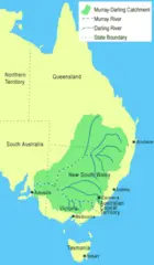
250px Murray Catchment Map Mjc02
Aus Locator Map
Abortionlawsaustraliamap
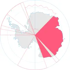
Antarctica, Australia Territorial Claim
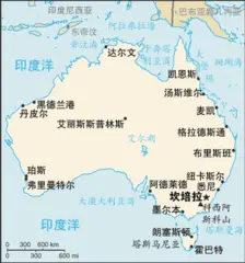
As Map Zh Cn
As Map
.jpg)
Aus Layered Day(center)
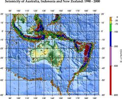
Ausseis
Austalpsregionmap
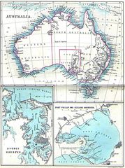
Australia 1860
Australia Exclusive Economic Zones
Australia Kosovo Locator
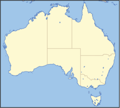
Australia Locator Map
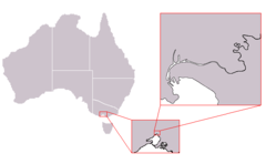
Australia Melbourne Inner Locator
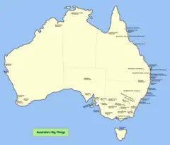
Australia Big Things Map

Australia Blue
Australia First Map
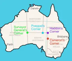
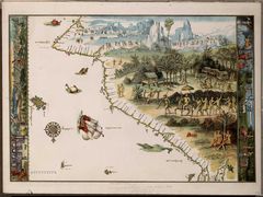
Australia Four Corners Surveyors Etc
Australia Green
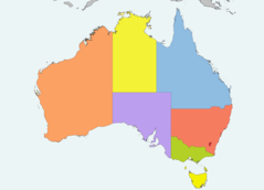
Australia Location Map Recolored